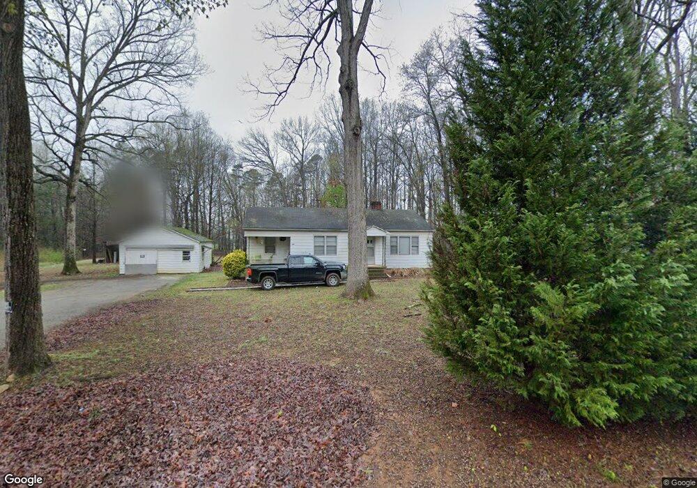
210 Safrit Rd Salisbury, NC 28146
Estimated Value: $224,000 - $323,000
--
Bed
1
Bath
1,112
Sq Ft
$247/Sq Ft
Est. Value
About This Home
This home is located at 210 Safrit Rd, Salisbury, NC 28146 and is currently estimated at $274,222, approximately $246 per square foot. 210 Safrit Rd is a home located in Rowan County with nearby schools including China Grove Elementary School, Southeast Middle School, and Jesse C Carson High School.
Ownership History
Date
Name
Owned For
Owner Type
Purchase Details
Closed on
Apr 18, 2024
Sold by
Safrit Donald Ray and Safrit Theresa L
Bought by
Safrit Donald Ray and Safrit Theresa L
Current Estimated Value
Purchase Details
Closed on
Sep 1, 2021
Sold by
Safrit Donald Ray and Safrit Theresa L
Bought by
Safrit Donald Ray and Safrit Theresa L
Purchase Details
Closed on
Sep 3, 1999
Sold by
Safrit Alice A
Bought by
Safrit Alice A and Safrit Donald R
Create a Home Valuation Report for This Property
The Home Valuation Report is an in-depth analysis detailing your home's value as well as a comparison with similar homes in the area
Home Values in the Area
Average Home Value in this Area
Purchase History
| Date | Buyer | Sale Price | Title Company |
|---|---|---|---|
| Safrit Donald Ray | -- | None Listed On Document | |
| Safrit Donald Ray | -- | None Listed On Document | |
| Safrit Donald Ray | -- | None Listed On Document | |
| Safrit Donald Ray | -- | None Listed On Document | |
| Safrit Alice A | $10,000 | -- |
Source: Public Records
Tax History Compared to Growth
Tax History
| Year | Tax Paid | Tax Assessment Tax Assessment Total Assessment is a certain percentage of the fair market value that is determined by local assessors to be the total taxable value of land and additions on the property. | Land | Improvement |
|---|---|---|---|---|
| 2025 | $1,481 | $220,983 | $123,659 | $97,324 |
| 2024 | $1,481 | $220,983 | $123,659 | $97,324 |
| 2023 | $1,481 | $220,983 | $123,659 | $97,324 |
| 2022 | $1,255 | $167,850 | $109,652 | $58,198 |
| 2021 | $1,245 | $167,850 | $109,652 | $58,198 |
| 2020 | $1,245 | $167,850 | $109,652 | $58,198 |
| 2019 | $1,245 | $167,850 | $109,652 | $58,198 |
| 2018 | $1,156 | $157,149 | $109,651 | $47,498 |
| 2017 | $1,156 | $157,149 | $109,651 | $47,498 |
| 2016 | $1,156 | $157,149 | $109,651 | $47,498 |
| 2015 | $1,174 | $157,149 | $109,651 | $47,498 |
| 2014 | $1,035 | $145,343 | $96,151 | $49,192 |
Source: Public Records
Map
Nearby Homes
- 0 Brookfield Cir Unit CAR4292885
- 0 Ed Weavers Rd
- 1352 Eva Ln
- 1143 Journey Ln
- 1365 Safrit Rd
- 1140 Peeler Rd
- 6000 S Main St
- 1925 Mount Hope Church Rd
- 355 Swink Ave
- 0 Swink Ave
- 6115 Southern Ln
- 6255 Meadow Ln
- 137 Stafford Estates Dr
- 0 Maple St
- 179 Spring Oak Dr
- 1291 Mill Wheel Dr
- 330 Oak Ridge Run
- 1018 Grist Mill Run Unit 66zt
- 00 Neelytown Rd
- 850 and 830 E Nc 152 Hwy E
- 111 Safrit Rd
- 309 Safrit Rd
- 311 Safrit Rd
- 1514 Webb Rd
- 335 Safrit Rd
- 1512 Webb Rd
- 1604 Webb Rd
- 1045 Castlebrook Dr
- 1065 Castlebrook Dr
- 314 Safrit Rd
- 1085 Castlebrook Dr
- 1614 Webb Rd
- 355 Safrit Rd
- 407 Safrit Rd
- 1405 Webb Rd
- 1313 Webb Rd
- 1105 Castlebrook Dr
- 409 Safrit Rd
- 1020 Castlebrook Dr
- 1038 Castlebrook Dr