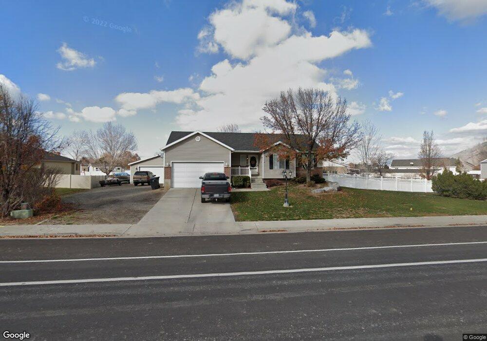
210 Slant Rd Mapleton, UT 84664
Estimated Value: $653,000 - $740,444
3
Beds
3
Baths
1,317
Sq Ft
$533/Sq Ft
Est. Value
About This Home
This home is located at 210 Slant Rd, Mapleton, UT 84664 and is currently estimated at $701,815, approximately $532 per square foot. 210 Slant Rd is a home located in Utah County with nearby schools including Maple Ridge Elementary, Mapleton Junior High School, and Maple Mountain High School.
Ownership History
Date
Name
Owned For
Owner Type
Purchase Details
Closed on
Aug 24, 2022
Sold by
Diana Allen Sonja
Bought by
Colledge David
Current Estimated Value
Home Financials for this Owner
Home Financials are based on the most recent Mortgage that was taken out on this home.
Original Mortgage
$605,000
Outstanding Balance
$576,619
Interest Rate
5.13%
Estimated Equity
$125,196
Purchase Details
Closed on
Mar 12, 2020
Sold by
Myers Bennie Clint and Myers Sandra E
Bought by
Allen Royce Ira and Allen Sonja Diana
Home Financials for this Owner
Home Financials are based on the most recent Mortgage that was taken out on this home.
Original Mortgage
$376,200
Interest Rate
3.5%
Mortgage Type
New Conventional
Purchase Details
Closed on
Mar 3, 2009
Sold by
Myers Bennie Clint and Myers Sandra
Bought by
Myers Bennie Clint and Myers Sandra E
Home Financials for this Owner
Home Financials are based on the most recent Mortgage that was taken out on this home.
Original Mortgage
$112,300
Interest Rate
5.08%
Mortgage Type
New Conventional
Purchase Details
Closed on
Aug 25, 2008
Sold by
Goshen Town
Bought by
Fridell Ward and Fridell Kimberly
Purchase Details
Closed on
Mar 28, 2007
Sold by
Andersen Cory W and Andersen Stacy D
Bought by
Myers Bennie Clint and Myers Sandra
Home Financials for this Owner
Home Financials are based on the most recent Mortgage that was taken out on this home.
Original Mortgage
$85,000
Interest Rate
6.29%
Mortgage Type
Purchase Money Mortgage
Purchase Details
Closed on
Mar 30, 2001
Sold by
Salisbury Development Lc
Bought by
Andersen Cory W and Andersen Stacy D
Home Financials for this Owner
Home Financials are based on the most recent Mortgage that was taken out on this home.
Original Mortgage
$130,292
Interest Rate
7.06%
Create a Home Valuation Report for This Property
The Home Valuation Report is an in-depth analysis detailing your home's value as well as a comparison with similar homes in the area
Home Values in the Area
Average Home Value in this Area
Purchase History
| Date | Buyer | Sale Price | Title Company |
|---|---|---|---|
| Colledge David | -- | None Listed On Document | |
| Allen Royce Ira | -- | Pro Title & Escrow Inc | |
| Myers Bennie Clint | -- | Provo Land Title Company | |
| Fridell Ward | -- | None Available | |
| Myers Bennie Clint | -- | Metro National Title Orem | |
| Andersen Cory W | -- | Provo Land Title Company |
Source: Public Records
Mortgage History
| Date | Status | Borrower | Loan Amount |
|---|---|---|---|
| Open | Colledge David | $605,000 | |
| Previous Owner | Allen Royce Ira | $376,200 | |
| Previous Owner | Myers Bennie Clint | $112,300 | |
| Previous Owner | Myers Bennie Clint | $85,000 | |
| Previous Owner | Andersen Cory W | $130,292 |
Source: Public Records
Tax History
| Year | Tax Paid | Tax Assessment Tax Assessment Total Assessment is a certain percentage of the fair market value that is determined by local assessors to be the total taxable value of land and additions on the property. | Land | Improvement |
|---|---|---|---|---|
| 2025 | $2,983 | $325,215 | -- | -- |
| 2024 | $2,983 | $292,215 | $0 | $0 |
| 2023 | $3,080 | $303,600 | $0 | $0 |
| 2022 | $3,197 | $311,630 | $0 | $0 |
| 2021 | $2,667 | $399,200 | $158,800 | $240,400 |
| 2020 | $2,631 | $380,900 | $140,500 | $240,400 |
| 2019 | $2,167 | $320,200 | $135,700 | $184,500 |
| 2018 | $2,038 | $286,700 | $115,800 | $170,900 |
| 2017 | $1,944 | $145,090 | $0 | $0 |
| 2016 | $1,908 | $141,570 | $0 | $0 |
| 2015 | $1,746 | $128,810 | $0 | $0 |
| 2014 | $1,599 | $115,830 | $0 | $0 |
Source: Public Records
Map
Nearby Homes
- 1810 W 300 S Unit D
- 1656 W 300 S Unit B
- 1655 W 200 S Unit A
- 2652 W Maple St Unit 281
- 1780 W Maple St
- 2216 W Silver Leaf Dr Unit 35
- 203 N 1900 W
- 216 N 1750 W
- 715 W 4600 S Unit Lot I303
- 715 W 4600 S Unit Lot I304
- 281 N Pheasant Dr
- 442 S Doubleday St
- 293 N Pheasant Dr
- 141 N Pinnacle Ave
- 262 N Santa fe Dr
- 2414 W Santa fe Dr
- 2458 W Aurora Ave Unit 287
- 2559 W Aurora Ave Unit 292
- 889 Sego Lily Way
- 29 N Sunrise Ranch Dr
- 210 S Slant Rd
- 232 S Slant Rd
- 60 S Slant Rd
- 1971 W 130 S
- 1809 W 200 S
- 1809 W 200 S Unit C
- 1809 W 200 S Unit D
- 1809 W 200 S Unit B
- 1809 W 200 S Unit A
- 1881 W 130 S
- 1927 W 130 S
- 1809 W 200 S Unit D
- 1809 W 200 S Unit B
- 1809 W 200 S Unit A
- 2001 W 130 S
- 276 S Slant Rd
- 276 S Slant Rd
- 1838 W 300 S
- 1838 W 300 S Unit D
- 1838 W 300 S Unit B
Your Personal Tour Guide
Ask me questions while you tour the home.