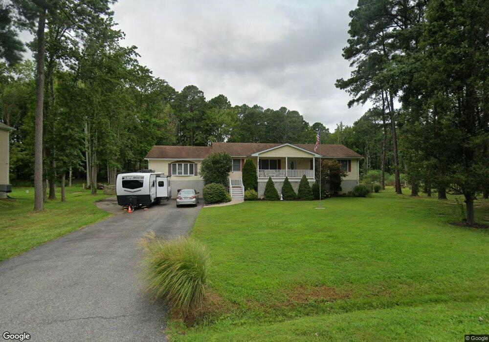
210 Somerset Rd Stevensville, MD 21666
Romancoke NeighborhoodEstimated Value: $469,000 - $580,000
--
Bed
2
Baths
2,144
Sq Ft
$248/Sq Ft
Est. Value
About This Home
This home is located at 210 Somerset Rd, Stevensville, MD 21666 and is currently estimated at $531,558, approximately $247 per square foot. 210 Somerset Rd is a home located in Queen Anne's County with nearby schools including Matapeake Elementary School, Matapeake Middle School, and Kent Island High School.
Ownership History
Date
Name
Owned For
Owner Type
Purchase Details
Closed on
Aug 23, 2005
Sold by
Shaffer Robert and Shaffer Carol
Bought by
Raska Brian A and Raska Catherine A
Current Estimated Value
Home Financials for this Owner
Home Financials are based on the most recent Mortgage that was taken out on this home.
Original Mortgage
$200,000
Outstanding Balance
$105,400
Interest Rate
5.71%
Mortgage Type
New Conventional
Estimated Equity
$426,158
Purchase Details
Closed on
Aug 29, 1984
Sold by
Holden Larry W and Holden Cynda J
Bought by
Shaffer Robert and Shaffer Carol
Create a Home Valuation Report for This Property
The Home Valuation Report is an in-depth analysis detailing your home's value as well as a comparison with similar homes in the area
Home Values in the Area
Average Home Value in this Area
Purchase History
| Date | Buyer | Sale Price | Title Company |
|---|---|---|---|
| Raska Brian A | $350,000 | -- | |
| Shaffer Robert | $16,500 | -- |
Source: Public Records
Mortgage History
| Date | Status | Borrower | Loan Amount |
|---|---|---|---|
| Open | Raska Brian A | $200,000 |
Source: Public Records
Tax History Compared to Growth
Tax History
| Year | Tax Paid | Tax Assessment Tax Assessment Total Assessment is a certain percentage of the fair market value that is determined by local assessors to be the total taxable value of land and additions on the property. | Land | Improvement |
|---|---|---|---|---|
| 2025 | $3,657 | $421,500 | $0 | $0 |
| 2024 | $3,463 | $384,800 | $0 | $0 |
| 2023 | $3,279 | $348,100 | $153,500 | $194,600 |
| 2022 | $3,184 | $337,967 | $0 | $0 |
| 2021 | $3,098 | $327,833 | $0 | $0 |
| 2020 | $3,098 | $317,700 | $133,500 | $184,200 |
| 2019 | $2,954 | $302,967 | $0 | $0 |
| 2018 | $2,815 | $288,233 | $0 | $0 |
| 2017 | $2,683 | $273,500 | $0 | $0 |
| 2016 | -- | $273,500 | $0 | $0 |
| 2015 | $1,436 | $273,500 | $0 | $0 |
| 2014 | $1,436 | $308,300 | $0 | $0 |
Source: Public Records
Map
Nearby Homes
- 300 Talbot Rd
- 224 Wicomico Rd
- 116 Talbot Rd
- 122 S Carolina Rd
- 101 Oak St
- 122 Mallard Dr
- 116 Mallard Dr
- 8905 Romancoke Rd
- 9401 Romancoke Rd
- Lot 1 - E/Kent Point Romancoke
- 321 Oregon Rd
- 306 N Lake Rd
- 123 Long Point Rd
- 118 N Lake Dr
- 114 N Lake Dr
- 203 Olive Branch Rd
- Lot 8 Ackerman Dr
- 210 Pennick Dr
- 145 N Lake Dr
- 412 Five Farms Dr
- 214 Somerset Rd
- 216 Somerset Rd
- 115 Caroline Rd
- 209 Somerset Rd
- 200 Somerset Rd
- 218 Somerset Rd
- 205 Somerset Rd
- 201 Caroline Rd
- 201 Somerset Rd
- 207 Somerset Rd
- 220 Somerset Rd
- 215 Somerset Rd
- 222 Somerset Rd
- 213 Caroline Rd
- 170 Somerset Rd
- 219 Somerset Rd
- 209 Caroline Rd
- 0 Oregon Rd Unit 1006940374
- 0 Oregon Rd Unit 1006350604
- 0 Oregon Rd Unit QA9891354