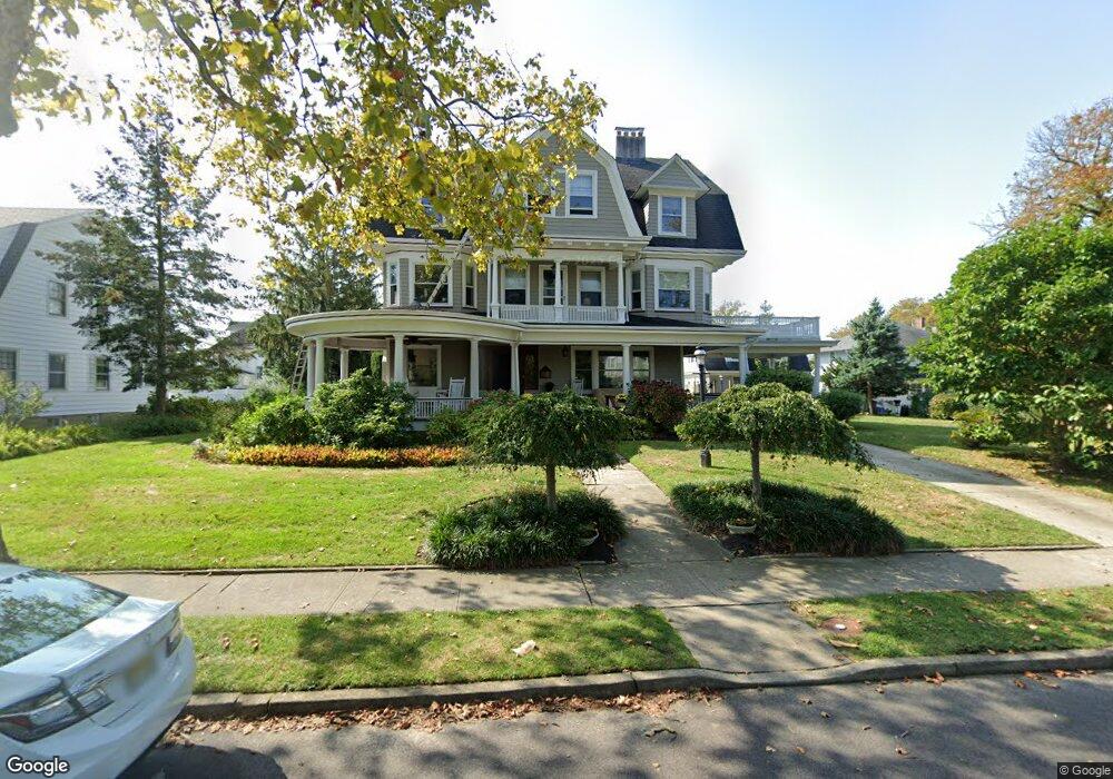
210 Spier Ave Allenhurst, NJ 07711
Estimated Value: $5,271,000 - $6,285,000
6
Beds
4
Baths
5,326
Sq Ft
$1,097/Sq Ft
Est. Value
About This Home
This home is located at 210 Spier Ave, Allenhurst, NJ 07711 and is currently estimated at $5,841,481, approximately $1,096 per square foot. 210 Spier Ave is a home located in Monmouth County with nearby schools including Hope Academy Charter School and St. Mary of the Assumption School.
Ownership History
Date
Name
Owned For
Owner Type
Purchase Details
Closed on
Jul 30, 1998
Sold by
Kolbrenner Dale
Bought by
Copperthwaite Harry and Copperthwaite Alicia
Current Estimated Value
Home Financials for this Owner
Home Financials are based on the most recent Mortgage that was taken out on this home.
Original Mortgage
$428,000
Outstanding Balance
$89,133
Interest Rate
6.9%
Estimated Equity
$5,752,348
Create a Home Valuation Report for This Property
The Home Valuation Report is an in-depth analysis detailing your home's value as well as a comparison with similar homes in the area
Home Values in the Area
Average Home Value in this Area
Purchase History
| Date | Buyer | Sale Price | Title Company |
|---|---|---|---|
| Copperthwaite Harry | $535,000 | -- |
Source: Public Records
Mortgage History
| Date | Status | Borrower | Loan Amount |
|---|---|---|---|
| Open | Copperthwaite Harry | $428,000 |
Source: Public Records
Tax History Compared to Growth
Tax History
| Year | Tax Paid | Tax Assessment Tax Assessment Total Assessment is a certain percentage of the fair market value that is determined by local assessors to be the total taxable value of land and additions on the property. | Land | Improvement |
|---|---|---|---|---|
| 2025 | $26,293 | $4,700,100 | $3,092,400 | $1,607,700 |
| 2024 | $22,644 | $4,464,000 | $2,862,900 | $1,601,100 |
| 2023 | $22,644 | $3,628,800 | $2,122,300 | $1,506,500 |
| 2022 | $21,204 | $3,145,500 | $1,801,200 | $1,344,300 |
| 2021 | $19,514 | $2,801,100 | $1,571,600 | $1,229,500 |
| 2020 | $20,697 | $2,616,500 | $1,449,300 | $1,167,200 |
| 2019 | $19,514 | $2,454,600 | $1,294,100 | $1,160,500 |
| 2018 | $19,109 | $2,400,600 | $1,294,100 | $1,106,500 |
| 2017 | $17,714 | $2,276,800 | $1,231,000 | $1,045,800 |
| 2016 | $17,510 | $2,104,600 | $1,130,100 | $974,500 |
| 2015 | $17,152 | $1,860,300 | $1,009,000 | $851,300 |
| 2014 | $20,921 | $2,461,300 | $1,336,300 | $1,125,000 |
Source: Public Records
Map
Nearby Homes
- 222 Cedar Ave
- 127 Cedar Ave
- 309 Spier Ave
- 48 Neptune Ave
- 104 Lake Dr
- 309 Hume St
- 312 Hume St
- 15 Buena Vista Ct
- 205 Edgemont Dr Unit 3
- 205 Edgemont Dr Unit 1
- 18 Lady Bess Dr
- 519 Laurel Ave
- 400 Deal Lake Dr Unit 3J
- 400 Deal Lake Dr Unit 8F
- 400 Deal Lake Dr Unit 3K
- 400 Deal Lake Dr Unit 4G
- 400 Deal Lake Dr Unit 5F
- 400 Deal Lake Dr Unit 7H & 7G
- 400 Deal Lake Dr Unit 7J
- 400 Deal Lake Dr Unit 3F
- 206 Spier Ave
- 212 Spier Ave
- 211 Corlies Ave
- 215 Corlies Ave
- 207 Corlies Ave
- 216 Spier Ave
- 209 Spier Ave
- 200 Norwood Ave N
- 211 Spier Ave
- 219 Corlies Ave
- 201 Spier Ave
- 201 Corlies Ave
- 756 Corlies Ave
- 215 Spier Ave
- 220 Spier Ave
- 203 Corlies Ave
- 223 Corlies Ave
- 219 Spier Ave
- 224 Spier Ave
- 204 Norwood Ave S