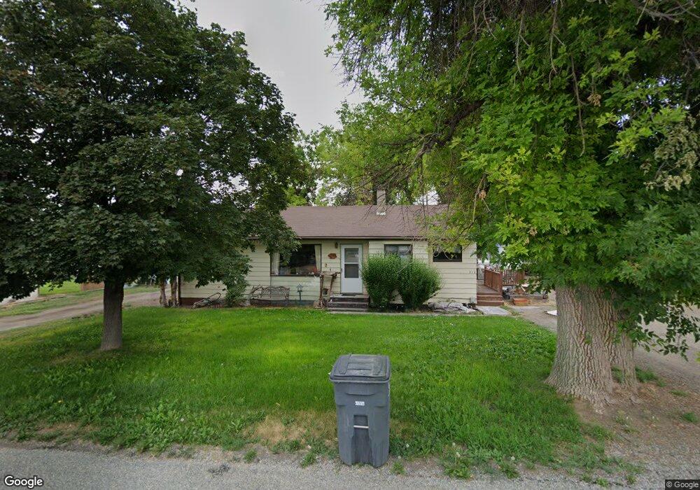
210 Spruce St Kimberly, ID 83341
Estimated Value: $280,651 - $325,000
4
Beds
1
Bath
1,425
Sq Ft
$207/Sq Ft
Est. Value
About This Home
This home is located at 210 Spruce St, Kimberly, ID 83341 and is currently estimated at $295,413, approximately $207 per square foot. 210 Spruce St is a home located in Twin Falls County with nearby schools including Kimberly Elementary School, STRICKER ELEMENTARY SCHOOL, and Kimberly Middle School.
Ownership History
Date
Name
Owned For
Owner Type
Purchase Details
Closed on
May 3, 2019
Sold by
Slaughter Walter and Slaughter Carol C
Bought by
Twin Falls County
Current Estimated Value
Purchase Details
Closed on
Nov 16, 2005
Sold by
Guyer Warren R and Guyer Margie M
Bought by
North Roberta
Home Financials for this Owner
Home Financials are based on the most recent Mortgage that was taken out on this home.
Original Mortgage
$81,500
Interest Rate
5.93%
Mortgage Type
New Conventional
Create a Home Valuation Report for This Property
The Home Valuation Report is an in-depth analysis detailing your home's value as well as a comparison with similar homes in the area
Home Values in the Area
Average Home Value in this Area
Purchase History
| Date | Buyer | Sale Price | Title Company |
|---|---|---|---|
| Twin Falls County | -- | None Available | |
| North Roberta | -- | -- |
Source: Public Records
Mortgage History
| Date | Status | Borrower | Loan Amount |
|---|---|---|---|
| Previous Owner | North Roberta | $81,500 |
Source: Public Records
Tax History
| Year | Tax Paid | Tax Assessment Tax Assessment Total Assessment is a certain percentage of the fair market value that is determined by local assessors to be the total taxable value of land and additions on the property. | Land | Improvement |
|---|---|---|---|---|
| 2025 | $1,349 | $263,231 | $97,801 | $165,430 |
| 2024 | $1,317 | $265,681 | $97,801 | $167,880 |
| 2023 | $1,203 | $264,051 | $97,801 | $166,250 |
| 2022 | $1,331 | $218,268 | $52,018 | $166,250 |
| 2021 | $1,416 | $169,551 | $33,241 | $136,310 |
| 2020 | $1,078 | $127,071 | $33,241 | $93,830 |
| 2019 | $1,152 | $125,411 | $33,241 | $92,170 |
| 2018 | $1,132 | $118,411 | $20,461 | $97,950 |
| 2017 | $1,032 | $104,791 | $20,461 | $84,330 |
| 2016 | $879 | $85,891 | $0 | $0 |
| 2015 | $884 | $85,891 | $20,461 | $65,430 |
| 2012 | -- | $91,448 | $0 | $0 |
Source: Public Records
Map
Nearby Homes
- 715 Center St W
- 219 Madison St W
- 4028 3500 E
- 687 Will Ln
- 530 Madeleine Way Unit Homesite 219
- 890 Adamite Rd
- 904 Adamite Rd
- 867 Adamite Rd
- 889 Adamite Rd
- 966 Adamite Rd
- 921 Ballard Ln
- 152 U S 30
- 965 Adamite Rd
- 843 Coral Rd
- 1411 Cayuse Creek Dr
- 336 Maxine Ln W
- 987 Adamite Rd
- 322 Maxine Ln W Unit Homesite 210
- 322 Maxine Ln W
- 1005 Adamite Rd
- 643 Monroe St
- 130 Spruce St
- 211 Spruce St
- 120 Spruce St
- 619 Monroe St
- 604 Center St W
- 601 Monroe St
- 620 Monroe St
- 735 Monroe St
- 739 Monroe St
- 307 Spruce St
- 610 Monroe St
- 529 Monroe St
- 636 Center St W
- 304 Spruce St
- 622 Center Street Residential
- 743 Monroe St
- 309 Spruce St
- 622 Center St W
- 525 Monroe St
Your Personal Tour Guide
Ask me questions while you tour the home.