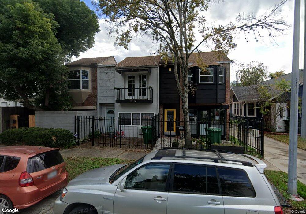
210 Stratford St Unit B Houston, TX 77006
Montrose NeighborhoodEstimated Value: $410,608 - $477,000
2
Beds
2
Baths
1,902
Sq Ft
$231/Sq Ft
Est. Value
About This Home
This home is located at 210 Stratford St Unit B, Houston, TX 77006 and is currently estimated at $439,902, approximately $231 per square foot. 210 Stratford St Unit B is a home located in Harris County with nearby schools including Gregory-Lincoln Ed Center, Wharton Dual Language Academy, and Lamar High School.
Ownership History
Date
Name
Owned For
Owner Type
Purchase Details
Closed on
May 8, 2020
Sold by
Arbesgast Robert Coley and Arbesgast Haley W
Bought by
Quaini Annalisa and Nguyen Duy Lap
Current Estimated Value
Home Financials for this Owner
Home Financials are based on the most recent Mortgage that was taken out on this home.
Original Mortgage
$229,600
Outstanding Balance
$203,457
Interest Rate
3.3%
Mortgage Type
New Conventional
Estimated Equity
$236,445
Purchase Details
Closed on
Jan 10, 2014
Sold by
Buchanan Bobby A and Maseberg Barbara J
Bought by
Arbegast Robert Coley and Arbegast Haley W
Home Financials for this Owner
Home Financials are based on the most recent Mortgage that was taken out on this home.
Original Mortgage
$193,687
Interest Rate
4.34%
Mortgage Type
VA
Create a Home Valuation Report for This Property
The Home Valuation Report is an in-depth analysis detailing your home's value as well as a comparison with similar homes in the area
Home Values in the Area
Average Home Value in this Area
Purchase History
| Date | Buyer | Sale Price | Title Company |
|---|---|---|---|
| Quaini Annalisa | -- | None Available | |
| Arbegast Robert Coley | -- | Chicago Title |
Source: Public Records
Mortgage History
| Date | Status | Borrower | Loan Amount |
|---|---|---|---|
| Open | Quaini Annalisa | $229,600 | |
| Previous Owner | Arbegast Robert Coley | $193,687 |
Source: Public Records
Tax History Compared to Growth
Tax History
| Year | Tax Paid | Tax Assessment Tax Assessment Total Assessment is a certain percentage of the fair market value that is determined by local assessors to be the total taxable value of land and additions on the property. | Land | Improvement |
|---|---|---|---|---|
| 2025 | $4,930 | $375,000 | $172,800 | $202,200 |
| 2024 | $4,930 | $345,772 | $172,800 | $172,972 |
| 2023 | $4,930 | $368,480 | $172,800 | $195,680 |
| 2022 | $6,659 | $302,422 | $163,200 | $139,222 |
| 2021 | $6,689 | $287,000 | $153,600 | $133,400 |
| 2020 | $6,138 | $253,476 | $153,600 | $99,876 |
| 2019 | $6,414 | $253,476 | $153,600 | $99,876 |
| 2018 | $5,598 | $221,228 | $134,400 | $86,828 |
| 2017 | $5,870 | $221,228 | $134,400 | $86,828 |
| 2016 | $5,870 | $221,228 | $134,400 | $86,828 |
| 2015 | $4,288 | $221,228 | $134,400 | $86,828 |
| 2014 | $4,288 | $216,124 | $134,400 | $81,724 |
Source: Public Records
Map
Nearby Homes
- 215 Avondale St
- 2703 Mason St Unit 16
- 2703 Mason St Unit 13
- 234 Westheimer Rd Unit 8
- 211 Stratford St
- 239 Westheimer Rd Unit 1
- 201 Westheimer Rd Unit E
- 309 Stratford St Unit 18
- 10 Courtlandt Place
- 12 Hyde Park Blvd Unit 7
- 12 Hyde Park Blvd Unit 5
- 101 Stratford St Unit 103
- 2514 Morgan St
- 402 Tuam St Unit 7
- 402 Tuam St Unit 2
- 403 Anita St Unit 10
- 501 Avondale St
- 98 Drew St Unit B
- 502 Hawthorne St
- 415 Tuam St
- 210 Stratford St
- 210 Stratford St Unit A
- 210 Stratford St Unit C
- 212 Stratford St
- 206 Stratford St
- 216 Stratford St Unit 5
- 216 Stratford St Unit 1
- 216 Stratford St Unit 3
- 216 Stratford St Unit 4
- 204 Stratford St
- 211 Avondale St
- 213 Avondale St
- 211 Stratford St Unit 2
- 211 Stratford St Unit 6
- 202 Stratford St
- 205 Avondale St Unit 11
- 205 Avondale St Unit 10
- 205 Avondale St Unit 9
- 205 Avondale St Unit 7
- 205 Avondale St Unit 12