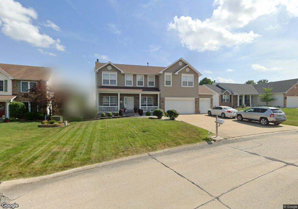
210 Surrey Trail Dr Saint Peters, MO 63376
Estimated Value: $445,000 - $517,000
4
Beds
3
Baths
2,580
Sq Ft
$184/Sq Ft
Est. Value
About This Home
This home is located at 210 Surrey Trail Dr, Saint Peters, MO 63376 and is currently estimated at $476,008, approximately $184 per square foot. 210 Surrey Trail Dr is a home located in St. Charles County with nearby schools including Progress South Elementary School, Fort Zumwalt South Middle School, and Fort Zumwalt South High School.
Ownership History
Date
Name
Owned For
Owner Type
Purchase Details
Closed on
Mar 21, 2024
Sold by
Reynolds Jack T and Reynolds Diana M
Bought by
Reynolds
Current Estimated Value
Purchase Details
Closed on
Jan 28, 2005
Sold by
Mcdonald Daniel L and Mcdonald Laurie Ann
Bought by
Reynolds Jack T and Reynolds Diana
Home Financials for this Owner
Home Financials are based on the most recent Mortgage that was taken out on this home.
Original Mortgage
$182,400
Interest Rate
5.71%
Mortgage Type
Purchase Money Mortgage
Purchase Details
Closed on
Apr 30, 2001
Sold by
Tr Hughes Inc
Bought by
Mcdonald Daniel L and Mcdonald Laurie Ann
Home Financials for this Owner
Home Financials are based on the most recent Mortgage that was taken out on this home.
Original Mortgage
$157,600
Interest Rate
6.81%
Purchase Details
Closed on
Oct 20, 2000
Sold by
Kaplan Development And Investment Co
Bought by
Tr Hughes Inc
Create a Home Valuation Report for This Property
The Home Valuation Report is an in-depth analysis detailing your home's value as well as a comparison with similar homes in the area
Home Values in the Area
Average Home Value in this Area
Purchase History
| Date | Buyer | Sale Price | Title Company |
|---|---|---|---|
| Reynolds | -- | None Listed On Document | |
| Reynolds Jack T | $228,000 | Inv | |
| Mcdonald Daniel L | -- | -- | |
| Tr Hughes Inc | -- | -- |
Source: Public Records
Mortgage History
| Date | Status | Borrower | Loan Amount |
|---|---|---|---|
| Previous Owner | Reynolds Jack T | $182,400 | |
| Previous Owner | Mcdonald Daniel L | $157,600 |
Source: Public Records
Tax History Compared to Growth
Tax History
| Year | Tax Paid | Tax Assessment Tax Assessment Total Assessment is a certain percentage of the fair market value that is determined by local assessors to be the total taxable value of land and additions on the property. | Land | Improvement |
|---|---|---|---|---|
| 2025 | $5,463 | $89,450 | -- | -- |
| 2023 | $5,466 | $82,845 | $0 | $0 |
| 2022 | $5,075 | $71,574 | $0 | $0 |
| 2021 | $5,079 | $71,574 | $0 | $0 |
| 2020 | $4,629 | $63,113 | $0 | $0 |
| 2019 | $4,441 | $60,392 | $0 | $0 |
| 2018 | $3,906 | $50,679 | $0 | $0 |
| 2017 | $3,862 | $50,679 | $0 | $0 |
| 2016 | $3,733 | $48,795 | $0 | $0 |
| 2015 | $3,431 | $48,236 | $0 | $0 |
| 2014 | $3,088 | $42,677 | $0 | $0 |
Source: Public Records
Map
Nearby Homes
- 146 Huntington Crossing Dr
- 307 Santa Fe Trail Dr
- 211 Butternut Stage Dr
- 113 Stage Coach Landing Dr
- 114 Knaust Rd
- 7 Park City Ct
- 212 Jacobs Way
- 225 Jacobs Way
- 5 Arborgate Dr Unit 69A
- 2068 Williamstown Dr
- 1 Pauley Cir
- 67 Oakridge West Dr
- 42 Kingspointe Dr
- 421 Jacobs Place Dr
- 31 Lace Bark Ct
- 34 Aspen Pointe Dr
- 8201 Bristol Valley Dr
- 619 Turtle Creek Ct
- 367 Shamrock St
- 361 Shamrock St
- 214 Surrey Trail Dr
- 206 Surrey Trail Dr
- 221 Thoroughbred Trail
- 218 Surrey Trail Dr
- 225 Thoroughbred Trail
- 202 Surrey Trail Dr
- 217 Thoroughbred Trail
- 211 Surrey Trail Dr
- 207 Surrey Trail Dr
- 215 Surrey Trail Dr
- 222 Surrey Trail Dr
- 229 Thoroughbred Trail
- 203 Surrey Trail Dr
- 209 Thoroughbred Trail
- 186 Huntington Crossing Dr
- 18 Canter Ct
- 218 Thoroughbred Trail
- 224 Thoroughbred Trail
- 223 Surrey Trail Dr