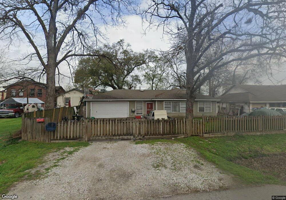
210 Theron St Houston, TX 77022
Northside-Northline NeighborhoodEstimated Value: $216,000 - $263,000
2
Beds
1
Bath
1,182
Sq Ft
$198/Sq Ft
Est. Value
About This Home
This home is located at 210 Theron St, Houston, TX 77022 and is currently estimated at $234,509, approximately $198 per square foot. 210 Theron St is a home located in Harris County with nearby schools including Herrera Elementary School, Burbank Middle School, and Sam Houston Math, Science & Technology Center.
Ownership History
Date
Name
Owned For
Owner Type
Purchase Details
Closed on
Sep 9, 2015
Sold by
Villarreal Ann N
Bought by
Tovar Jose C and Tovar Delia
Current Estimated Value
Purchase Details
Closed on
Jan 4, 2000
Sold by
Larios Ramon E
Bought by
Villareal Ana N
Create a Home Valuation Report for This Property
The Home Valuation Report is an in-depth analysis detailing your home's value as well as a comparison with similar homes in the area
Home Values in the Area
Average Home Value in this Area
Purchase History
| Date | Buyer | Sale Price | Title Company |
|---|---|---|---|
| Tovar Jose C | -- | None Available | |
| Villareal Ana N | -- | Texas American Title Company |
Source: Public Records
Mortgage History
| Date | Status | Borrower | Loan Amount |
|---|---|---|---|
| Closed | Villareal Ana N | $0 |
Source: Public Records
Tax History Compared to Growth
Tax History
| Year | Tax Paid | Tax Assessment Tax Assessment Total Assessment is a certain percentage of the fair market value that is determined by local assessors to be the total taxable value of land and additions on the property. | Land | Improvement |
|---|---|---|---|---|
| 2025 | $4,398 | $215,854 | $120,445 | $95,409 |
| 2024 | $4,398 | $210,181 | $120,445 | $89,736 |
| 2023 | $4,398 | $210,859 | $104,504 | $106,355 |
| 2022 | $3,722 | $169,038 | $77,935 | $91,103 |
| 2021 | $3,523 | $151,166 | $77,935 | $73,231 |
| 2020 | $3,430 | $141,628 | $77,935 | $63,693 |
| 2019 | $3,225 | $127,458 | $63,765 | $63,693 |
| 2018 | $2,494 | $98,579 | $44,281 | $54,298 |
| 2017 | $2,493 | $98,579 | $44,281 | $54,298 |
| 2016 | $2,493 | $98,579 | $44,281 | $54,298 |
| 2015 | $1,591 | $93,173 | $35,425 | $57,748 |
| 2014 | $1,591 | $85,644 | $24,798 | $60,846 |
Source: Public Records
Map
Nearby Homes
- 136 Theron St
- 65 Neyland St
- 105 Oddo St
- 715 E 34th St
- 0 E 31st St Unit 75519178
- 0 W Hardy St Unit 97848877
- 0 W Hardy St Unit 80694202
- 3111 Eastman St
- 0 Yorkshire St Unit 17401015
- 210 Van Molan St
- 4402 Airline Dr
- 7014 Finn St
- 1230 Johnston St
- 7018 Finn St
- 1228 Johnston St
- 1224 Johnston St
- 1222 Johnston St
- 1216 Johnston St Unit A/B
- 164 Wallace St
- 1224 Neyland St