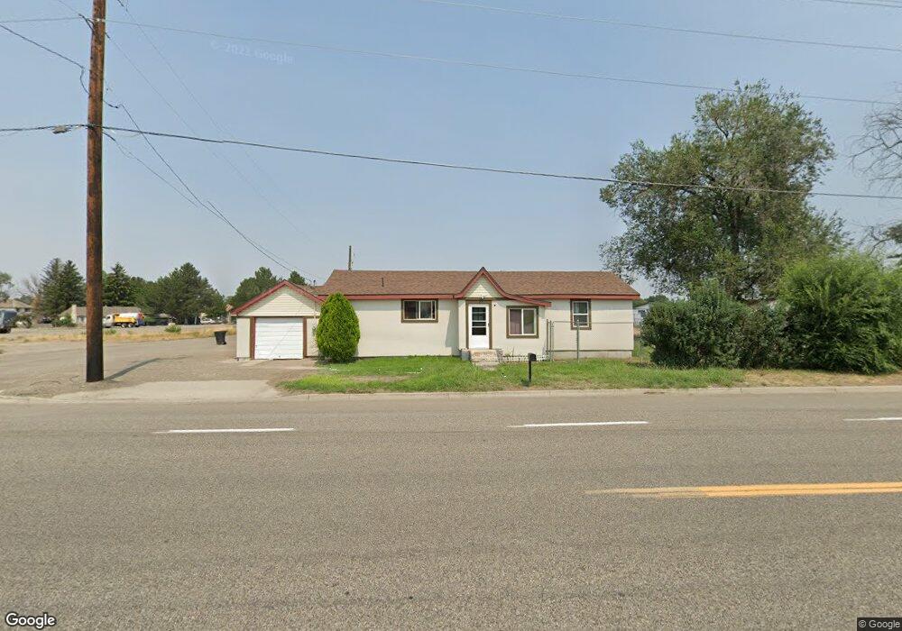
210 University Ave E Gooding, ID 83330
Estimated Value: $246,000 - $263,543
3
Beds
2
Baths
1,876
Sq Ft
$137/Sq Ft
Est. Value
About This Home
This home is located at 210 University Ave E, Gooding, ID 83330 and is currently estimated at $257,886, approximately $137 per square foot. 210 University Ave E is a home located in Gooding County with nearby schools including Gooding Elementary School, Gooding Middle School, and Gooding High School.
Ownership History
Date
Name
Owned For
Owner Type
Purchase Details
Closed on
Feb 17, 2023
Sold by
Taylor Scott and Taylor Amber
Bought by
Cotton Wood Rentals Llc
Current Estimated Value
Purchase Details
Closed on
Jan 4, 2017
Sold by
Taylor Amber and Taylor Scott
Bought by
Taylor Scott
Home Financials for this Owner
Home Financials are based on the most recent Mortgage that was taken out on this home.
Original Mortgage
$48,750
Interest Rate
4.16%
Mortgage Type
Unknown
Create a Home Valuation Report for This Property
The Home Valuation Report is an in-depth analysis detailing your home's value as well as a comparison with similar homes in the area
Home Values in the Area
Average Home Value in this Area
Purchase History
| Date | Buyer | Sale Price | Title Company |
|---|---|---|---|
| Cotton Wood Rentals Llc | -- | Accommodation/Courtesy Recordi | |
| Taylor Scott | -- | First American Title Jerome | |
| Taylor Scott | -- | First American Title Jerome |
Source: Public Records
Mortgage History
| Date | Status | Borrower | Loan Amount |
|---|---|---|---|
| Previous Owner | Taylor Scott | $48,750 |
Source: Public Records
Tax History
| Year | Tax Paid | Tax Assessment Tax Assessment Total Assessment is a certain percentage of the fair market value that is determined by local assessors to be the total taxable value of land and additions on the property. | Land | Improvement |
|---|---|---|---|---|
| 2025 | $2,075 | $185,874 | $85,313 | $100,561 |
| 2024 | $1,522 | $130,431 | $66,144 | $64,287 |
| 2023 | $1,489 | $124,220 | $62,994 | $61,226 |
| 2022 | $1,510 | $118,153 | $62,994 | $55,159 |
| 2021 | $1,417 | $94,952 | $42,420 | $52,532 |
| 2020 | $1,079 | $59,485 | $19,688 | $39,797 |
| 2019 | $1,102 | $55,541 | $19,688 | $35,853 |
| 2018 | $1,001 | $51,732 | $26,250 | $25,482 |
| 2017 | $957 | $0 | $0 | $0 |
| 2016 | $1,018 | $0 | $0 | $0 |
Source: Public Records
Map
Nearby Homes
- 210 University Ave E
- 2240 Washington St
- 2230 & 2240 Washington St
- 240 University Ave E
- 2230 Washington St
- 2257 Montana St
- 215 University Ave E
- 101 University Ave
- 2209 Main St
- TBD U S Highway 26
- 2300 Main St
- 2144 Main St
- 2371 Highway 26
- 2275 Highway 26
- 2135 Highway 26
- 2167 Highway 26
- 2005 Highway 26
- 2017 Highway 26
- 1935 Highway 26
- 1967 Highway 26
Your Personal Tour Guide
Ask me questions while you tour the home.