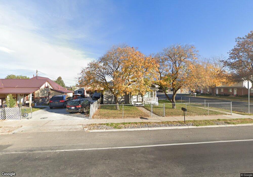
210 W 400 N Spanish Fork, UT 84660
Estimated Value: $362,000 - $417,000
3
Beds
1
Bath
1,431
Sq Ft
$276/Sq Ft
Est. Value
About This Home
This home is located at 210 W 400 N, Spanish Fork, UT 84660 and is currently estimated at $394,879, approximately $275 per square foot. 210 W 400 N is a home located in Utah County with nearby schools including Brockbank Elementary School, Spanish Fork Jr High School, and Spanish Fork High School.
Ownership History
Date
Name
Owned For
Owner Type
Purchase Details
Closed on
Sep 12, 2019
Sold by
Munford Real Estate Llc
Bought by
Munford Real Estate Llc
Current Estimated Value
Purchase Details
Closed on
Sep 13, 2018
Sold by
Pulham Mark and Pulham Heidi
Bought by
Munford Real Estate Llc
Home Financials for this Owner
Home Financials are based on the most recent Mortgage that was taken out on this home.
Original Mortgage
$190,000
Outstanding Balance
$165,706
Interest Rate
4.6%
Mortgage Type
Purchase Money Mortgage
Estimated Equity
$229,173
Purchase Details
Closed on
Jul 19, 2006
Sold by
Shell Hyrum L and Shell Andrea A
Bought by
Pulham Mark and Pulham Heidi
Purchase Details
Closed on
Apr 26, 2004
Sold by
Rainey Paul C and Rainey Melanie
Bought by
Shell Hyrum L and Shell Andrea A
Home Financials for this Owner
Home Financials are based on the most recent Mortgage that was taken out on this home.
Original Mortgage
$107,808
Interest Rate
5.35%
Mortgage Type
FHA
Create a Home Valuation Report for This Property
The Home Valuation Report is an in-depth analysis detailing your home's value as well as a comparison with similar homes in the area
Home Values in the Area
Average Home Value in this Area
Purchase History
| Date | Buyer | Sale Price | Title Company |
|---|---|---|---|
| Munford Real Estate Llc | -- | Accommodation | |
| Munford Real Estate Llc | -- | Charge Title | |
| Pulham Mark | -- | None Available | |
| Shell Hyrum L | -- | Pro Title & Escrow Inc |
Source: Public Records
Mortgage History
| Date | Status | Borrower | Loan Amount |
|---|---|---|---|
| Open | Munford Real Estate Llc | $190,000 | |
| Previous Owner | Shell Hyrum L | $107,808 |
Source: Public Records
Tax History Compared to Growth
Tax History
| Year | Tax Paid | Tax Assessment Tax Assessment Total Assessment is a certain percentage of the fair market value that is determined by local assessors to be the total taxable value of land and additions on the property. | Land | Improvement |
|---|---|---|---|---|
| 2025 | $1,681 | $183,315 | $124,700 | $208,600 |
| 2024 | $1,744 | $173,250 | $0 | $0 |
| 2023 | $1,537 | $179,960 | $0 | $0 |
| 2022 | $1,527 | $155,595 | $0 | $0 |
| 2021 | $1,309 | $212,000 | $72,400 | $139,600 |
| 2020 | $1,182 | $186,100 | $60,300 | $125,800 |
| 2019 | $1,069 | $177,000 | $60,300 | $116,700 |
| 2018 | $1,011 | $161,800 | $60,300 | $101,500 |
| 2017 | $896 | $77,110 | $0 | $0 |
| 2016 | $810 | $68,805 | $0 | $0 |
| 2015 | $739 | $61,985 | $0 | $0 |
| 2014 | $692 | $58,245 | $0 | $0 |
Source: Public Records
Map
Nearby Homes