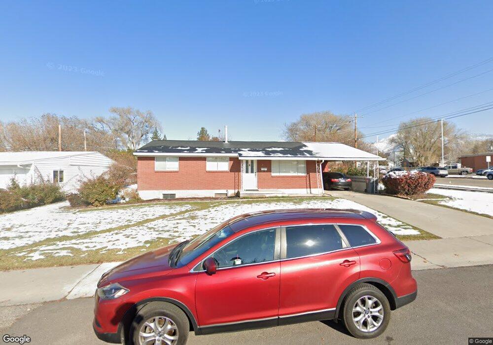
210 W 600 N American Fork, UT 84003
Estimated Value: $428,899 - $511,000
3
Beds
1
Bath
1,080
Sq Ft
$438/Sq Ft
Est. Value
About This Home
This home is located at 210 W 600 N, American Fork, UT 84003 and is currently estimated at $472,725, approximately $437 per square foot. 210 W 600 N is a home located in Utah County with nearby schools including Shelley Elementary School, American Fork Junior High School, and American Fork High School.
Ownership History
Date
Name
Owned For
Owner Type
Purchase Details
Closed on
Oct 14, 2021
Sold by
Karren Thomas A
Bought by
Karren Thomas A and Tom Karren Trust
Current Estimated Value
Purchase Details
Closed on
Dec 22, 2020
Sold by
Hudson Dorothy Colette and Forsyth Joyce
Bought by
Karren Thomas A
Create a Home Valuation Report for This Property
The Home Valuation Report is an in-depth analysis detailing your home's value as well as a comparison with similar homes in the area
Home Values in the Area
Average Home Value in this Area
Purchase History
| Date | Buyer | Sale Price | Title Company |
|---|---|---|---|
| Karren Thomas A | -- | None Available | |
| Karren Thomas A | -- | Backman Ntp |
Source: Public Records
Mortgage History
| Date | Status | Borrower | Loan Amount |
|---|---|---|---|
| Closed | Karren Thomas A | $0 |
Source: Public Records
Tax History Compared to Growth
Tax History
| Year | Tax Paid | Tax Assessment Tax Assessment Total Assessment is a certain percentage of the fair market value that is determined by local assessors to be the total taxable value of land and additions on the property. | Land | Improvement |
|---|---|---|---|---|
| 2025 | $1,844 | $222,420 | $195,700 | $208,700 |
| 2024 | $1,844 | $204,930 | $0 | $0 |
| 2023 | $1,736 | $204,545 | $0 | $0 |
| 2022 | $1,892 | $220,000 | $0 | $0 |
| 2021 | $1,615 | $293,300 | $140,400 | $152,900 |
| 2020 | $1,509 | $265,700 | $125,400 | $140,300 |
| 2019 | $1,360 | $247,800 | $107,500 | $140,300 |
| 2018 | $1,256 | $218,800 | $96,800 | $122,000 |
| 2017 | $1,209 | $113,630 | $0 | $0 |
| 2016 | $1,159 | $101,200 | $0 | $0 |
| 2015 | $1,132 | $93,830 | $0 | $0 |
| 2014 | $1,114 | $91,080 | $0 | $0 |
Source: Public Records
Map
Nearby Homes
- 540 N 300 W
- 621 N 100 W
- 782 N 200 W
- 796 N 200 W
- 641 N 420 W
- 365 N 100 W
- 374 N Center St
- 183 E 760 St N
- 356 N 480 W
- 914 N 400 W Unit A
- 10238 N 6530 W Unit 15
- 1051 N 390 E Unit 103
- 6079 W Whisper Ln Unit 404
- 1220 E 700 N
- 1039 N 390 E Unit 102
- 11338 N Annes Way Unit 8
- 6111 W Whisper Ln Unit 402
- 984 N 300 W
- 3889 W 950 Cir N Unit 366
- 370 W Pacific Dr Unit 1