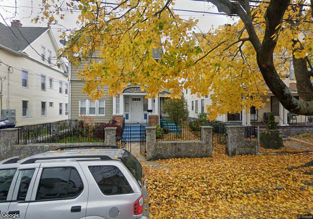
210 Whitney Ave Bridgeport, CT 06606
Brooklawn-Saint Vincent NeighborhoodEstimated Value: $281,000 - $456,000
4
Beds
2
Baths
1,622
Sq Ft
$240/Sq Ft
Est. Value
About This Home
This home is located at 210 Whitney Ave, Bridgeport, CT 06606 and is currently estimated at $389,951, approximately $240 per square foot. 210 Whitney Ave is a home located in Fairfield County with nearby schools including Read School, Central High School, and Catholic Academy of Bridgeport-St. Raphael Academy.
Ownership History
Date
Name
Owned For
Owner Type
Purchase Details
Closed on
May 15, 2002
Sold by
Hunt Margherita L
Bought by
Melendez Reina M
Current Estimated Value
Home Financials for this Owner
Home Financials are based on the most recent Mortgage that was taken out on this home.
Original Mortgage
$120,700
Outstanding Balance
$51,755
Interest Rate
7.15%
Estimated Equity
$338,196
Create a Home Valuation Report for This Property
The Home Valuation Report is an in-depth analysis detailing your home's value as well as a comparison with similar homes in the area
Home Values in the Area
Average Home Value in this Area
Purchase History
| Date | Buyer | Sale Price | Title Company |
|---|---|---|---|
| Melendez Reina M | $129,000 | -- | |
| Melendez Reina M | $129,000 | -- |
Source: Public Records
Mortgage History
| Date | Status | Borrower | Loan Amount |
|---|---|---|---|
| Open | Melendez Reina M | $50,000 | |
| Closed | Melendez Reina M | $18,000 | |
| Open | Melendez Reina M | $120,700 | |
| Closed | Melendez Reina M | $120,700 |
Source: Public Records
Tax History Compared to Growth
Tax History
| Year | Tax Paid | Tax Assessment Tax Assessment Total Assessment is a certain percentage of the fair market value that is determined by local assessors to be the total taxable value of land and additions on the property. | Land | Improvement |
|---|---|---|---|---|
| 2025 | $6,447 | $148,370 | $70,120 | $78,250 |
| 2024 | $6,447 | $148,370 | $70,120 | $78,250 |
| 2023 | $6,447 | $148,370 | $70,120 | $78,250 |
| 2022 | $6,447 | $148,370 | $70,120 | $78,250 |
| 2021 | $6,447 | $148,370 | $70,120 | $78,250 |
| 2020 | $5,787 | $107,180 | $42,490 | $64,690 |
| 2019 | $5,787 | $107,180 | $42,490 | $64,690 |
| 2018 | $5,827 | $107,180 | $42,490 | $64,690 |
| 2017 | $5,827 | $107,180 | $42,490 | $64,690 |
| 2016 | $5,827 | $107,180 | $42,490 | $64,690 |
| 2015 | $5,508 | $130,520 | $42,840 | $87,680 |
| 2014 | $5,508 | $130,520 | $42,840 | $87,680 |
Source: Public Records
Map
Nearby Homes
- 2395 Main St Unit 2397
- 76 Porter St
- 330 French St
- 90 Tom Thumb St
- 724 Capitol Ave Unit 726
- 390 Charles St Unit 106
- 78 Fairmount Ave
- 119 Madison Terrace
- 152 River St
- 936 Lindley St
- 178 Island Brook Ave
- 31 Taft Ave
- 508 Hawley Ave
- 106 Manhattan Ave Unit 108
- 123 Harlem Ave
- 957 William St Unit A
- 926 Hart St
- 916 Hart St
- 203 Wayne St
- 318 Center St
- 200 Whitney Ave Unit 204
- 216 Whitney Ave
- 190 Whitney Ave Unit 3rd Apartment
- 190 Whitney Ave Unit 1st Floor
- 190 Whitney Ave Unit 2nd floor
- 209 Whitney Ave Unit 213
- 180 Whitney Ave
- 199 Whitney Ave
- 199 Whitney Ave Unit 1
- 199 Whitney Ave Unit 3
- 191 Parrott Ave
- 191 Parrott Ave Unit 1
- 191 Parrott Ave Unit 3rd
- 221 Whitney Ave
- 226 Whitney Ave
- 205 Parrott Ave
- 183 Parrott Ave
- 215 Parrott Ave
- 191 Whitney Ave