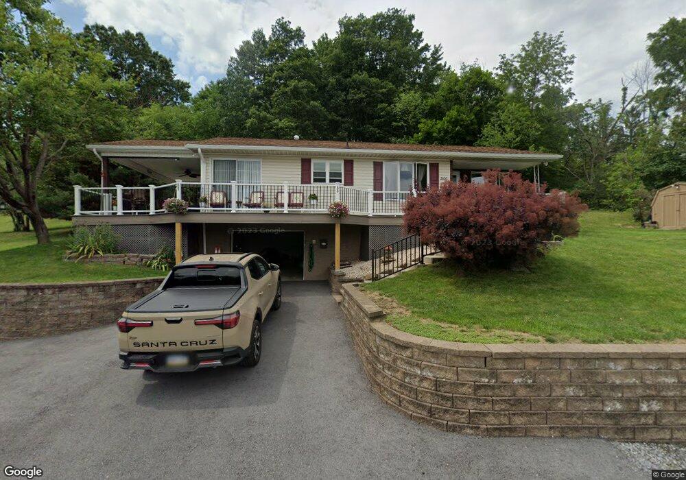
2100 21st St Altoona, PA 16601
Newburg NeighborhoodEstimated Value: $172,495 - $193,000
2
Beds
1
Bath
1,079
Sq Ft
$170/Sq Ft
Est. Value
About This Home
This home is located at 2100 21st St, Altoona, PA 16601 and is currently estimated at $183,374, approximately $169 per square foot. 2100 21st St is a home located in Blair County with nearby schools including Tender Love for Children Child Care, Altoona Central Catholic School, and Holy Trinity Catholic School.
Ownership History
Date
Name
Owned For
Owner Type
Purchase Details
Closed on
Sep 11, 2013
Sold by
Burns Paul W and Burns Rebecca S
Bought by
Lahive William C and Lehive Cecelia M
Current Estimated Value
Purchase Details
Closed on
Jun 19, 2008
Sold by
Krater Steven A and Krater Pamela
Bought by
Burns Paul W
Home Financials for this Owner
Home Financials are based on the most recent Mortgage that was taken out on this home.
Original Mortgage
$131,000
Interest Rate
6.01%
Mortgage Type
New Conventional
Purchase Details
Closed on
Jan 17, 2007
Sold by
Stout Cheryl A and Stout Sue
Bought by
Fannie Mae
Create a Home Valuation Report for This Property
The Home Valuation Report is an in-depth analysis detailing your home's value as well as a comparison with similar homes in the area
Home Values in the Area
Average Home Value in this Area
Purchase History
| Date | Buyer | Sale Price | Title Company |
|---|---|---|---|
| Lahive William C | $150,000 | None Available | |
| Burns Paul W | $137,900 | None Available | |
| Fannie Mae | $1,527 | None Available |
Source: Public Records
Mortgage History
| Date | Status | Borrower | Loan Amount |
|---|---|---|---|
| Previous Owner | Burns Paul W | $131,000 |
Source: Public Records
Tax History Compared to Growth
Tax History
| Year | Tax Paid | Tax Assessment Tax Assessment Total Assessment is a certain percentage of the fair market value that is determined by local assessors to be the total taxable value of land and additions on the property. | Land | Improvement |
|---|---|---|---|---|
| 2025 | $2,219 | $151,900 | $27,800 | $124,100 |
| 2024 | $2,113 | $151,900 | $27,800 | $124,100 |
| 2023 | $1,879 | $151,900 | $27,800 | $124,100 |
| 2022 | $1,844 | $151,900 | $27,800 | $124,100 |
| 2021 | $1,768 | $151,900 | $27,800 | $124,100 |
| 2020 | $1,765 | $151,900 | $27,800 | $124,100 |
| 2019 | $1,711 | $151,900 | $27,800 | $124,100 |
| 2018 | $1,647 | $151,900 | $27,800 | $124,100 |
| 2017 | $9,034 | $151,900 | $27,800 | $124,100 |
| 2016 | $543 | $11,710 | $230 | $11,480 |
| 2015 | $543 | $11,710 | $230 | $11,480 |
| 2014 | $543 | $11,710 | $230 | $11,480 |
Source: Public Records
Map
Nearby Homes
- 2014 20th St Unit 18
- 2300 16th Ave Unit 2
- 1611 21st Ave
- 1524 21st Ave Unit 26
- 1515 20th Ave Unit 19
- 1511 20th Ave
- 1517 25th Ave Unit 19
- 1510 19th Ave Unit 12
- 1508 25th Ave
- 2501 15th St Unit 15
- 2715 16th St
- 2114 14th St
- 1421 17th Ave
- 2022 Pine Ave
- 1308 17th Ave
- 1320 16th Ave Unit 22
- 1223 25th Ave
- 1222 19th Ave
- 1216 23rd Ave
- 1318 14th Ave
- 2100 21st St
- 2101 21st St
- 2103 21st St
- 2120 21st St
- 2022 21st St
- 2117 20th St Unit 21
- 2021 21st St
- 2107 20th St Unit 15
- 2023 20th St Unit 27
- 2018 21st St
- 2131 21st St
- 2021 20th St
- 2254 James Gate Ln
- 2309 20th St Unit 19
- 2102 20th St
- 2120 20th St Unit 22
- 2108 20th St Unit 10
- 2104 20th St Unit 6
- 2301 20th St Unit 7
- 2100 20th St Unit 2