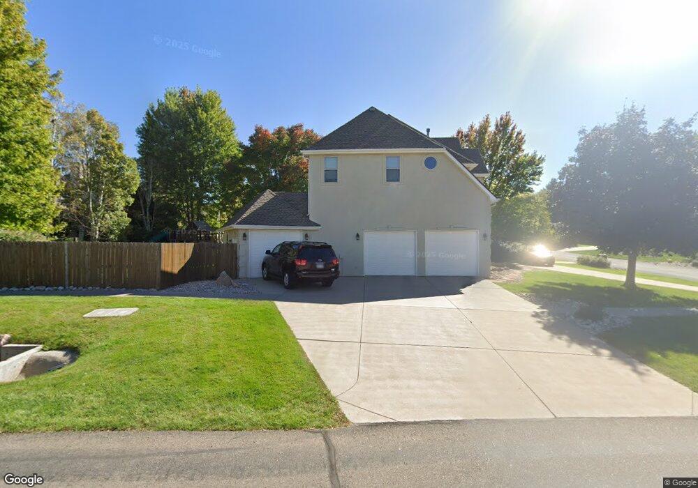
2100 63rd Ave Greeley, CO 80634
Westridge NeighborhoodEstimated Value: $631,000 - $855,000
4
Beds
3
Baths
2,892
Sq Ft
$244/Sq Ft
Est. Value
About This Home
This home is located at 2100 63rd Ave, Greeley, CO 80634 and is currently estimated at $706,229, approximately $244 per square foot. 2100 63rd Ave is a home located in Weld County with nearby schools including Greeley West High School, University Schools, and Union Colony Preparatory School.
Ownership History
Date
Name
Owned For
Owner Type
Purchase Details
Closed on
Aug 4, 2009
Sold by
Coan Brent and Coan Amie
Bought by
Hirsch Cecilia Maria
Current Estimated Value
Home Financials for this Owner
Home Financials are based on the most recent Mortgage that was taken out on this home.
Original Mortgage
$363,199
Outstanding Balance
$231,383
Interest Rate
5.41%
Mortgage Type
FHA
Estimated Equity
$474,846
Purchase Details
Closed on
Aug 6, 1997
Sold by
Olando Ltd Liability Co
Bought by
Coan Brent and Coan Amie
Create a Home Valuation Report for This Property
The Home Valuation Report is an in-depth analysis detailing your home's value as well as a comparison with similar homes in the area
Home Values in the Area
Average Home Value in this Area
Purchase History
We collect this data history from publicly available records. To have your information removed, we recommend requesting removal directly through your county’s website.
| Date | Buyer | Sale Price | Title Company |
|---|---|---|---|
| Hirsch Cecilia Maria | $369,900 | Htco | |
| Coan Brent | $36,500 | -- |
Source: Public Records
Mortgage History
We collect this data history from publicly available records. To have your information removed, we recommend requesting removal directly through your county’s website.
| Date | Status | Borrower | Loan Amount |
|---|---|---|---|
| Open | Hirsch Cecilia Maria | $363,199 |
Source: Public Records
Tax History
| Year | Tax Paid | Tax Assessment Tax Assessment Total Assessment is a certain percentage of the fair market value that is determined by local assessors to be the total taxable value of land and additions on the property. | Land | Improvement |
|---|---|---|---|---|
| 2026 | $3,634 | $38,780 | $5,810 | $32,970 |
| 2025 | $3,312 | $39,620 | $5,940 | $33,680 |
| 2024 | $3,312 | $39,620 | $5,940 | $33,680 |
| 2023 | $3,160 | $42,970 | $6,430 | $36,540 |
| 2022 | $2,939 | $33,540 | $6,260 | $27,280 |
| 2021 | $3,032 | $34,510 | $6,440 | $28,070 |
| 2020 | $2,899 | $33,100 | $5,290 | $27,810 |
| 2019 | $2,907 | $33,100 | $5,290 | $27,810 |
| 2018 | $2,409 | $28,940 | $5,260 | $23,680 |
| 2017 | $2,422 | $28,940 | $5,260 | $23,680 |
| 2016 | $2,019 | $27,130 | $5,810 | $21,320 |
| 2015 | $2,011 | $27,130 | $5,810 | $21,320 |
| 2014 | $1,930 | $25,410 | $4,940 | $20,470 |
Source: Public Records
Map
Nearby Homes
- 6111 W 21st St
- 6600 W 20th St Unit 53
- 6606 W 24th St
- 2048 Fairway Ln
- 6700 W 22nd St
- 5719 W 24th St
- 1847 61st Ave
- 1900 68th Ave Unit 11 5
- 1900 68th Ave Unit 810
- 2218 69th Ave
- 6813 W 23rd St
- 307 57th Ave
- 2121 Clubhouse Dr
- 2123 Clubhouse Dr
- 6925 W 19th St Unit 15
- 1737 69th Ave
- 7209 W 21st St
- 1504 60th Ave
- 5627 W 16th Street Rd
- 1625 55th Ave
- 2106 63rd Ave
- 2105 62nd Avenue Ct
- 2111 62nd Avenue Ct
- 6247 W 21st St
- 6231 W 21st St
- 2103 63rd Ave
- 2112 63rd Ave
- 6305 W 21st St
- 2109 63rd Ave
- 2117 62nd Avenue Ct
- 6223 W 21st St
- 2115 63rd Ave
- 6313 W 21st St
- 2118 63rd Ave
- 2102 64th Ave
- 2125 62nd Avenue Ct
- 2104 62nd Avenue Ct
- 2108 64th Ave
- 2110 62nd Ave
- 6217 W 21st St
Your Personal Tour Guide
Ask me questions while you tour the home.