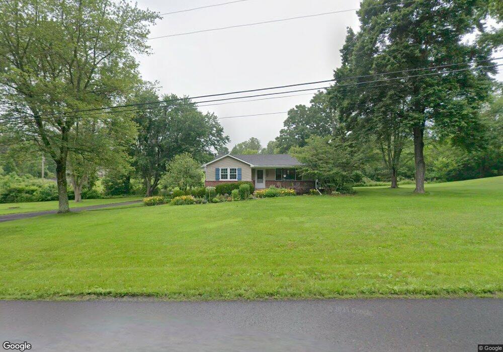
2100 Branch Rd Perkasie, PA 18944
East Rockhill NeighborhoodEstimated Value: $334,000 - $413,574
3
Beds
1
Bath
1,210
Sq Ft
$310/Sq Ft
Est. Value
About This Home
This home is located at 2100 Branch Rd, Perkasie, PA 18944 and is currently estimated at $375,394, approximately $310 per square foot. 2100 Branch Rd is a home located in Bucks County with nearby schools including Pennridge High School.
Ownership History
Date
Name
Owned For
Owner Type
Purchase Details
Closed on
Feb 25, 2010
Sold by
Federal Home Loan Mortgage Corporation
Bought by
Brady Christopher C
Current Estimated Value
Home Financials for this Owner
Home Financials are based on the most recent Mortgage that was taken out on this home.
Original Mortgage
$157,102
Outstanding Balance
$102,920
Interest Rate
4.75%
Mortgage Type
FHA
Estimated Equity
$272,474
Purchase Details
Closed on
Dec 16, 2009
Sold by
Carroll James E and Carroll Ruth A
Bought by
Federal Home Loan Mortgage Corp
Purchase Details
Closed on
May 27, 2005
Sold by
Barnhart George R and Barnhart Christine E
Bought by
Carroll James E and Carroll Ruth A
Home Financials for this Owner
Home Financials are based on the most recent Mortgage that was taken out on this home.
Original Mortgage
$250,000
Interest Rate
4.87%
Mortgage Type
Fannie Mae Freddie Mac
Create a Home Valuation Report for This Property
The Home Valuation Report is an in-depth analysis detailing your home's value as well as a comparison with similar homes in the area
Home Values in the Area
Average Home Value in this Area
Purchase History
| Date | Buyer | Sale Price | Title Company |
|---|---|---|---|
| Brady Christopher C | $160,000 | Land Title Svcs Of Nj Inc | |
| Federal Home Loan Mortgage Corp | $1,010 | None Available | |
| Carroll James E | $250,000 | -- |
Source: Public Records
Mortgage History
| Date | Status | Borrower | Loan Amount |
|---|---|---|---|
| Open | Brady Christopher C | $157,102 | |
| Previous Owner | Carroll James E | $250,000 |
Source: Public Records
Tax History Compared to Growth
Tax History
| Year | Tax Paid | Tax Assessment Tax Assessment Total Assessment is a certain percentage of the fair market value that is determined by local assessors to be the total taxable value of land and additions on the property. | Land | Improvement |
|---|---|---|---|---|
| 2025 | $4,199 | $24,000 | $5,560 | $18,440 |
| 2024 | $4,199 | $24,000 | $5,560 | $18,440 |
| 2023 | $4,151 | $24,000 | $5,560 | $18,440 |
| 2022 | $4,151 | $24,000 | $5,560 | $18,440 |
| 2021 | $4,151 | $24,000 | $5,560 | $18,440 |
| 2020 | $4,151 | $24,000 | $5,560 | $18,440 |
| 2019 | $4,127 | $24,000 | $5,560 | $18,440 |
| 2018 | $4,079 | $24,000 | $5,560 | $18,440 |
| 2017 | $4,049 | $24,000 | $5,560 | $18,440 |
| 2016 | $4,049 | $24,000 | $5,560 | $18,440 |
| 2015 | -- | $24,000 | $5,560 | $18,440 |
| 2014 | -- | $24,000 | $5,560 | $18,440 |
Source: Public Records
Map
Nearby Homes
- 2004 Evergreen Dr
- 28 Bryant Dr
- 584 Campus Dr
- 137 Sunnyside Ln
- 512 Campus Dr
- 1720 Route 313
- 3267 Bushwood Dr
- 44 Deer Run Rd
- 445 Elephant Rd
- 1229 N Ridge Rd
- 1118 N 5th St
- 1412 Route 113
- 1032 N 7th St
- 0 Old Bethlehem Rd
- Woodford Plan at Everleigh Woods
- Manchester Plan at Everleigh Woods
- Arcadia Plan at Everleigh Woods
- Parker Plan at Everleigh Woods
- Sebastian Plan at Everleigh Woods
- Hawthorne Plan at Everleigh Woods
- 2110 Branch Rd
- 2090 Branch Rd
- 2120 Branch Rd
- 2020 Branch Rd
- 250 W Route 313
- 300 Route 313
- 300 Route 313
- 300 Route 313
- 2140 Branch Rd
- 232 Route 313
- 2314 Branch Rd
- 1950 Branch Rd
- 2003 Evergreen Dr
- 117 Pennsylvania 313
- 2001 Evergreen Dr
- 2000 Evergreen Dr
- 2327 Branch Rd
- 1901 Branch Rd
- 237 Cedarview Dr
- 235 Cedarview Dr