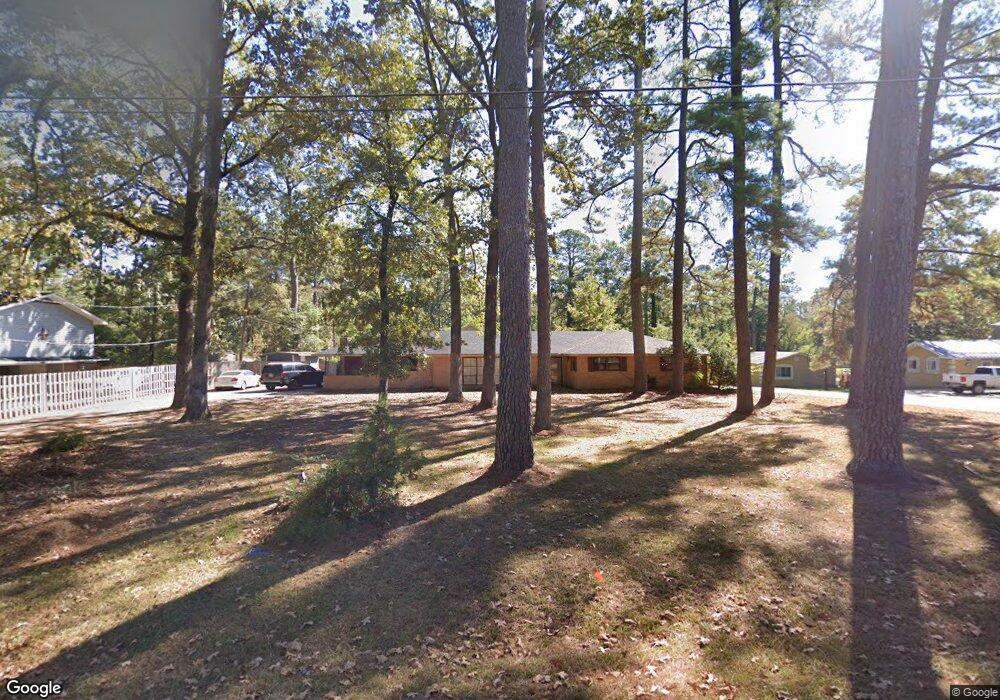
2100 Carter St West Monroe, LA 71291
Claiborne NeighborhoodEstimated Value: $216,000 - $324,000
3
Beds
2
Baths
2,468
Sq Ft
$109/Sq Ft
Est. Value
About This Home
This home is located at 2100 Carter St, West Monroe, LA 71291 and is currently estimated at $267,898, approximately $108 per square foot. 2100 Carter St is a home located in Ouachita Parish with nearby schools including Highland Elementary School, West Monroe High School, and Northeast Baptist School.
Ownership History
Date
Name
Owned For
Owner Type
Purchase Details
Closed on
Jun 24, 2025
Sold by
Irving Norris Mark and Tatum Annie
Bought by
Carter Propco Llc
Current Estimated Value
Purchase Details
Closed on
May 4, 2017
Sold by
E & D Bailey Development Llc
Bought by
Norris Mark I and Norris Annie Marie
Purchase Details
Closed on
Apr 20, 2017
Sold by
Noble Jack Cole
Bought by
Noble Carlton Otis
Purchase Details
Closed on
Sep 26, 2007
Sold by
Odom Carl R and Odom Mary D
Bought by
Rhymes Thomas Lestes and Rhymes Patricia Guraedy
Create a Home Valuation Report for This Property
The Home Valuation Report is an in-depth analysis detailing your home's value as well as a comparison with similar homes in the area
Home Values in the Area
Average Home Value in this Area
Purchase History
| Date | Buyer | Sale Price | Title Company |
|---|---|---|---|
| Carter Propco Llc | -- | None Listed On Document | |
| Norris Mark I | $128,800 | None Available | |
| E & D Bailey Development Llc | $115,000 | None Available | |
| Noble Carlton Otis | -- | None Available | |
| Rhymes Thomas Lestes | $23,000 | None Available |
Source: Public Records
Tax History Compared to Growth
Tax History
| Year | Tax Paid | Tax Assessment Tax Assessment Total Assessment is a certain percentage of the fair market value that is determined by local assessors to be the total taxable value of land and additions on the property. | Land | Improvement |
|---|---|---|---|---|
| 2024 | $3,925 | $26,373 | $2,750 | $23,623 |
| 2023 | $3,925 | $22,998 | $2,750 | $20,248 |
| 2022 | $3,314 | $22,998 | $2,750 | $20,248 |
| 2021 | $3,356 | $37,361 | $2,750 | $34,611 |
| 2020 | $3,356 | $37,361 | $2,750 | $34,611 |
| 2019 | $2,978 | $33,251 | $2,250 | $31,001 |
| 2018 | $1,202 | $13,420 | $2,250 | $11,170 |
| 2017 | $1,202 | $13,395 | $2,250 | $11,145 |
| 2016 | $694 | $7,750 | $1,650 | $6,100 |
| 2015 | $22 | $7,750 | $1,650 | $6,100 |
| 2014 | $22 | $7,750 | $711 | $7,039 |
| 2013 | $527 | $13,420 | $2,250 | $11,170 |
Source: Public Records
Map
Nearby Homes
- 2004 Carter St
- 0 Highway 80 Unit 213443
- 115 Thompson Rd Unit 1.09+-acres
- 2300 Rainbow Dr
- 104 Delane Dr
- 2211 Wellerman Rd
- 1827 Wellerman Rd
- 1509 Dean Chapel Rd
- 14 Ranch Oak Dr
- 112 Willow Branch Dr
- 429 Laird St
- 101 Contrail Dr
- 00 W Highland Ave
- 112 W Highland Ave
- 502 Wallace Rd
- 905 Italiana Place
- 2342 Arkansas Rd Unit 2350 ARKANSAS ROAD
- 122 Mizell Ln
- 1404 Goodhope Rd
- 1619 Arkansas Rd
- 2006 Carter St
- 2007 Carter St
- 2101 Carter St
- 2006 Rainbow Dr
- 2003 Carter St
- 2002 Rainbow Dr
- 2002 Carter Dr
- 2100 Rainbow Dr
- 2002 Carter St
- 2005 Rainbow Dr
- 2003 Rainbow Dr
- 2007 Rainbow Dr
- 2001 Carter St
- 2001 Rainbow Dr
- 2102 Rainbow Dr
- 2000 Carter St
- 2009 Rainbow Dr
- 104 Jonathan St
- 108 Jonathan St
- 1205 Dean Chapel Rd