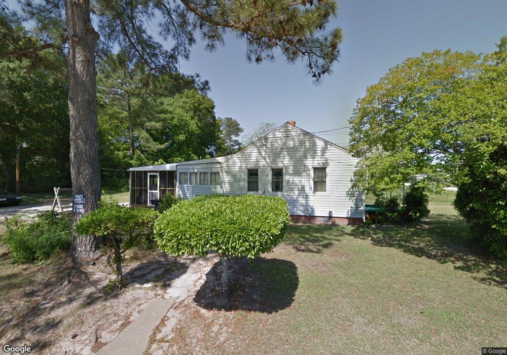
2100 Division St Augusta, GA 30904
West End NeighborhoodEstimated Value: $95,366 - $133,000
2
Beds
1
Bath
1,059
Sq Ft
$112/Sq Ft
Est. Value
About This Home
This home is located at 2100 Division St, Augusta, GA 30904 and is currently estimated at $118,092, approximately $111 per square foot. 2100 Division St is a home located in Richmond County with nearby schools including Lamar Elementary School, W.S. Hornsby Elementary School, and Johnson Magnet.
Ownership History
Date
Name
Owned For
Owner Type
Purchase Details
Closed on
May 4, 2010
Sold by
Sapp Jacqueline B
Bought by
Bank Boston He Trust 1999-1
Current Estimated Value
Purchase Details
Closed on
Apr 13, 2001
Sold by
Usry Harry E
Bought by
Sapp Jacqueline
Home Financials for this Owner
Home Financials are based on the most recent Mortgage that was taken out on this home.
Original Mortgage
$42,900
Interest Rate
6.99%
Create a Home Valuation Report for This Property
The Home Valuation Report is an in-depth analysis detailing your home's value as well as a comparison with similar homes in the area
Home Values in the Area
Average Home Value in this Area
Purchase History
| Date | Buyer | Sale Price | Title Company |
|---|---|---|---|
| Bank Boston He Trust 1999-1 | $42,500 | -- | |
| Sapp Jacqueline | $42,900 | -- |
Source: Public Records
Mortgage History
| Date | Status | Borrower | Loan Amount |
|---|---|---|---|
| Previous Owner | Sapp Jacqueline | $42,900 |
Source: Public Records
Tax History
| Year | Tax Paid | Tax Assessment Tax Assessment Total Assessment is a certain percentage of the fair market value that is determined by local assessors to be the total taxable value of land and additions on the property. | Land | Improvement |
|---|---|---|---|---|
| 2025 | $630 | $34,132 | $2,895 | $31,237 |
| 2024 | $630 | $20,004 | $2,895 | $17,109 |
| 2023 | $324 | $28,312 | $2,895 | $25,417 |
| 2022 | $513 | $25,636 | $2,895 | $22,741 |
| 2021 | $411 | $16,913 | $2,898 | $14,015 |
| 2020 | $428 | $18,015 | $4,000 | $14,015 |
| 2019 | $436 | $18,015 | $4,000 | $14,015 |
| 2018 | $776 | $18,015 | $4,000 | $14,015 |
| 2017 | $773 | $18,015 | $4,000 | $14,015 |
| 2016 | $773 | $18,015 | $4,000 | $14,015 |
| 2015 | $777 | $18,015 | $4,000 | $14,015 |
| 2014 | $777 | $18,015 | $4,000 | $14,015 |
Source: Public Records
Map
Nearby Homes
- 2063 Broad St
- 2025 Ellis St
- 2021 Ellis St
- 299 Milledge Rd
- 2018 Greene St
- 1925 Ellis St
- 2200 Country Club Ct
- 9 Lake Shore Loop
- 1933 Telfair St
- 531 Carr St
- 501 Milledge Rd Unit 9A
- 501 Milledge Rd Unit 14A
- 513 Beaufort Dr
- 2327 Woodbine Rd
- 809 Ona Dr
- 608 Eve St
- 1852 Hicks St
- 1850 Hicks St
- 1916 Walker St
- 1847 Telfair St
Your Personal Tour Guide
Ask me questions while you tour the home.