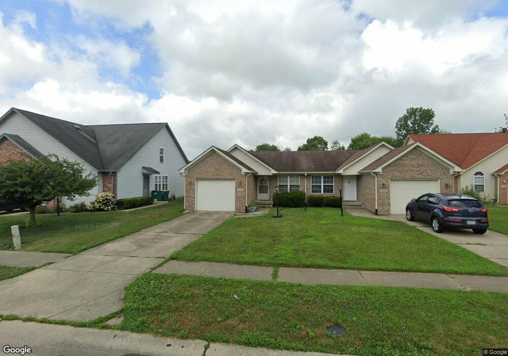
2100 Galaxy Dr Franklin, IN 46131
Estimated Value: $193,027 - $212,000
2
Beds
2
Baths
1,083
Sq Ft
$186/Sq Ft
Est. Value
About This Home
This home is located at 2100 Galaxy Dr, Franklin, IN 46131 and is currently estimated at $201,757, approximately $186 per square foot. 2100 Galaxy Dr is a home located in Johnson County with nearby schools including Northwood Elementary School, Franklin Community Middle School, and Custer Baker Intermediate School.
Ownership History
Date
Name
Owned For
Owner Type
Purchase Details
Closed on
Oct 22, 2009
Sold by
Britton Diane M and Long Patti J
Bought by
Patterson Julie D
Current Estimated Value
Home Financials for this Owner
Home Financials are based on the most recent Mortgage that was taken out on this home.
Original Mortgage
$72,560
Outstanding Balance
$47,453
Interest Rate
5.11%
Mortgage Type
FHA
Estimated Equity
$154,304
Create a Home Valuation Report for This Property
The Home Valuation Report is an in-depth analysis detailing your home's value as well as a comparison with similar homes in the area
Home Values in the Area
Average Home Value in this Area
Purchase History
| Date | Buyer | Sale Price | Title Company |
|---|---|---|---|
| Patterson Julie D | -- | Chicago Title Insurance Comp |
Source: Public Records
Mortgage History
| Date | Status | Borrower | Loan Amount |
|---|---|---|---|
| Open | Patterson Julie D | $72,560 |
Source: Public Records
Tax History Compared to Growth
Tax History
| Year | Tax Paid | Tax Assessment Tax Assessment Total Assessment is a certain percentage of the fair market value that is determined by local assessors to be the total taxable value of land and additions on the property. | Land | Improvement |
|---|---|---|---|---|
| 2025 | $3,775 | $188,100 | $16,000 | $172,100 |
| 2024 | $3,374 | $152,500 | $16,000 | $136,500 |
| 2023 | $2,955 | $132,800 | $16,000 | $116,800 |
| 2022 | $2,678 | $120,400 | $16,000 | $104,400 |
| 2021 | $1,998 | $89,900 | $6,600 | $83,300 |
| 2020 | $1,998 | $89,900 | $6,600 | $83,300 |
| 2019 | $2,047 | $92,100 | $6,600 | $85,500 |
| 2018 | $1,930 | $87,400 | $6,600 | $80,800 |
| 2017 | $1,494 | $74,200 | $6,600 | $67,600 |
| 2016 | $1,346 | $74,200 | $6,600 | $67,600 |
| 2014 | $1,456 | $72,800 | $12,800 | $60,000 |
| 2013 | $1,456 | $71,100 | $12,800 | $58,300 |
Source: Public Records
Map
Nearby Homes
- 1081 Country Meadow Ct
- 1115 Cobra Dr
- 1134 Spring Meadow Ct
- 1181 Harvest Ridge Cir
- 2087 Mach Ln
- 1804 Acorn Rd
- 1942 Turning Leaf Dr
- 1278 Northcraft Ct
- 315 Schoolhouse Rd
- 1195 S Aberdeen Dr
- 1213 Greenbriar Way
- 1151 N Aberdeen Dr
- 1624 Roberts Rd
- 1338 Swan Dr
- 1664 Woodside Cir
- 1283 Crabapple Rd
- 1618 Woodside Cir
- 2084 Pelican Dr
- 2090 Pelican Dr
- 1343 Crabapple Rd
- 2102 Galaxy Dr
- 2094 Galaxy Dr
- 2104 Galaxy Dr
- 2090 Galaxy Dr
- 2108 Galaxy - 2104 Dr
- 2108 Galaxy Dr
- 2080 Galaxy Dr Unit 2086
- 2112-2116 Galaxy Dr
- 1074 Spring Meadow Ct
- 2112 Galaxy Dr
- 2078 Galaxy Dr
- 1076 Spring Meadow Ct
- 1075 Spring Meadow Ct
- 2099 Galaxy Dr
- 2101 Galaxy Dr
- 2105 Galaxy Dr
- 2120 Galaxy Dr
- 2107 Galaxy Dr
- 2074 Galaxy Dr
- 2091 Galaxy Dr Unit 2099