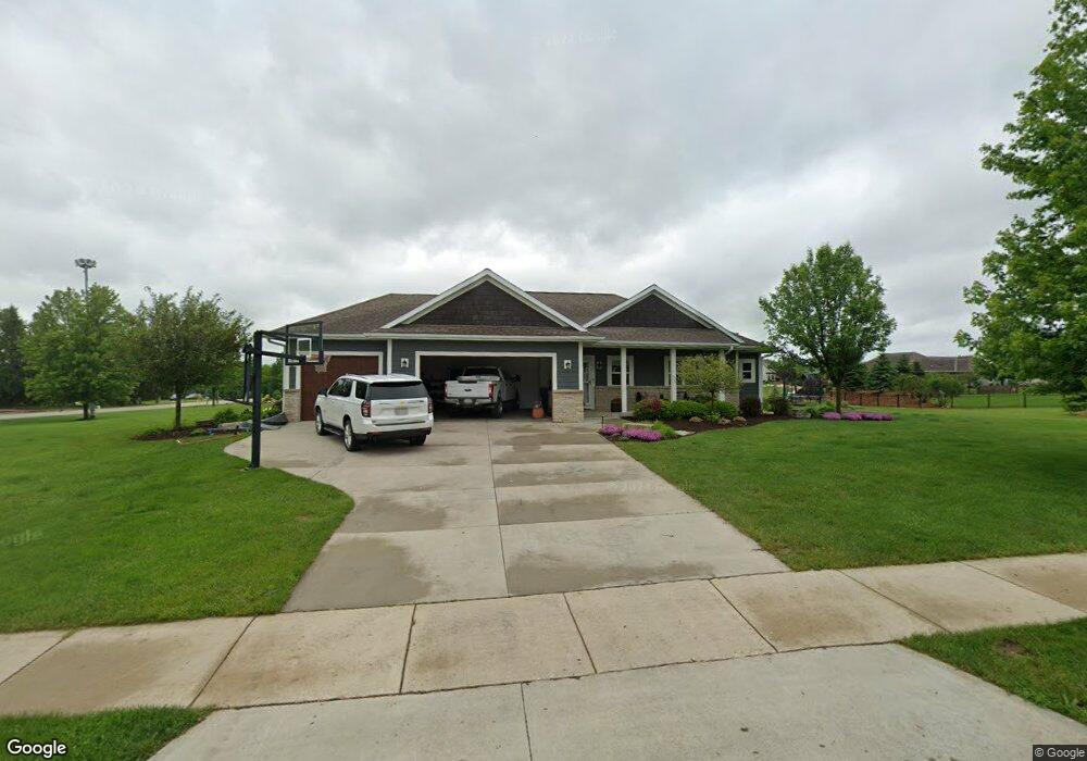
2100 Grandview Dr Slinger, WI 53086
Estimated Value: $525,551 - $620,000
--
Bed
--
Bath
--
Sq Ft
0.92
Acres
About This Home
This home is located at 2100 Grandview Dr, Slinger, WI 53086 and is currently estimated at $574,138. 2100 Grandview Dr is a home with nearby schools including Slinger High School and St Peter Elementary School.
Ownership History
Date
Name
Owned For
Owner Type
Purchase Details
Closed on
Dec 3, 2015
Sold by
Mcguire Matthew
Bought by
Mcguire Matthew and Mcguire Lindsay M
Current Estimated Value
Home Financials for this Owner
Home Financials are based on the most recent Mortgage that was taken out on this home.
Original Mortgage
$280,819
Outstanding Balance
$226,632
Interest Rate
4.5%
Mortgage Type
FHA
Estimated Equity
$347,506
Purchase Details
Closed on
Aug 27, 2014
Sold by
Firststatebank
Bought by
Mcgire Matthew
Create a Home Valuation Report for This Property
The Home Valuation Report is an in-depth analysis detailing your home's value as well as a comparison with similar homes in the area
Home Values in the Area
Average Home Value in this Area
Purchase History
| Date | Buyer | Sale Price | Title Company |
|---|---|---|---|
| Mcguire Matthew | -- | None Available | |
| Mcgire Matthew | $40,000 | None Available |
Source: Public Records
Mortgage History
| Date | Status | Borrower | Loan Amount |
|---|---|---|---|
| Open | Mcguire Matthew | $280,819 |
Source: Public Records
Tax History Compared to Growth
Tax History
| Year | Tax Paid | Tax Assessment Tax Assessment Total Assessment is a certain percentage of the fair market value that is determined by local assessors to be the total taxable value of land and additions on the property. | Land | Improvement |
|---|---|---|---|---|
| 2024 | $5,582 | $493,300 | $86,700 | $406,600 |
| 2023 | $5,180 | $387,000 | $66,700 | $320,300 |
| 2022 | $5,305 | $387,000 | $66,700 | $320,300 |
| 2021 | $5,066 | $387,000 | $66,700 | $320,300 |
| 2020 | $5,016 | $336,400 | $61,600 | $274,800 |
| 2019 | $4,953 | $336,400 | $61,600 | $274,800 |
| 2018 | $4,910 | $336,400 | $61,600 | $274,800 |
| 2017 | $4,658 | $305,200 | $58,700 | $246,500 |
| 2016 | $4,427 | $262,600 | $58,700 | $203,900 |
| 2015 | $4,074 | $233,700 | $58,700 | $175,000 |
| 2014 | $839 | $46,900 | $46,900 | $0 |
| 2013 | $878 | $48,600 | $48,600 | $0 |
Source: Public Records
Map
Nearby Homes
- 1900 Hillside Rd
- 2300 Sherman Rd
- 4229 Sherman Rd
- 3790 Sherman Rd
- 3555 Hillside Rd
- 3053 Bogey Ln
- 4455 Club Dr
- 4434 Foxboro Ct
- Madison II Plan at Cedar Creek Estates
- Prairiefield II Plan at Cedar Creek Estates
- McKinley I Plan at Cedar Creek Estates
- The Walnut Plan at Cedar Creek Estates
- The Juneberry Plan at Cedar Creek Estates
- Savannah Plan at Cedar Creek Estates
- Hampton Ridge Plan at Cedar Creek Estates
- Jefferson I Plan at Cedar Creek Estates
- Wakefield Plan at Cedar Creek Estates
- 497 Limestone Ln
- Breckenridge I Plan at Cedar Creek Estates
- Hampton Bay Plan at Cedar Creek Estates
- 2095 Grandview Dr
- 2085 Grandview Dr
- 2050 Highland Ct
- 2077 Grandview Dr
- 2080 Grandview Dr
- 2115 Grandview Dr
- 2020 Highland Ct
- 2075 Grandview Dr
- 2025 Highland Ct
- 2025 Highland Ct Unit 2025
- 2000 Highland Ct
- 2070 Grandview Dr
- 2125 Grandview Dr
- 1975 Highland Ct
- 2065 Grandview Dr
- 2025 Grandview Dr
- 2020 Grandview Dr
- 2055 Grandview Dr
- 2040 Grandview Dr
- 2005 Grandview Dr