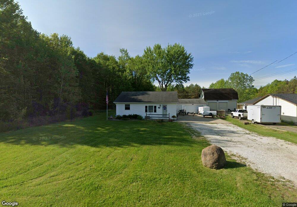
2100 Ohltown McDonald Rd Mc Donald, OH 44437
Estimated Value: $105,000 - $281,000
3
Beds
2
Baths
1,612
Sq Ft
$124/Sq Ft
Est. Value
About This Home
This home is located at 2100 Ohltown McDonald Rd, Mc Donald, OH 44437 and is currently estimated at $200,034, approximately $124 per square foot. 2100 Ohltown McDonald Rd is a home located in Trumbull County with nearby schools including Seaborn Elementary School, Mineral Ridge High School, and Niles Preparatory Academy.
Ownership History
Date
Name
Owned For
Owner Type
Purchase Details
Closed on
Jan 15, 2004
Sold by
Lloyd Phyllis V
Bought by
Lang Bradley E
Current Estimated Value
Purchase Details
Closed on
Jan 22, 2001
Sold by
Lloyd Sheldon S
Bought by
Lloyd Phyllis
Purchase Details
Closed on
Apr 13, 1994
Sold by
Grantz Gladys
Bought by
Sheldon S Lloyd Phyllis V Lloyd
Purchase Details
Closed on
Jan 1, 1990
Bought by
Gladys Grantz
Create a Home Valuation Report for This Property
The Home Valuation Report is an in-depth analysis detailing your home's value as well as a comparison with similar homes in the area
Home Values in the Area
Average Home Value in this Area
Purchase History
| Date | Buyer | Sale Price | Title Company |
|---|---|---|---|
| Lang Bradley E | $50,000 | -- | |
| Lloyd Phyllis | -- | -- | |
| Sheldon S Lloyd Phyllis V Lloyd | $29,000 | -- | |
| Gladys Grantz | -- | -- |
Source: Public Records
Tax History Compared to Growth
Tax History
| Year | Tax Paid | Tax Assessment Tax Assessment Total Assessment is a certain percentage of the fair market value that is determined by local assessors to be the total taxable value of land and additions on the property. | Land | Improvement |
|---|---|---|---|---|
| 2024 | $2,027 | $41,900 | $10,120 | $31,780 |
| 2023 | $2,027 | $41,900 | $10,120 | $31,780 |
| 2022 | $1,630 | $31,260 | $10,120 | $21,140 |
| 2021 | $1,630 | $31,260 | $10,120 | $21,140 |
| 2020 | $1,633 | $31,260 | $10,120 | $21,140 |
| 2019 | $1,609 | $28,670 | $10,120 | $18,550 |
| 2018 | $1,602 | $28,670 | $10,120 | $18,550 |
| 2017 | $1,600 | $28,670 | $10,120 | $18,550 |
| 2016 | $1,696 | $29,020 | $10,120 | $18,900 |
| 2015 | $1,693 | $29,020 | $10,120 | $18,900 |
| 2014 | $1,698 | $29,020 | $10,120 | $18,900 |
| 2013 | $1,671 | $29,020 | $10,120 | $18,900 |
Source: Public Records
Map
Nearby Homes
- 2957 Greenfield Ave
- 2246 Ohltown McDonald Rd
- 3050 Trumbull Ave
- 0 Arlington St Unit 5080704
- 3114 Youngstown Ave
- 3117 Youngstown Ave
- 804 Texas Ave
- 1721 Ohltown McDonald Rd
- 14 Olive St
- 2169 Salt Springs Rd
- 522 Illinois Ave
- 0 Summit
- 412 Ohio Ave
- 304 Ohio Ave
- 438 Hayes Ave
- 219 Pennsylvania Ave
- 207 Pennsylvania Ave
- 334 Hayes Ave
- 318 Hayes Ave
- 507 E 5th St
- 2092 Ohltown McDonald Rd
- 2084 Ohltown McDonald Rd
- 2078 Ohltown McDonald Rd
- 3020 Niles
- 2073 Ohltown McDonald Rd
- 2129 Ohltown McDonald Rd
- 3011 Mayfield Ave
- 2062 Ohltown McDonald Rd
- 3012 Mayfield Ave
- 3001 Mayfield Ave
- 2050 Ohltown McDonald Rd
- 3118 Wildwood Dr
- 2991 Mayfield Ave
- 2125 W 6th St
- 2992 Mayfield Ave
- 3124 Wildwood Dr
- 2983 Mayfield Ave
- 2165 Ohltown McDonald Rd
- 2038 Ohltown McDonald Rd
- 2982 Mayfield Ave