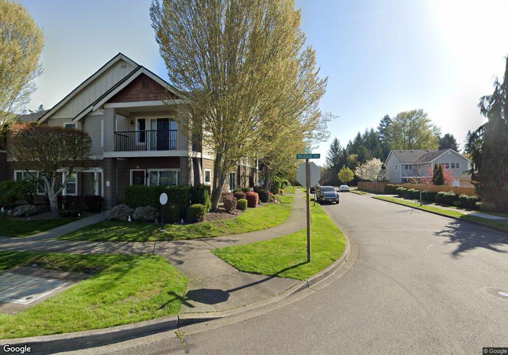
2100 Palisade Blvd Unit 7D Dupont, WA 98327
Estimated Value: $367,706 - $378,000
3
Beds
2
Baths
1,329
Sq Ft
$281/Sq Ft
Est. Value
About This Home
This home is located at 2100 Palisade Blvd Unit 7D, Dupont, WA 98327 and is currently estimated at $372,927, approximately $280 per square foot. 2100 Palisade Blvd Unit 7D is a home located in Pierce County with nearby schools including Chloe Clark Elementary School, Saltars Point Elementary School, and Pioneer Middle School.
Ownership History
Date
Name
Owned For
Owner Type
Purchase Details
Closed on
Jun 28, 2021
Sold by
Amon Reyes Josiah and Amon Crystal K
Bought by
Reyes Josiah Amon and Reyes Crystal K
Current Estimated Value
Purchase Details
Closed on
Dec 1, 2018
Sold by
Breckenridge Property Fund 2016 Llc
Bought by
Reyes Josiah Amon
Home Financials for this Owner
Home Financials are based on the most recent Mortgage that was taken out on this home.
Original Mortgage
$245,259
Interest Rate
4.8%
Mortgage Type
VA
Purchase Details
Closed on
Aug 8, 2018
Sold by
Tann Veronica
Bought by
Breckenridge Property Fund 2016 Llc
Purchase Details
Closed on
Dec 14, 2010
Sold by
Keating Patrick F and Keating Diana L
Bought by
Tann Veronica
Home Financials for this Owner
Home Financials are based on the most recent Mortgage that was taken out on this home.
Original Mortgage
$181,555
Interest Rate
4.21%
Mortgage Type
FHA
Purchase Details
Closed on
May 3, 1999
Sold by
Hurley Keith M and Hurley Molly A
Bought by
Keating Patrick E and Keating Diana L
Home Financials for this Owner
Home Financials are based on the most recent Mortgage that was taken out on this home.
Original Mortgage
$121,890
Interest Rate
6.96%
Mortgage Type
VA
Purchase Details
Closed on
Nov 19, 1997
Sold by
Carino Homes Inc
Bought by
Hurley Keith M and Hurley Molly A
Home Financials for this Owner
Home Financials are based on the most recent Mortgage that was taken out on this home.
Original Mortgage
$106,947
Interest Rate
7.23%
Mortgage Type
VA
Create a Home Valuation Report for This Property
The Home Valuation Report is an in-depth analysis detailing your home's value as well as a comparison with similar homes in the area
Home Values in the Area
Average Home Value in this Area
Purchase History
| Date | Buyer | Sale Price | Title Company |
|---|---|---|---|
| Reyes Josiah Amon | -- | None Listed On Document | |
| Reyes Josiah Amon | $239,989 | Ticor Title | |
| Breckenridge Property Fund 2016 Llc | $197,000 | None Available | |
| Tann Veronica | $184,000 | First American Title Ins Co | |
| Keating Patrick E | $139,026 | -- | |
| Hurley Keith M | $104,865 | Rainier Title Company |
Source: Public Records
Mortgage History
| Date | Status | Borrower | Loan Amount |
|---|---|---|---|
| Previous Owner | Reyes Josiah Amon | $245,259 | |
| Previous Owner | Tann Veronica | $181,555 | |
| Previous Owner | Keating Patrick E | $121,890 | |
| Previous Owner | Hurley Keith M | $106,947 |
Source: Public Records
Tax History Compared to Growth
Tax History
| Year | Tax Paid | Tax Assessment Tax Assessment Total Assessment is a certain percentage of the fair market value that is determined by local assessors to be the total taxable value of land and additions on the property. | Land | Improvement |
|---|---|---|---|---|
| 2025 | $2,765 | $345,500 | $81,900 | $263,600 |
| 2024 | $2,765 | $340,200 | $64,600 | $275,600 |
| 2023 | $2,765 | $340,200 | $64,600 | $275,600 |
| 2022 | $2,711 | $340,200 | $64,600 | $275,600 |
| 2021 | $2,857 | $281,700 | $53,800 | $227,900 |
| 2019 | $2,555 | $256,100 | $48,900 | $207,200 |
| 2018 | $2,247 | $247,900 | $56,700 | $191,200 |
| 2017 | $2,058 | $190,700 | $56,700 | $134,000 |
| 2016 | $1,823 | $168,100 | $56,700 | $111,400 |
| 2014 | $1,901 | $160,100 | $56,700 | $103,400 |
| 2013 | $1,901 | $139,200 | $46,000 | $93,200 |
Source: Public Records
Map
Nearby Homes
- 2147 Hammond Ave Unit B10
- 2176 Palisade Blvd Unit F-3
- 2176 McDonald Ave
- 2237 Tolmie St
- 1607 Kincaid St Unit E-8
- 1856 Spencer Ct Unit 12F
- 1680 Kennedy Place Unit A4
- 1331 Rowan Ct Unit 1331
- 1373 Hudson St Unit 1373
- 1285 Griggs St
- 605 Louviers Ave
- 1263 Hudson St
- 2699 Erwin Ave Unit 2699
- 504 Dupont Ave
- 1975 Garry Oaks Ave Unit C
- 2055 Garry Oaks Ave Unit B
- 403 Louviers Ave
- 205 Brandywine Ave
- 2420 Simmons St Unit B
- 3114 Walker Rd
- 2102 Palisade Blvd Unit 7F
- 2108 Palisade Blvd Unit 7E
- 2110 Palisade Blvd Unit 7C
- 2104 Palisade Blvd Unit 7B
- 2106 Palisade Blvd Unit 7A
- 2100 Palisade Blvd Unit D-7
- 2122 Palisade Blvd Unit F-6
- 2128 Palisade Blvd Unit E-6
- 2122 Palisade Blvd Unit 6F
- 2128 Palisade Blvd Unit 6E
- 2120 Palisade Blvd Unit 6D
- 2124 Palisade Blvd Unit 6B
- 2120 Palisade Blvd Unit D-6
- 2130 Palisade Blvd Unit C-6
- 2130 Palisade Blvd Unit 6C
- 2126 Palisade Blvd Unit 6A
- 2103 Hammond Ave Unit E-8
- 2109 Hammond Ave Unit 8F
- 2103 Hammond Ave Unit 8E