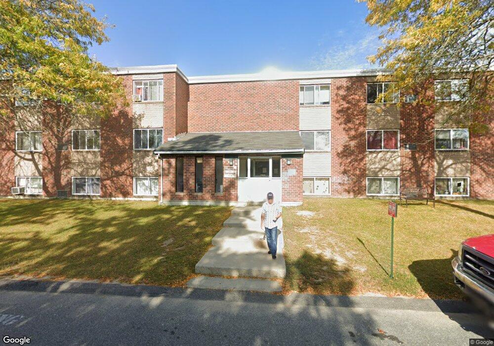
2100 Phillips Rd Unit 25 New Bedford, MA 02745
Estimated Value: $175,000 - $279,091
2
Beds
1
Bath
854
Sq Ft
$248/Sq Ft
Est. Value
About This Home
This home is located at 2100 Phillips Rd Unit 25, New Bedford, MA 02745 and is currently estimated at $211,523, approximately $247 per square foot. 2100 Phillips Rd Unit 25 is a home located in Bristol County with nearby schools including Casimir Pulaski Elementary School, Normandin Middle School, and New Bedford High School.
Ownership History
Date
Name
Owned For
Owner Type
Purchase Details
Closed on
Apr 10, 1995
Sold by
Dime Sb Ny
Bought by
Mary N Monteiro T and Monteiro Mary N
Current Estimated Value
Purchase Details
Closed on
Sep 14, 1993
Sold by
Ferris Robert P
Bought by
Dime Sb Of Ny
Create a Home Valuation Report for This Property
The Home Valuation Report is an in-depth analysis detailing your home's value as well as a comparison with similar homes in the area
Home Values in the Area
Average Home Value in this Area
Purchase History
| Date | Buyer | Sale Price | Title Company |
|---|---|---|---|
| Mary N Monteiro T | $10,000 | -- | |
| Mary N Monteiro T N | $10,000 | -- | |
| Dime Sb Of Ny | $11,443 | -- | |
| Dime Sb Of Ny | $11,443 | -- |
Source: Public Records
Tax History Compared to Growth
Tax History
| Year | Tax Paid | Tax Assessment Tax Assessment Total Assessment is a certain percentage of the fair market value that is determined by local assessors to be the total taxable value of land and additions on the property. | Land | Improvement |
|---|---|---|---|---|
| 2025 | $1,370 | $121,100 | $0 | $121,100 |
| 2024 | $1,442 | $120,200 | $0 | $120,200 |
| 2023 | $1,136 | $79,500 | $0 | $79,500 |
| 2022 | $1,051 | $67,600 | $0 | $67,600 |
| 2021 | $896 | $57,500 | $0 | $57,500 |
| 2020 | $936 | $57,900 | $0 | $57,900 |
| 2019 | $921 | $55,900 | $0 | $55,900 |
| 2018 | $732 | $44,000 | $0 | $44,000 |
| 2017 | $629 | $37,700 | $0 | $37,700 |
| 2016 | $562 | $34,100 | $0 | $34,100 |
| 2015 | $536 | $34,100 | $0 | $34,100 |
| 2014 | $552 | $36,400 | $0 | $36,400 |
Source: Public Records
Map
Nearby Homes
- 210 Heritage Dr
- 145 Heritage Dr
- 64 Blaze Rd
- 34 Poplar Rd
- 1063 Westgate St
- SS Charbonneau Ln
- 13 Luscomb Ln
- 16 Swallow St
- 1069 Cherokee St
- 50 Blueberry Dr
- ES Phillips Rd
- 1475 Braley Rd Unit 17
- 319 Northwest St
- 1350 Phillips Rd
- 1045 Forbes St
- 37 Maxine St
- 4597 Acushnet Ave
- 40 Foley Dr
- ES Acushnet Ave
- 599 Quanapoag Rd
- 2100 Phillips Rd Unit 11
- 2100 Phillips Rd Unit 37
- 2100 Phillips Rd Unit 24
- 2100 Phillips Rd Unit 27
- 2100 Phillips Rd Unit 6
- 2100 Phillips Rd Unit 29
- 2100 Phillips Rd Unit 23
- 2100 Phillips Rd Unit 9
- 2100 Phillips Rd Unit 20
- 2100 Phillips Rd Unit 33
- 2100 Phillips Rd Unit 17
- 2100 Phillips Rd Unit 10
- 2100 Phillips Rd Unit 7
- 2100 Phillips Rd Unit 1
- 2100 Phillips Rd Unit 5
- 2100 Phillips Rd Unit 2
- 2100 Phillips Rd Unit 15
- 2100 Phillips Rd Unit 12
- 2100 Phillips Rd Unit 13
- 2100 Phillips Rd Unit 19