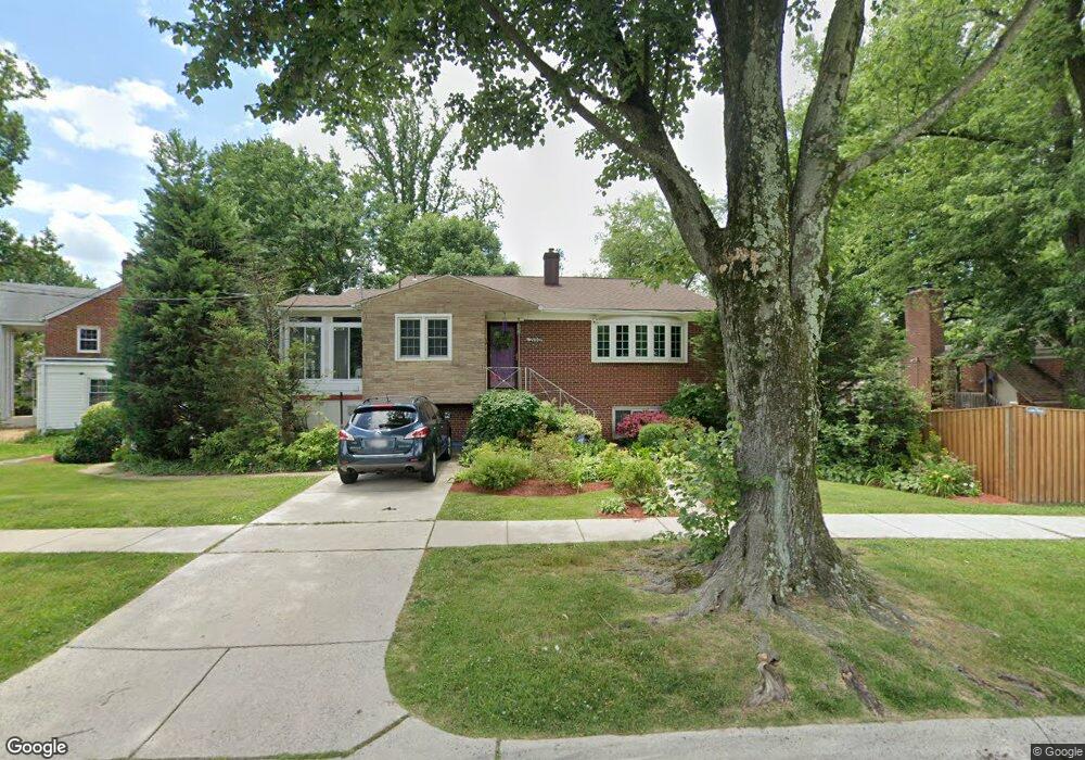
2100 Porter Rd Silver Spring, MD 20910
Estimated Value: $617,000 - $740,000
Studio
3
Baths
1,729
Sq Ft
$383/Sq Ft
Est. Value
About This Home
This home is located at 2100 Porter Rd, Silver Spring, MD 20910 and is currently estimated at $662,364, approximately $383 per square foot. 2100 Porter Rd is a home located in Montgomery County with nearby schools including Rosemary Hills Elementary School, North Chevy Chase Elementary School, and Silver Creek Middle School.
Ownership History
Date
Name
Owned For
Owner Type
Purchase Details
Closed on
Jul 6, 2006
Sold by
Fouquet David
Bought by
Thompson Desiree
Current Estimated Value
Home Financials for this Owner
Home Financials are based on the most recent Mortgage that was taken out on this home.
Original Mortgage
$42,000
Outstanding Balance
$24,893
Interest Rate
6.62%
Mortgage Type
Stand Alone Second
Estimated Equity
$637,471
Purchase Details
Closed on
May 26, 2006
Sold by
Fouquet David
Bought by
Thompson Desiree
Home Financials for this Owner
Home Financials are based on the most recent Mortgage that was taken out on this home.
Original Mortgage
$42,000
Outstanding Balance
$24,893
Interest Rate
6.62%
Mortgage Type
Stand Alone Second
Estimated Equity
$637,471
Create a Home Valuation Report for This Property
The Home Valuation Report is an in-depth analysis detailing your home's value as well as a comparison with similar homes in the area
Home Values in the Area
Average Home Value in this Area
Purchase History
| Date | Buyer | Sale Price | Title Company |
|---|---|---|---|
| Thompson Desiree | $459,300 | -- | |
| Thompson Desiree | $459,300 | -- |
Source: Public Records
Mortgage History
| Date | Status | Borrower | Loan Amount |
|---|---|---|---|
| Open | Thompson Desiree | $42,000 | |
| Open | Thompson Desiree | $367,300 | |
| Closed | Thompson Desiree | $42,000 | |
| Closed | Thompson Desiree | $367,300 |
Source: Public Records
Tax History
| Year | Tax Paid | Tax Assessment Tax Assessment Total Assessment is a certain percentage of the fair market value that is determined by local assessors to be the total taxable value of land and additions on the property. | Land | Improvement |
|---|---|---|---|---|
| 2025 | $6,439 | $511,867 | -- | -- |
| 2024 | $6,439 | $495,800 | $332,400 | $163,400 |
| 2023 | $7,021 | $488,300 | $0 | $0 |
| 2022 | $3,875 | $480,800 | $0 | $0 |
| 2021 | $5,118 | $473,300 | $332,400 | $140,900 |
| 2020 | $4,777 | $472,833 | $0 | $0 |
| 2019 | $5,037 | $472,367 | $0 | $0 |
| 2018 | $6,114 | $471,900 | $332,400 | $139,500 |
| 2017 | $4,977 | $461,533 | $0 | $0 |
| 2016 | -- | $451,167 | $0 | $0 |
| 2015 | $4,449 | $440,800 | $0 | $0 |
| 2014 | $4,449 | $440,067 | $0 | $0 |
Source: Public Records
Map
Nearby Homes
- 2106 Ross Rd
- 1900 Lyttonsville Rd
- 1900 Lyttonsville Rd
- 1900 Lyttonsville Rd
- 1900 Lyttonsville Rd Unit 602
- 1900 Lyttonsville Rd Unit 1003
- 1900 Lyttonsville Rd
- 1900 Lyttonsville Rd
- 1900 Lyttonsville Rd Unit P96
- 1900 Lyttonsville Rd
- 1911 Lyttonsville Rd
- 2100 Washington Ave Unit 4C
- 2100 Washington Ave
- 1790 Verbena St NW
- 1760 E West Hwy
- 2205 Washington Ave Unit 102
- 2312 Colston Dr Unit 201
- 2038 Derby Ridge Ln
- 8803 Courts Way
- 2248 Washington Ave Unit 101
- 8724 Milford Ave
- 8815 Maywood Ave
- 8813 Maywood Ave
- 8722 Milford Ave
- 8811 Maywood Ave
- 8809 Maywood Ave
- 8720 Milford Ave
- 8725 Milford Ave
- 8807 Maywood Ave
- 8814 Maywood Ave
- 8718 Milford Ave
- 8816 Maywood Ave
- 8812 Maywood Ave
- 8723 Milford Ave
- 2108 Porter Rd
- 8810 Maywood Ave
- 8805 Maywood Ave
- 8802 Leonard Dr
- 8800 Leonard Dr
- 8808 Maywood Ave
Your Personal Tour Guide
Ask me questions while you tour the home.