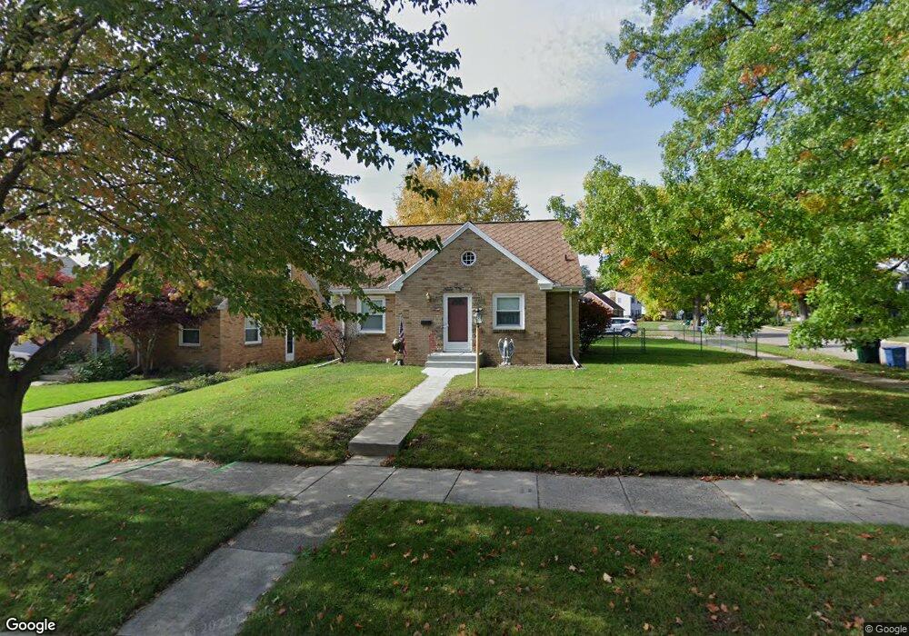
2100 Quentin Ave Lansing, MI 48910
Colonial Village NeighborhoodEstimated Value: $186,343 - $231,000
3
Beds
2
Baths
1,011
Sq Ft
$198/Sq Ft
Est. Value
About This Home
This home is located at 2100 Quentin Ave, Lansing, MI 48910 and is currently estimated at $199,836, approximately $197 per square foot. 2100 Quentin Ave is a home located in Ingham County with nearby schools including Averill Elementary School, Attwood School, and J.W. Sexton High School.
Ownership History
Date
Name
Owned For
Owner Type
Purchase Details
Closed on
Jun 30, 2011
Sold by
Mccarthy Jeff and Mccarthy Sarah D
Bought by
Sabin Robert
Current Estimated Value
Home Financials for this Owner
Home Financials are based on the most recent Mortgage that was taken out on this home.
Original Mortgage
$104,703
Outstanding Balance
$72,439
Interest Rate
4.63%
Mortgage Type
VA
Estimated Equity
$127,397
Purchase Details
Closed on
Jun 7, 2001
Sold by
Chapko Ronald and Chapko Amelia
Bought by
Mccarthy Jeff
Home Financials for this Owner
Home Financials are based on the most recent Mortgage that was taken out on this home.
Original Mortgage
$120,258
Interest Rate
7.11%
Mortgage Type
VA
Purchase Details
Closed on
Mar 1, 1995
Create a Home Valuation Report for This Property
The Home Valuation Report is an in-depth analysis detailing your home's value as well as a comparison with similar homes in the area
Home Values in the Area
Average Home Value in this Area
Purchase History
| Date | Buyer | Sale Price | Title Company |
|---|---|---|---|
| Sabin Robert | $102,500 | Tri County Title Agency Llc | |
| Mccarthy Jeff | $117,900 | Midstate Title Company | |
| -- | $82,900 | -- |
Source: Public Records
Mortgage History
| Date | Status | Borrower | Loan Amount |
|---|---|---|---|
| Open | Sabin Robert | $104,703 | |
| Previous Owner | Mccarthy Jeff | $120,258 |
Source: Public Records
Tax History
| Year | Tax Paid | Tax Assessment Tax Assessment Total Assessment is a certain percentage of the fair market value that is determined by local assessors to be the total taxable value of land and additions on the property. | Land | Improvement |
|---|---|---|---|---|
| 2025 | $3,822 | $86,500 | $11,800 | $74,700 |
| 2024 | $31 | $79,800 | $11,800 | $68,000 |
| 2023 | $3,582 | $74,000 | $11,800 | $62,200 |
| 2022 | $3,227 | $71,200 | $11,200 | $60,000 |
| 2021 | $3,160 | $66,300 | $7,700 | $58,600 |
| 2020 | $3,141 | $61,300 | $7,700 | $53,600 |
| 2019 | $3,012 | $59,000 | $7,700 | $51,300 |
| 2018 | $2,821 | $55,500 | $7,700 | $47,800 |
| 2017 | $2,701 | $55,500 | $7,700 | $47,800 |
| 2016 | $2,583 | $49,700 | $7,700 | $42,000 |
| 2015 | $2,583 | $48,100 | $15,326 | $32,774 |
| 2014 | $2,583 | $46,800 | $11,494 | $35,306 |
Source: Public Records
Map
Nearby Homes
- 1517 Lenore Ave
- 1323 Cooper Ave
- 1312 W Mount Hope Ave
- 1618 Loraine Ave
- 1740 Wellington Rd Unit 103
- 1114 Goodrich St
- 2001 S Martin Luther King Junior Blvd
- 1116 George St
- 1309 Hammond St
- 2505 Fairfax Rd
- 1511 Pattengill Ave
- 1017 W Barnes Ave
- 900 W Mount Hope Ave
- 2421 Stirling Ave
- 815 Smith Ave
- 815 Woodbine Ave
- 1120 Alsdorf St
- 712 Lenore Ave
- 1327 Moores River Dr
- 717 Smith Ave
- 2106 Quentin Ave
- 2112 Quentin Ave
- 2116 Quentin Ave
- 1600 Lenore Ave
- 1606 Lenore Ave
- 2103 Quentin Ave
- 1612 Lenore Ave
- 2122 Quentin Ave
- 1623 Lenore Ave
- 1618 Lenore Ave
- 1612 Cooper Ave
- 1521 Lenore Ave
- 1618 Cooper Ave
- 2113 Quentin Ave
- 1622 Cooper Ave
- 2117 Quentin Ave
- 1701 Lenore Ave
- 1600 Cooper Ave
- 1626 Cooper Ave
Your Personal Tour Guide
Ask me questions while you tour the home.