Estimated payment $141/month
Highlights
- Horses Allowed On Property
- Farm
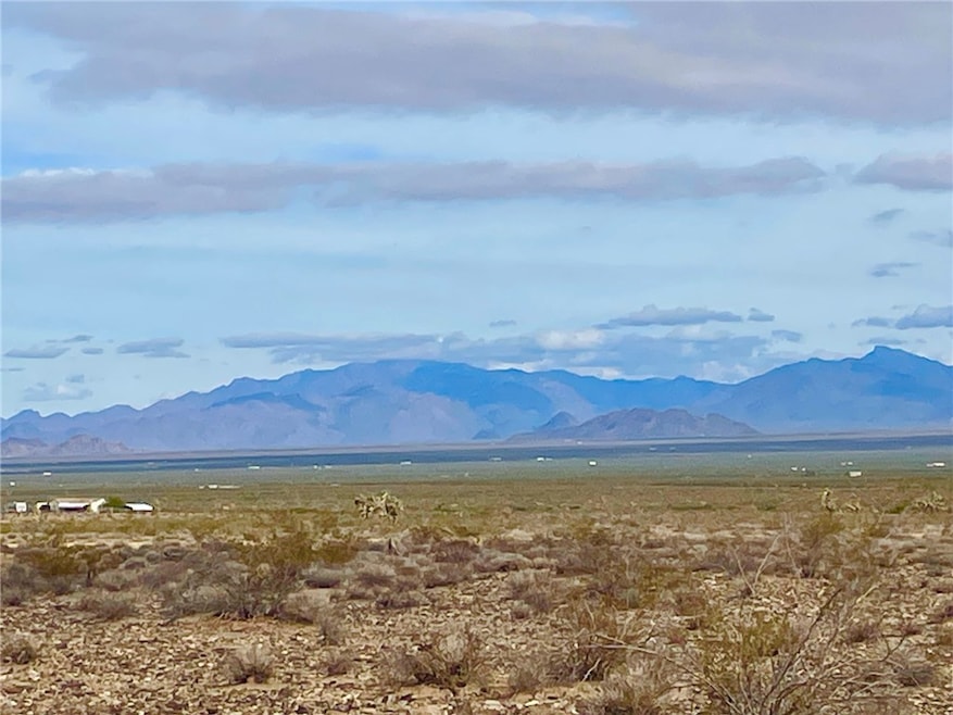
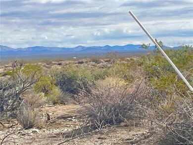
- Gentle Sloping Lot
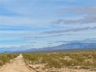
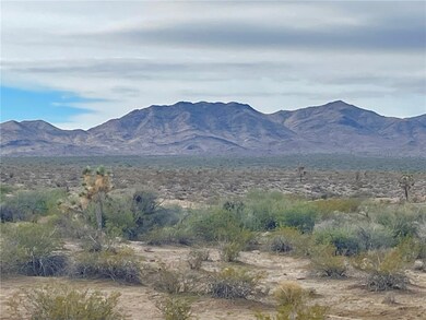
- 39.96 Acre Lot
About This Lot
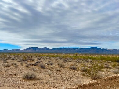
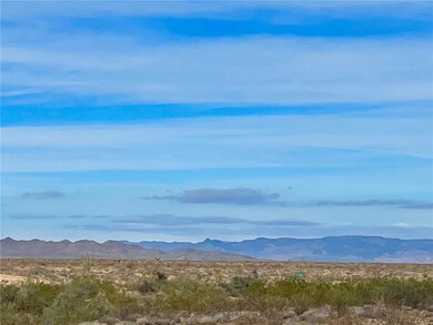
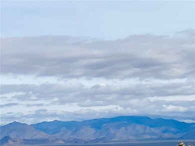
HISTORIC Stagecoach Trails 40 acre parcel for sale! Oh so AFFORDABLE! CLOSE to the MOUNTAINS & BLM land! PRIVATE, TRANQUIL and oh so QUIET! OFF-GRID enthusiasts dream. SO MUCH to do. Horseback riding, off-roading, hiking, camping, boating (Alamo Lake State Park or Lake Havasu City)... YOUR LIFE, YOUR WAY! Very few county restrictions. MINERAL & WATER RIGHTS CONVEY! Plenty of flat areas to develop your campsite or future homesite. Located off County Maintained Road, Butch Cassidy. The VIEWS are amazing. Situated in between Lake Havasu City and Kingman for your shopping. Be as social or anti social as YOU choose to be out here! If you can DREAM it, you can ACHIEVE it out here. Call for more details.
Listing Agent
Havasu Realty Brokerage Phone: (602) 809-1592 License #SA662787000 Listed on: 11/17/2025
Property Details
Property Type
- Land
Est. Annual Taxes
- $155
Lot Details
- 39.96 Acre Lot
- Lot Dimensions are 1322x1317
- The property's road front is unimproved
- Gentle Sloping Lot
- Zoning described as M- AR Agricultural Res
HOA Fees
- $17 Monthly HOA Fees
Additional Features
- Farm
- Horses Allowed On Property
- Septic Needed
Community Details
- Buck Reynolds Association
- Stage Coach Trails At Santa Fe Subdivision
Listing and Financial Details
- Tax Lot 2100
Map
Home Values in the Area
Average Home Value in this Area
Tax History
| Year | Tax Paid | Tax Assessment Tax Assessment Total Assessment is a certain percentage of the fair market value that is determined by local assessors to be the total taxable value of land and additions on the property. | Land | Improvement |
|---|---|---|---|---|
| 2026 | -- | -- | -- | -- |
| 2025 | $157 | $2,592 | $0 | $0 |
| 2024 | $157 | $2,505 | $0 | $0 |
| 2023 | $157 | $1,946 | $0 | $0 |
| 2022 | $132 | $1,852 | $0 | $0 |
| 2021 | $145 | $1,781 | $0 | $0 |
| 2019 | $165 | $2,504 | $0 | $0 |
| 2018 | $160 | $2,556 | $0 | $0 |
| 2017 | $146 | $2,222 | $0 | $0 |
| 2016 | $149 | $1,764 | $0 | $0 |
| 2015 | $156 | $1,864 | $0 | $0 |
Property History
| Date | Event | Price | List to Sale | Price per Sq Ft |
|---|---|---|---|---|
| 11/17/2025 11/17/25 | For Sale | $21,000 | -- | -- |
Purchase History
| Date | Type | Sale Price | Title Company |
|---|---|---|---|
| Warranty Deed | $12,000 | Pioneer Title Agency Inc | |
| Deed In Lieu Of Foreclosure | -- | Pioneer Title Agency Inc | |
| Warranty Deed | $85,000 | First American Title Ins Co | |
| Cash Sale Deed | $30,000 | Transnation Title | |
| Special Warranty Deed | -- | First American Title Ins Co |
Mortgage History
| Date | Status | Loan Amount | Loan Type |
|---|---|---|---|
| Previous Owner | $63,750 | Seller Take Back |
Source: Western Arizona REALTOR® Data Exchange (WARDEX)
MLS Number: 034228
APN: 123-20-011
Disclaimer: Certain information contained herein is derived from information provided by parties other than Homes.com. All information provided is deemed reliable, but is not guaranteed to be accurate and should be independently verified.
![]() IDX information is provided exclusively for personal, non-commercial use, and may not be used for any purpose other than to identify prospective properties consumers may be interested in purchasing. Information is deemed reliable but not guaranteed.
IDX information is provided exclusively for personal, non-commercial use, and may not be used for any purpose other than to identify prospective properties consumers may be interested in purchasing. Information is deemed reliable but not guaranteed.
- 471 W Juniper Dr
- 31-C Daytona Dr
- Tbe E Red Barrel Dr
- 6a Red Barrel Sagebrush Trail
- 6c Red Barrel Dr Sagebrush Trail
- 6D E Red Barrel Rd
- #812 Stagecoach Trail Unit 812
- 19532 S Lone Ranger Rd
- Yucc Unit a Arizona 86438
- 19130 S Lone Ranger
- 24231013 S Gene Autry Rd
- 0 S Kit Carson Unit 1036307
- 18695 S Gene Autry Rd
- 19595 S Kit Carson Rd
- Parcel 2327 Tom Mix Rd
- 120 ACRES S Dale Evans Rd
- PARCEL3177 S Butch Cassidy Rd
- Lot 173 E Cholla Dr
- 8375 E Cholla Dr
- 3485 E Cholla Dr
- 3761 Hiawatha Dr
- 4110 Columbia Dr
- 3781 Solar Bay
- 4196 Mercury Dr
- 3769 Solar Bay
- 720 Mcculloch Blvd S
- 3611 Vega Ln
- 3592 Desert Garden Dr
- 790 Osage Ct
- 4105 Highlander Ave
- 1136 Mcculloch Blvd S
- 1100 Mcculloch Blvd S
- 790 Kootenay Dr
- 3917 Montezuma Dr
- 3720 Churchill Dr
- 621 Pueblo Dr
- 4080 Vagabond Dr
- 3400 Buckboard Dr
- 1507 Blackfoot Ln S
- 3511 Chesapeake Blvd
