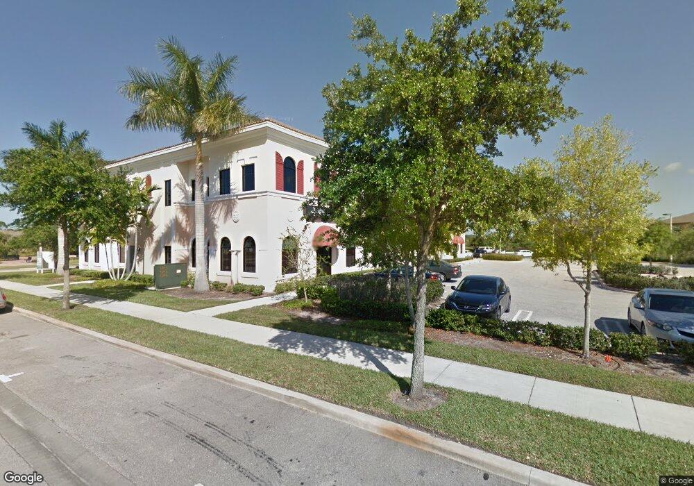
2100 SE Hillmoor Dr Unit 202 Port Saint Lucie, FL 34952
Sandhill Crossing NeighborhoodEstimated Value: $401,988
--
Bed
--
Bath
1,746
Sq Ft
$230/Sq Ft
Est. Value
About This Home
This home is located at 2100 SE Hillmoor Dr Unit 202, Port Saint Lucie, FL 34952 and is currently estimated at $401,988, approximately $230 per square foot. 2100 SE Hillmoor Dr Unit 202 is a home located in St. Lucie County with nearby schools including Morningside Elementary School, Mariposa Elementary School, and Floresta Elementary School.
Ownership History
Date
Name
Owned For
Owner Type
Purchase Details
Closed on
Nov 4, 2011
Sold by
Land Holding Llc
Bought by
4600 Warehouses Llc
Current Estimated Value
Purchase Details
Closed on
Aug 23, 2010
Sold by
Land Planning Systems Inc
Bought by
Land Holding Llc
Purchase Details
Closed on
Jun 28, 2007
Sold by
East Lake Office Investors Lllp
Bought by
Land Planning Systems Inc
Home Financials for this Owner
Home Financials are based on the most recent Mortgage that was taken out on this home.
Original Mortgage
$396,950
Interest Rate
6.03%
Mortgage Type
Purchase Money Mortgage
Create a Home Valuation Report for This Property
The Home Valuation Report is an in-depth analysis detailing your home's value as well as a comparison with similar homes in the area
Home Values in the Area
Average Home Value in this Area
Purchase History
| Date | Buyer | Sale Price | Title Company |
|---|---|---|---|
| 4600 Warehouses Llc | $125,000 | First American Title Insuran | |
| Land Holding Llc | -- | None Available | |
| Land Planning Systems Inc | $381,200 | Attorney |
Source: Public Records
Mortgage History
| Date | Status | Borrower | Loan Amount |
|---|---|---|---|
| Previous Owner | Land Planning Systems Inc | $396,950 |
Source: Public Records
Tax History Compared to Growth
Tax History
| Year | Tax Paid | Tax Assessment Tax Assessment Total Assessment is a certain percentage of the fair market value that is determined by local assessors to be the total taxable value of land and additions on the property. | Land | Improvement |
|---|---|---|---|---|
| 2024 | $4,057 | $200,700 | -- | $200,700 |
| 2023 | $4,057 | $200,700 | $0 | $200,700 |
| 2022 | $3,452 | $138,400 | $0 | $138,400 |
| 2021 | $3,598 | $138,400 | $0 | $138,400 |
| 2020 | $3,684 | $138,400 | $0 | $138,400 |
| 2019 | $3,750 | $138,400 | $0 | $138,400 |
| 2018 | $3,675 | $138,400 | $0 | $138,400 |
| 2017 | $3,724 | $138,400 | $0 | $138,400 |
| 2016 | $3,758 | $138,400 | $0 | $138,400 |
| 2015 | $3,827 | $138,400 | $0 | $138,400 |
| 2014 | $3,640 | $138,400 | $0 | $0 |
Source: Public Records
Map
Nearby Homes
- 2061 SE Glen Ridge Dr
- 2078 SE Glen Ridge Dr
- 2301 SE Tavares Dr
- 2094 SE Eatonville Dr
- 2136 SE Eatonville Dr
- 2122 SE Grand Dr
- 2300 SE Union Park Dr
- 2366 SE Tavares Dr
- 2383 SE Ruskin Dr
- 2364 SE Union Park Dr
- 2148 SE Destin Dr
- 2380 SE Union Park Dr
- 2008 SE Avon Park Dr
- 2181 SE Grand Dr
- 2185 SE Grand Dr
- 1922 SE Niceville Dr
- 2186 SE Destin Dr
- 4293 SE Brittney Cir
- 2495 SE Ruskin Dr
- 2036 SE Avon Park Dr
- 2100 SE Hillmoor Dr Unit 205B
- 2100 SE Hillmoor Dr Unit 204A
- 2100 SE Hillmoor Dr Unit 201
- 2100 SE Hillmoor Dr
- 2100 SE Hillmoor Dr Unit 206
- 2100 SE Hillmoor Dr Unit 104
- 2100 SE Hillmoor Dr Unit 204-B
- 2100 SE Hillmoor Dr Unit 205-A
- 2100 SE Hillmoor Dr Unit 101
- 2065 SE Glen Ridge Dr
- 2057 SE Glen Ridge Dr
- 2069 SE Glen Ridge Dr
- 2073 SE Glen Ridge Dr
- 2085 SE Glen Ridge Dr
- 2089 SE Glen Ridge Dr
- 2081 SE Glen Ridge Dr
- 2097 SE Glen Ridge Dr
- 2101 SE Glen Ridge Dr
- 2105 SE Glen Ridge Dr
- 2109 SE Glen Ridge Dr