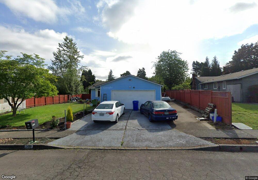
2100 SE Kane Ave Gresham, OR 97080
Mount Hood NeighborhoodEstimated Value: $380,000 - $447,000
3
Beds
2
Baths
1,082
Sq Ft
$387/Sq Ft
Est. Value
About This Home
This home is located at 2100 SE Kane Ave, Gresham, OR 97080 and is currently estimated at $418,625, approximately $386 per square foot. 2100 SE Kane Ave is a home located in Multnomah County with nearby schools including Hogan Cedars Elementary School, West Orient Middle School, and Sam Barlow High School.
Ownership History
Date
Name
Owned For
Owner Type
Purchase Details
Closed on
Jul 15, 1997
Sold by
Lagunes Mauricio D
Bought by
Hendrix Billy Roy and Hendrix Kathryn Irene
Current Estimated Value
Home Financials for this Owner
Home Financials are based on the most recent Mortgage that was taken out on this home.
Original Mortgage
$72,500
Outstanding Balance
$10,241
Interest Rate
7.83%
Mortgage Type
Purchase Money Mortgage
Estimated Equity
$408,384
Create a Home Valuation Report for This Property
The Home Valuation Report is an in-depth analysis detailing your home's value as well as a comparison with similar homes in the area
Home Values in the Area
Average Home Value in this Area
Purchase History
| Date | Buyer | Sale Price | Title Company |
|---|---|---|---|
| Hendrix Billy Roy | $117,500 | Fidelity National Title Co |
Source: Public Records
Mortgage History
| Date | Status | Borrower | Loan Amount |
|---|---|---|---|
| Open | Hendrix Billy Roy | $72,500 |
Source: Public Records
Tax History
| Year | Tax Paid | Tax Assessment Tax Assessment Total Assessment is a certain percentage of the fair market value that is determined by local assessors to be the total taxable value of land and additions on the property. | Land | Improvement |
|---|---|---|---|---|
| 2025 | $4,131 | $203,020 | -- | -- |
| 2024 | $3,955 | $197,110 | -- | -- |
| 2023 | $3,603 | $191,370 | $0 | $0 |
| 2022 | $3,502 | $185,800 | $0 | $0 |
| 2021 | $3,414 | $180,390 | $0 | $0 |
| 2020 | $3,212 | $175,140 | $0 | $0 |
| 2019 | $3,128 | $170,040 | $0 | $0 |
| 2018 | $2,983 | $165,090 | $0 | $0 |
| 2017 | $2,862 | $160,290 | $0 | $0 |
| 2016 | $2,523 | $155,630 | $0 | $0 |
Source: Public Records
Map
Nearby Homes
- 2073 SE Kane Ave
- 3122 SE 23rd St
- 3780 SE 21st Dr
- 2037 SE Centurion Way
- 2624 SE Hale Way
- 3788 SE 25th St
- 2846 SE 18th Cir
- 2245 SE Wendy Dr
- 3689 SE 14th St
- 2910 SE Hillyard Rd
- 2696 SE Palmquist Rd
- 1230 SE Barnes Rd
- 2392 SE 16th Aly
- 2240 SE 16th St
- 3169 SE 34th St
- 2358 SE Palmquist Rd
- 2125 SE 18th Aly
- 2600 SE Orient Dr
- 2293 SE 15th Aly
- 4647 SE 20th Terrace
- 2112 SE Kane Ave
- 2112 SE Kane Av (Not Busy)
- 2088 SE Kane Ave
- 2168 SE Kane Ave
- 2076 SE Kane Ave
- 2107 SE Kane Ave
- 2085 SE Kane Ave
- 2188 SE Kane Ave
- 2157 SE Kane Ave
- 2072 SE Kane Ave
- 2187 SE Kane Ave
- 2218 SE Kane Ave
- 2164 SE Paropa Ave
- 2121 SE Scott Ave
- 2217 SE Kane Ave
- 2133 SE Scott Ave
- 2061 SE Kane Ave
- 2248 SE Kane Ave
- 2152 SE Paropa Ave
- 2068 SE Kane Ave
Your Personal Tour Guide
Ask me questions while you tour the home.