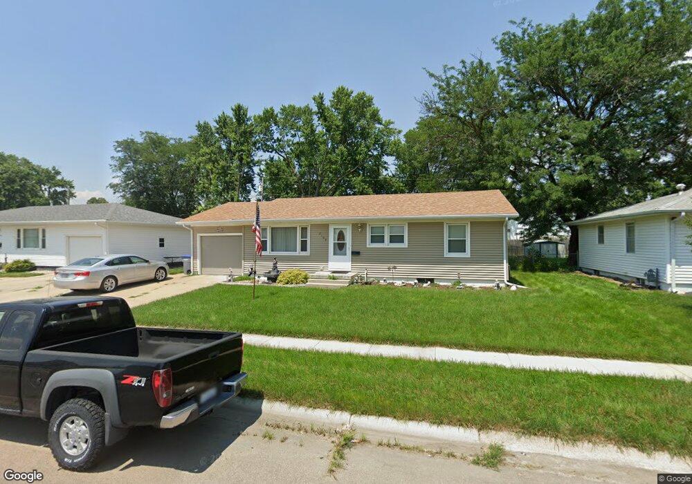
2100 Sunset Ave Norfolk, NE 68701
Estimated Value: $197,109 - $242,000
3
Beds
3
Baths
1,120
Sq Ft
$199/Sq Ft
Est. Value
About This Home
This home is located at 2100 Sunset Ave, Norfolk, NE 68701 and is currently estimated at $223,277, approximately $199 per square foot. 2100 Sunset Ave is a home located in Madison County with nearby schools including Norfolk Senior High School, Norfolk Catholic School, and Sacred Heart Elementary School.
Ownership History
Date
Name
Owned For
Owner Type
Purchase Details
Closed on
Oct 25, 2009
Sold by
Horn Donald L
Bought by
Wc Properties Llc
Current Estimated Value
Home Financials for this Owner
Home Financials are based on the most recent Mortgage that was taken out on this home.
Original Mortgage
$32,576
Outstanding Balance
$21,325
Interest Rate
5.05%
Mortgage Type
Future Advance Clause Open End Mortgage
Estimated Equity
$201,952
Create a Home Valuation Report for This Property
The Home Valuation Report is an in-depth analysis detailing your home's value as well as a comparison with similar homes in the area
Home Values in the Area
Average Home Value in this Area
Purchase History
| Date | Buyer | Sale Price | Title Company |
|---|---|---|---|
| Wc Properties Llc | $36,000 | None Available |
Source: Public Records
Mortgage History
| Date | Status | Borrower | Loan Amount |
|---|---|---|---|
| Open | Wc Properties Llc | $32,576 |
Source: Public Records
Tax History Compared to Growth
Tax History
| Year | Tax Paid | Tax Assessment Tax Assessment Total Assessment is a certain percentage of the fair market value that is determined by local assessors to be the total taxable value of land and additions on the property. | Land | Improvement |
|---|---|---|---|---|
| 2024 | $141 | $159,590 | $13,475 | $146,115 |
| 2023 | $2,661 | $143,935 | $13,475 | $130,460 |
| 2022 | $371 | $129,957 | $13,475 | $116,482 |
| 2021 | $2,226 | $120,339 | $13,475 | $106,864 |
| 2020 | $2,057 | $111,515 | $13,475 | $98,040 |
| 2019 | $1,929 | $101,011 | $13,475 | $87,536 |
| 2018 | $1,912 | $101,806 | $18,480 | $83,326 |
| 2017 | $1,804 | $95,916 | $18,480 | $77,436 |
| 2016 | $1,763 | $93,533 | $9,389 | $84,144 |
| 2015 | $1,763 | $93,533 | $9,389 | $84,144 |
| 2014 | $1,738 | $89,526 | $9,389 | $80,137 |
| 2013 | $1,689 | $84,283 | $9,389 | $74,894 |
Source: Public Records
Map
Nearby Homes
- 2005 Sunset Ave
- 2102 Sunset Ave
- 105 19th Dr
- 2005 Koenigstein Ave
- 207 S 17th St
- 1809 W Taylor Ave
- See Legal
- 1703 Miles Dr
- 1613 Miles Dr
- 1607 Miles Dr
- 1609 Miles Dr
- 1601 Miles Dr
- 1605 Miles Dr
- 1407 Koenigstein Ave
- 2300 Taylor Ave
- 2308 Taylor Ave
- 2109 W Prospect Ave
- 1313 W Park Ave
- 1312 Hayes Ave
- 303 N 13th Place
- 2008 Sunset Ave
- 2013 W Madison Ave
- 2011 W Madison Ave
- 2006 Sunset Ave
- 2104 Sunset Ave
- 2007 W Madison Ave
- 2101 Sunset Ave
- 2009 Sunset Ave
- 2103 Sunset Ave
- 2005 W Madison Ave
- 2004 Sunset Ave
- 2103 W Madison Ave
- 2106 Sunset Ave
- 2007 Sunset Ave
- 2105 Sunset Ave
- 2003 W Madison Ave
- 2105 W Madison Ave
- 2100 W Madison Ave
- 2107 Sunset Ave
- 2006 W Madison Ave