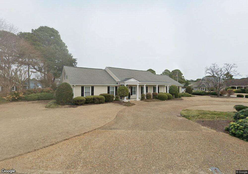
2100 W Admiral Dr Virginia Beach, VA 23451
Broad Bay Island NeighborhoodEstimated Value: $1,262,082 - $1,381,000
4
Beds
3
Baths
3,552
Sq Ft
$369/Sq Ft
Est. Value
About This Home
This home is located at 2100 W Admiral Dr, Virginia Beach, VA 23451 and is currently estimated at $1,309,271, approximately $368 per square foot. 2100 W Admiral Dr is a home located in Virginia Beach City with nearby schools including John B. Dey Elementary School, Great Neck Middle School, and Frank W. Cox High School.
Ownership History
Date
Name
Owned For
Owner Type
Purchase Details
Closed on
Jul 25, 2017
Sold by
Murray Michael A and Murray Roberta G
Bought by
Roberta G Murray A and Roberta G Murray A
Current Estimated Value
Purchase Details
Closed on
Sep 23, 2005
Sold by
Beare Peter
Bought by
Murray Michael
Home Financials for this Owner
Home Financials are based on the most recent Mortgage that was taken out on this home.
Original Mortgage
$550,000
Interest Rate
5.84%
Mortgage Type
New Conventional
Create a Home Valuation Report for This Property
The Home Valuation Report is an in-depth analysis detailing your home's value as well as a comparison with similar homes in the area
Home Values in the Area
Average Home Value in this Area
Purchase History
| Date | Buyer | Sale Price | Title Company |
|---|---|---|---|
| Roberta G Murray A | -- | None Available | |
| Murray Michael | $805,000 | -- |
Source: Public Records
Mortgage History
| Date | Status | Borrower | Loan Amount |
|---|---|---|---|
| Previous Owner | Murray Michael | $550,000 |
Source: Public Records
Tax History Compared to Growth
Tax History
| Year | Tax Paid | Tax Assessment Tax Assessment Total Assessment is a certain percentage of the fair market value that is determined by local assessors to be the total taxable value of land and additions on the property. | Land | Improvement |
|---|---|---|---|---|
| 2025 | $8,398 | $924,300 | $520,000 | $404,300 |
| 2024 | $8,398 | $865,800 | $491,400 | $374,400 |
| 2023 | $7,736 | $781,400 | $420,600 | $360,800 |
| 2022 | $7,613 | $769,000 | $389,200 | $379,800 |
| 2021 | $7,259 | $733,200 | $369,500 | $363,700 |
| 2020 | $6,973 | $685,300 | $353,800 | $331,500 |
| 2019 | $6,910 | $688,600 | $353,800 | $334,800 |
| 2018 | $6,903 | $688,600 | $353,800 | $334,800 |
| 2017 | $6,544 | $652,800 | $338,100 | $314,700 |
| 2016 | $6,067 | $612,800 | $338,100 | $274,700 |
| 2015 | $6,192 | $625,500 | $353,800 | $271,700 |
| 2014 | $5,600 | $596,800 | $393,100 | $203,700 |
Source: Public Records
Map
Nearby Homes
- 2123 Wake Forest St
- 2036 Alphine Rd
- 2005 Bay Rd
- The Savannah Plan at Cape Story by The Sea - Capestory by The Sea
- The Newcastle Plan at Cape Story by The Sea - Capestory by The Sea
- 2637 Broad Bay Rd
- 2509 Lone Pine Point
- 2219 Oak St
- 2581 Shore Dr
- 2319 Kendall St
- 2021 Thomas Bishop Ln
- 2009 Bay Island Quay
- 2328 Spindrift Rd
- 2300 Croix Dr
- 2830 Shore Dr Unit 507
- 2830 Shore Dr Unit PH1
- 2830 Shore Dr Unit 1000
- 2830 Shore Dr Unit 1103
- 2830 Shore Dr Unit 1200
- 2830 Shore Dr Unit 900
- 2616 Heston Rd
- 2104 W Admiral Dr
- 2612 Heston Rd
- 2108 W Admiral Dr
- 2105 W Admiral Dr
- 2617 Heston Rd
- 2101 W Admiral Dr
- 2621 Heston Rd
- 2109 W Admiral Dr
- 2613 Heston Rd
- 2625 Heston Rd
- 2101 W Kendall Cir
- 2608 Heston Rd
- 2112 W Admiral Dr
- 2609 Heston Rd
- 2629 Heston Rd
- 2104 Wake Forest St
- 2102 Wake Forest St
- 2108 Wake Forest St
- 2105 W Kendall Cir