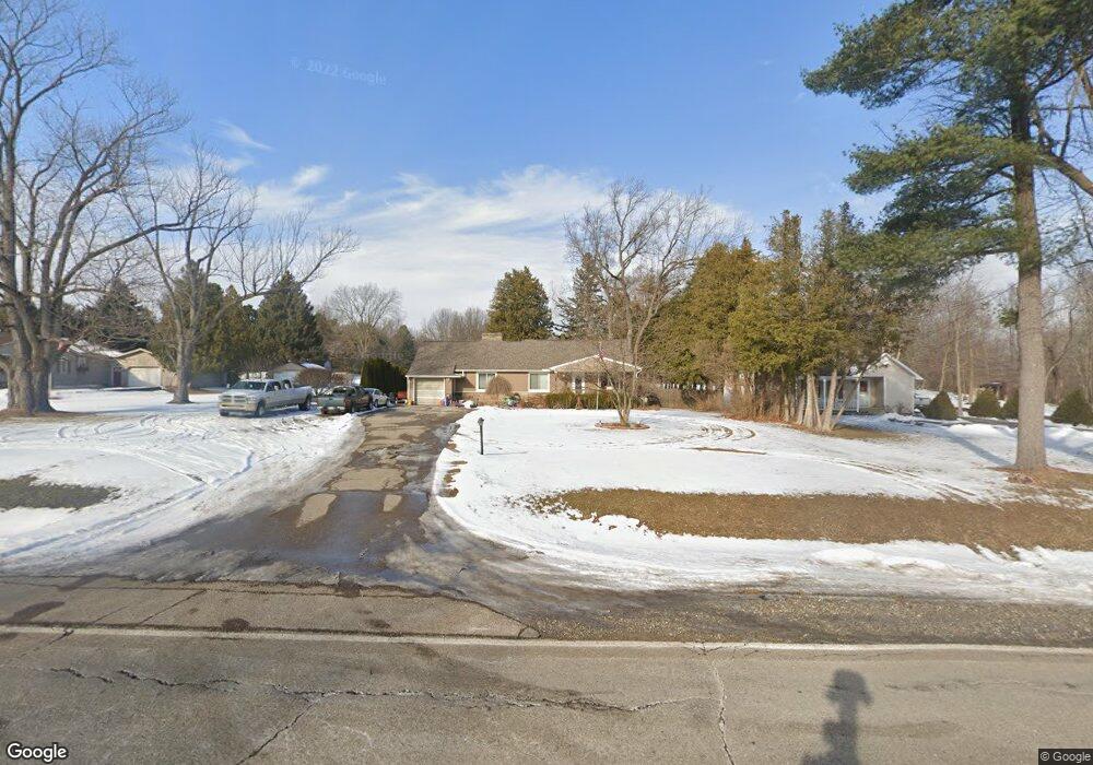
2100 W Frances Rd Mount Morris, MI 48458
Estimated Value: $174,000 - $207,128
3
Beds
2
Baths
1,422
Sq Ft
$137/Sq Ft
Est. Value
About This Home
This home is located at 2100 W Frances Rd, Mount Morris, MI 48458 and is currently estimated at $194,532, approximately $136 per square foot. 2100 W Frances Rd is a home located in Genesee County with nearby schools including Elisabeth Ann Johnson High School and St. Mary's School.
Ownership History
Date
Name
Owned For
Owner Type
Purchase Details
Closed on
Dec 20, 2005
Sold by
Cunningham Robert M and Cunningham Mary
Bought by
England Matthew P and Dubey Emily S
Current Estimated Value
Home Financials for this Owner
Home Financials are based on the most recent Mortgage that was taken out on this home.
Original Mortgage
$105,839
Outstanding Balance
$59,393
Interest Rate
6.34%
Mortgage Type
FHA
Estimated Equity
$135,139
Purchase Details
Closed on
Jan 22, 1999
Sold by
Estates Of Helen E Odette
Bought by
Cunningham Robert M
Create a Home Valuation Report for This Property
The Home Valuation Report is an in-depth analysis detailing your home's value as well as a comparison with similar homes in the area
Home Values in the Area
Average Home Value in this Area
Purchase History
| Date | Buyer | Sale Price | Title Company |
|---|---|---|---|
| England Matthew P | $107,500 | Garrow Title Agency | |
| Cunningham Robert M | $80,000 | Sargents Title Company Llc |
Source: Public Records
Mortgage History
| Date | Status | Borrower | Loan Amount |
|---|---|---|---|
| Open | England Matthew P | $105,839 |
Source: Public Records
Tax History Compared to Growth
Tax History
| Year | Tax Paid | Tax Assessment Tax Assessment Total Assessment is a certain percentage of the fair market value that is determined by local assessors to be the total taxable value of land and additions on the property. | Land | Improvement |
|---|---|---|---|---|
| 2025 | $3,442 | $84,200 | $0 | $0 |
| 2024 | $624 | $79,800 | $0 | $0 |
| 2023 | $596 | $68,600 | $0 | $0 |
| 2022 | $3,012 | $60,700 | $0 | $0 |
| 2021 | $2,996 | $55,900 | $0 | $0 |
| 2020 | $545 | $53,400 | $0 | $0 |
| 2019 | $536 | $50,500 | $0 | $0 |
| 2018 | $2,415 | $48,900 | $0 | $0 |
| 2017 | $2,348 | $48,900 | $0 | $0 |
| 2016 | $2,125 | $43,800 | $0 | $0 |
| 2015 | $2,141 | $44,800 | $0 | $0 |
| 2012 | -- | $43,200 | $43,200 | $0 |
Source: Public Records
Map
Nearby Homes
- 9075 Neff Rd
- 1515 W Frances Rd
- 9083 N Clio Rd
- 0000 Clio Rd
- 8136 Nixon Ave
- 1375 Lincoln Ave
- 12366 Highland St
- 8151 Benson Rd
- 12210 Benson Rd
- V/L Washington Ave
- 2485 W Dodge Rd
- 1095 Pine St
- 1501 Mount Morris Rd
- 2071 W Mount Morris Rd
- 5372 W Mount Morris Rd
- 1477 W Mt Morris Rd
- 7395 Red Maple Dr Unit 1
- 12043 Barber Ave
- 643 Roosevelt Ave
- 328 W Mount Morris St
- 2094 W Frances Rd
- 2120 W Frances Rd
- 2086 W Frances Rd
- 2146 W Frances Rd
- 2040 W Frances Rd
- 2156 W Frances Rd
- 2081 W Frances Rd
- 2067 W Frances Rd
- 2067 W Frances Rd
- 9105 Neff Rd
- 9151 Neff Rd
- 9083 Neff Rd
- 9097 Neff Rd
- 9093 Neff Rd
- 9125 Neff Rd
- 9125 Neff Rd
- 2006 W Frances Rd
- 9057 Neff Rd
- 2149 W Frances Rd
- 9037 Neff Rd