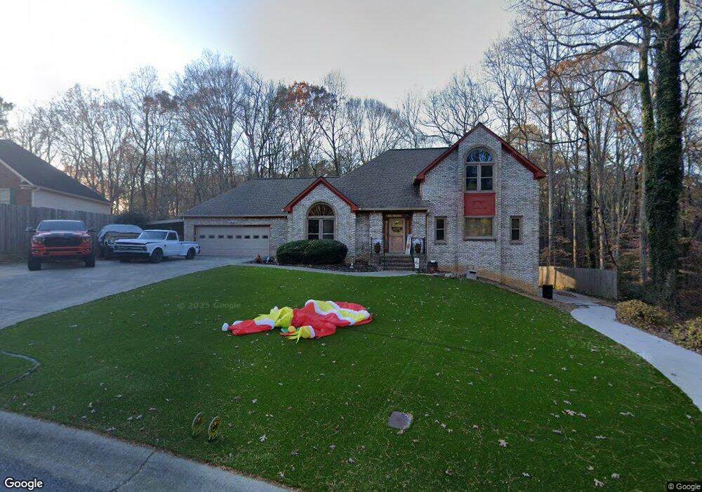
2100 Wynfield Point Dr Buford, GA 30519
Estimated Value: $416,000 - $465,000
3
Beds
3
Baths
2,202
Sq Ft
$200/Sq Ft
Est. Value
About This Home
This home is located at 2100 Wynfield Point Dr, Buford, GA 30519 and is currently estimated at $439,911, approximately $199 per square foot. 2100 Wynfield Point Dr is a home located in Gwinnett County with nearby schools including Freeman's Mill Elementary School, Twin Rivers Middle School, and Mountain View High School.
Ownership History
Date
Name
Owned For
Owner Type
Purchase Details
Closed on
Dec 30, 2003
Sold by
Seckinger Daniel D and Seckinger Tamara L
Bought by
Robertson Jamal
Current Estimated Value
Home Financials for this Owner
Home Financials are based on the most recent Mortgage that was taken out on this home.
Original Mortgage
$247,500
Outstanding Balance
$113,305
Interest Rate
5.82%
Mortgage Type
New Conventional
Estimated Equity
$326,606
Create a Home Valuation Report for This Property
The Home Valuation Report is an in-depth analysis detailing your home's value as well as a comparison with similar homes in the area
Home Values in the Area
Average Home Value in this Area
Purchase History
| Date | Buyer | Sale Price | Title Company |
|---|---|---|---|
| Robertson Jamal | $275,000 | -- |
Source: Public Records
Mortgage History
| Date | Status | Borrower | Loan Amount |
|---|---|---|---|
| Open | Robertson Jamal | $247,500 |
Source: Public Records
Tax History Compared to Growth
Tax History
| Year | Tax Paid | Tax Assessment Tax Assessment Total Assessment is a certain percentage of the fair market value that is determined by local assessors to be the total taxable value of land and additions on the property. | Land | Improvement |
|---|---|---|---|---|
| 2025 | $4,754 | $170,160 | $29,920 | $140,240 |
| 2024 | $4,799 | $166,400 | $35,920 | $130,480 |
| 2023 | $4,799 | $160,720 | $35,920 | $124,800 |
| 2022 | $4,231 | $140,880 | $27,920 | $112,960 |
| 2021 | $3,871 | $120,800 | $23,920 | $96,880 |
| 2020 | $3,899 | $120,800 | $23,920 | $96,880 |
| 2019 | $3,348 | $99,800 | $20,720 | $79,080 |
| 2018 | $3,351 | $99,800 | $20,720 | $79,080 |
| 2016 | $3,154 | $89,680 | $20,720 | $68,960 |
| 2015 | $2,940 | $78,800 | $15,920 | $62,880 |
| 2014 | $2,954 | $78,800 | $15,920 | $62,880 |
Source: Public Records
Map
Nearby Homes
- 2159 Sunny Hill Rd
- 2199 Sunny Hill Rd
- 2066 Holland Creek Ct
- 2053 Arbor Springs Way
- 1965 Holland Park Dr NE
- 1876 Hanover West Dr
- 1939 Sunny Hill Rd
- 1867 Willoughby Dr
- 1799 Braselton Hwy
- 1810 Sunset Harbour Pointe Unit 6
- 1880 Rocksram Dr Unit 1
- 1798 Braselton Hwy
- 1717 Willoughby Dr
- 1846 Dorminey Ct Unit 2
- 2032 Shin Ct NE
- 2375 Rock Springs Rd
- 2346 Hampton Park Dr Unit I
- 2147 Saint Albans Place
- 1721 Crowes Lake Ct Unit 1
- 1716 Crowes Lake Ct
- 2090 Wynfield Point Dr
- 2110 Wynfield Point Dr
- 2095 Wynfield Point Dr
- 2080 Wynfield Point Dr
- 2080 Wynfield Point Dr Unit A/42
- 2115 Wynfield Point Dr Unit 2
- 2070 Wynfield Point Dr
- 2120 Wynfield Point Dr
- 1948 Trestlebrook Way Unit 3
- 2065 Wynfield Point Dr
- 1938 Trestlebrook Way
- 2125 Wynfield Point Dr Unit 2
- 1968 Trestlebrook Way Unit 3
- 2062 Wyncliff Ct Unit 2
- 2130 Wynfield Point Dr
- 1998 Trestlebrook Way
- 2062 Wyncliff Ct NE
- 2055 Wynfield Point Dr
- 2052 Wyncliff Ct Unit 2
- 2140 Wynfield Point Dr