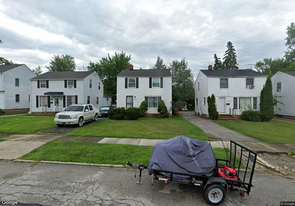
21002 Clare Ave Maple Heights, OH 44137
Estimated Value: $117,158 - $140,000
3
Beds
1
Bath
1,392
Sq Ft
$93/Sq Ft
Est. Value
About This Home
This home is located at 21002 Clare Ave, Maple Heights, OH 44137 and is currently estimated at $129,290, approximately $92 per square foot. 21002 Clare Ave is a home located in Cuyahoga County with nearby schools including Abraham Lincoln Elementary School, Rockside/ J.F. Kennedy School, and Barack Obama School.
Ownership History
Date
Name
Owned For
Owner Type
Purchase Details
Closed on
Aug 8, 1994
Sold by
Stech Daniel C
Bought by
Woodard Beverly J
Current Estimated Value
Home Financials for this Owner
Home Financials are based on the most recent Mortgage that was taken out on this home.
Original Mortgage
$70,850
Interest Rate
8.53%
Mortgage Type
FHA
Purchase Details
Closed on
Apr 3, 1985
Sold by
Stech Daniel C
Bought by
Stech Daniel C and Stech Lillian R
Purchase Details
Closed on
Jan 1, 1975
Bought by
Stech Daniel C
Create a Home Valuation Report for This Property
The Home Valuation Report is an in-depth analysis detailing your home's value as well as a comparison with similar homes in the area
Home Values in the Area
Average Home Value in this Area
Purchase History
| Date | Buyer | Sale Price | Title Company |
|---|---|---|---|
| Woodard Beverly J | $71,000 | -- | |
| Stech Daniel C | -- | -- | |
| Stech Daniel C | -- | -- |
Source: Public Records
Mortgage History
| Date | Status | Borrower | Loan Amount |
|---|---|---|---|
| Closed | Woodard Beverly J | $70,850 |
Source: Public Records
Tax History
| Year | Tax Paid | Tax Assessment Tax Assessment Total Assessment is a certain percentage of the fair market value that is determined by local assessors to be the total taxable value of land and additions on the property. | Land | Improvement |
|---|---|---|---|---|
| 2025 | $2,502 | $30,100 | $6,790 | $23,310 |
| 2024 | $2,773 | $30,100 | $6,790 | $23,310 |
| 2023 | $2,664 | $25,450 | $4,100 | $21,350 |
| 2022 | $2,655 | $25,445 | $4,095 | $21,350 |
| 2021 | $2,833 | $25,450 | $4,100 | $21,350 |
| 2020 | $2,414 | $19,290 | $3,120 | $16,170 |
| 2019 | $2,402 | $55,100 | $8,900 | $46,200 |
| 2018 | $2,305 | $19,290 | $3,120 | $16,170 |
| 2017 | $2,391 | $18,870 | $2,870 | $16,000 |
| 2016 | $2,313 | $18,870 | $2,870 | $16,000 |
| 2015 | $2,324 | $18,870 | $2,870 | $16,000 |
| 2014 | $2,324 | $20,720 | $3,150 | $17,570 |
Source: Public Records
Map
Nearby Homes
- 20905 Clare Ave
- 20814 Clare Ave
- 21202 Hillgrove Ave
- 20803 Kenyon Dr
- 21202 Gardenview Dr
- 21207 Franklin Rd
- 5147 Warrensville Center Rd
- 21601 Gardenview Dr
- 20715 Watson Rd
- 20600 Watson Rd
- 20111 Mountville Dr
- 20705 Hansen Rd
- 21860 Louis Rd
- 19910 Mountville Dr
- 19931 Raymond St
- 19520 Maple Heights Blvd
- 19289 Stafford Ave
- 5285 Mardale Ave
- 5301 Mardale Ave
- 5165 Camden Rd
- 21006 Clare Ave
- 20918 Clare Ave
- 21010 Clare Ave
- 20914 Clare Ave
- 21001 Kenyon Dr
- 21014 Clare Ave
- 20910 Clare Ave
- 21005 Kenyon Dr
- 20917 Kenyon Dr
- 21011 Kenyon Dr
- 21018 Clare Ave
- 20906 Clare Ave
- 21015 Kenyon Dr
- 21001 Clare Ave
- 21007 Clare Ave
- 20917 Clare Ave
- 21009 Clare Ave
- 20913 Clare Ave
- 20913 Kenyon Dr
- 21019 Kenyon Dr
Your Personal Tour Guide
Ask me questions while you tour the home.