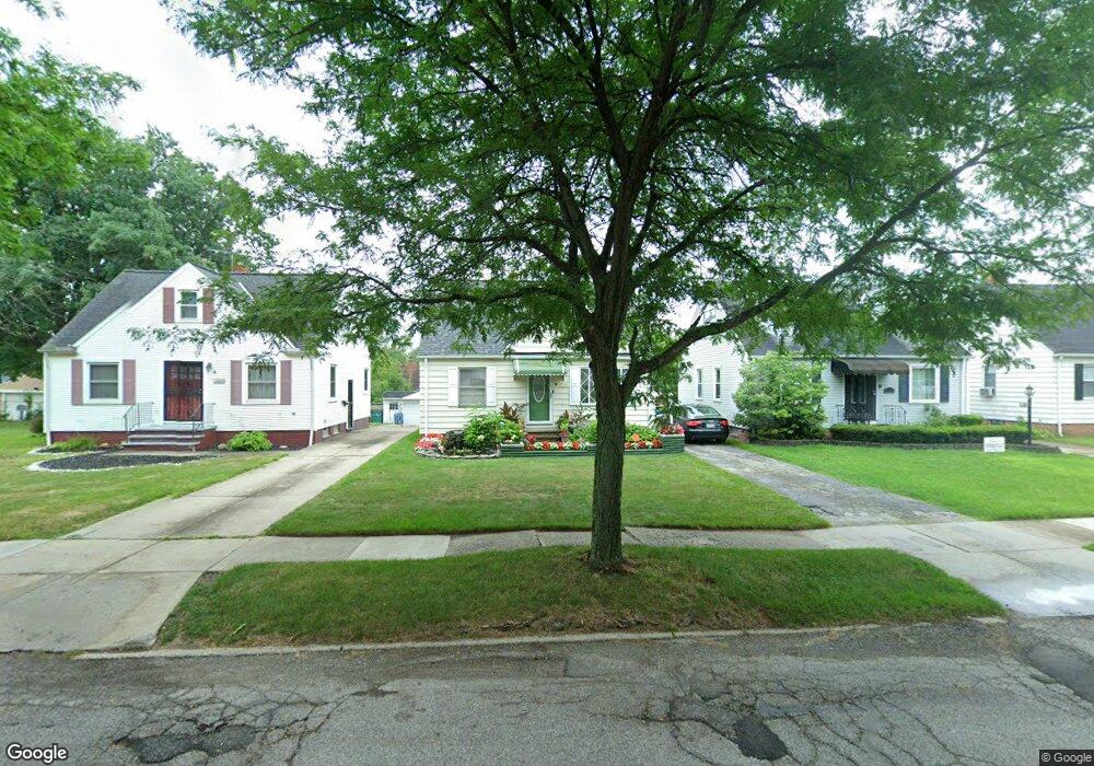
21002 Raymond St Maple Heights, OH 44137
Estimated Value: $105,432 - $120,000
3
Beds
1
Bath
1,092
Sq Ft
$102/Sq Ft
Est. Value
About This Home
This home is located at 21002 Raymond St, Maple Heights, OH 44137 and is currently estimated at $111,858, approximately $102 per square foot. 21002 Raymond St is a home located in Cuyahoga County with nearby schools including Abraham Lincoln Elementary School, Rockside/ J.F. Kennedy School, and Barack Obama School.
Ownership History
Date
Name
Owned For
Owner Type
Purchase Details
Closed on
Jun 1, 2001
Sold by
Sadler Nadine
Bought by
Sadler Jerome
Current Estimated Value
Home Financials for this Owner
Home Financials are based on the most recent Mortgage that was taken out on this home.
Original Mortgage
$63,750
Outstanding Balance
$29,976
Interest Rate
10.42%
Estimated Equity
$81,882
Purchase Details
Closed on
Aug 3, 1988
Sold by
Sokol Tholas
Bought by
Sadler Jerome
Purchase Details
Closed on
Sep 16, 1987
Sold by
Delmar Patrick P
Bought by
Sokol Tholas
Purchase Details
Closed on
Sep 1, 1987
Sold by
Matek Paul J
Bought by
Delmar Patrick P
Purchase Details
Closed on
Mar 15, 1982
Sold by
Delmar Patrick P
Bought by
Matek Paul J
Purchase Details
Closed on
Apr 4, 1979
Sold by
Delmar Martha P
Bought by
Delmar Patrick P
Purchase Details
Closed on
Jan 1, 1975
Bought by
Delmar Martha P
Create a Home Valuation Report for This Property
The Home Valuation Report is an in-depth analysis detailing your home's value as well as a comparison with similar homes in the area
Home Values in the Area
Average Home Value in this Area
Purchase History
| Date | Buyer | Sale Price | Title Company |
|---|---|---|---|
| Sadler Jerome | -- | -- | |
| Sadler Jerome | $47,000 | -- | |
| Sokol Tholas | -- | -- | |
| Delmar Patrick P | -- | -- | |
| Matek Paul J | $45,000 | -- | |
| Delmar Patrick P | -- | -- | |
| Delmar Martha P | -- | -- |
Source: Public Records
Mortgage History
| Date | Status | Borrower | Loan Amount |
|---|---|---|---|
| Open | Sadler Jerome | $63,750 |
Source: Public Records
Tax History
| Year | Tax Paid | Tax Assessment Tax Assessment Total Assessment is a certain percentage of the fair market value that is determined by local assessors to be the total taxable value of land and additions on the property. | Land | Improvement |
|---|---|---|---|---|
| 2024 | $2,871 | $31,325 | $7,000 | $24,325 |
| 2023 | $2,558 | $18,630 | $4,240 | $14,390 |
| 2022 | $2,041 | $18,620 | $4,235 | $14,385 |
| 2021 | $2,841 | $18,620 | $4,240 | $14,390 |
| 2020 | $1,864 | $14,110 | $3,220 | $10,890 |
| 2019 | $1,853 | $40,300 | $9,200 | $31,100 |
| 2018 | $1,720 | $14,110 | $3,220 | $10,890 |
| 2017 | $1,732 | $12,780 | $2,980 | $9,800 |
| 2016 | $1,676 | $12,780 | $2,980 | $9,800 |
| 2015 | $5,571 | $12,780 | $2,980 | $9,800 |
| 2014 | $5,571 | $14,040 | $3,260 | $10,780 |
Source: Public Records
Map
Nearby Homes
- 21207 Franklin Rd
- 20715 Watson Rd
- 21202 Hillgrove Ave
- 20905 Clare Ave
- 20517 Raymond St
- 20705 Hansen Rd
- 20600 Watson Rd
- 20806 Clare Ave
- 21600 Franklin Rd
- 5147 Warrensville Center Rd
- 21202 Gardenview Dr
- 21860 Louis Rd
- 21607 Libby Rd
- 19931 Raymond St
- 0 Miles Rd Unit 5188561
- 19520 Maple Heights Blvd
- 5165 Camden Rd
- 19289 Stafford Ave
- 5194 Homewood Ave
- 18990 Raymond St
- 20916 Raymond St
- 21006 Raymond St
- 20912 Raymond St
- 21010 Raymond St
- 20908 Raymond St
- 21014 Raymond St
- 21001 Franklin Rd
- 21005 Franklin Rd
- 20917 Franklin Rd
- 21009 Franklin Rd
- 20913 Franklin Rd
- 20904 Raymond St
- 21018 Raymond St
- 21013 Franklin Rd
- 21003 Raymond St
- 21007 Raymond St
- 20917 Raymond St
- 20905 Franklin Rd
- 21011 Raymond St
- 20913 Raymond St
Your Personal Tour Guide
Ask me questions while you tour the home.