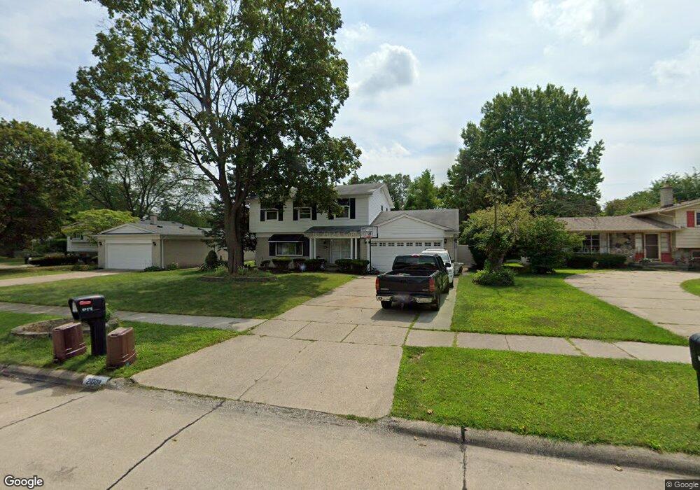
21009 Dartmouth Dr Unit Bldg-Unit Southfield, MI 48076
Estimated Value: $336,000 - $377,000
4
Beds
3
Baths
2,007
Sq Ft
$177/Sq Ft
Est. Value
About This Home
This home is located at 21009 Dartmouth Dr Unit Bldg-Unit, Southfield, MI 48076 and is currently estimated at $355,130, approximately $176 per square foot. 21009 Dartmouth Dr Unit Bldg-Unit is a home located in Oakland County with nearby schools including Alice M. Birney K-8 School, Southfield Christian School, and Yeshivas Darchei Torah.
Ownership History
Date
Name
Owned For
Owner Type
Purchase Details
Closed on
Mar 13, 2018
Sold by
Segment Properties Llc
Bought by
Edwards Mary
Current Estimated Value
Home Financials for this Owner
Home Financials are based on the most recent Mortgage that was taken out on this home.
Original Mortgage
$218,457
Outstanding Balance
$186,485
Interest Rate
4.22%
Mortgage Type
FHA
Estimated Equity
$168,645
Purchase Details
Closed on
Nov 24, 2015
Sold by
Sanders Robert L and Sanders Rosemary
Bought by
Segment Properties Llc
Purchase Details
Closed on
Feb 7, 2011
Sold by
Sanders Delores Buchanan and Sanders Robert Lee
Bought by
Sanders Delores Buchanan
Create a Home Valuation Report for This Property
The Home Valuation Report is an in-depth analysis detailing your home's value as well as a comparison with similar homes in the area
Home Values in the Area
Average Home Value in this Area
Purchase History
| Date | Buyer | Sale Price | Title Company |
|---|---|---|---|
| Edwards Mary | $226,000 | None Available | |
| Segment Properties Llc | $91,837 | Attorney | |
| Sanders Delores Buchanan | -- | None Available |
Source: Public Records
Mortgage History
| Date | Status | Borrower | Loan Amount |
|---|---|---|---|
| Open | Edwards Mary | $218,457 |
Source: Public Records
Tax History Compared to Growth
Tax History
| Year | Tax Paid | Tax Assessment Tax Assessment Total Assessment is a certain percentage of the fair market value that is determined by local assessors to be the total taxable value of land and additions on the property. | Land | Improvement |
|---|---|---|---|---|
| 2022 | $5,750 | $127,300 | $19,130 | $108,170 |
| 2021 | $5,992 | $107,010 | $19,130 | $87,880 |
| 2020 | $5,204 | $100,860 | $15,300 | $85,560 |
| 2018 | $5,592 | $84,210 | $15,300 | $68,910 |
| 2015 | -- | $61,090 | $0 | $0 |
| 2014 | -- | $52,000 | $0 | $0 |
| 2011 | -- | $48,800 | $0 | $0 |
Source: Public Records
Map
Nearby Homes
- 21140 Winchester St
- 20780 Wayland St
- 21330 Winchester St
- 21361 Andover Rd
- 21440 Constitution St
- 27925 Arlington Dr
- 27249 Nantucket Dr
- 000 Pontiac Trail
- 21731 Concord St
- 20345 Harbor Ln
- 21901 Concord St
- 28450 Tapert Dr
- 20120 Covington Pkwy
- 28330 Lahser Rd
- 20351 Lacrosse Ave
- 27430 Evergreen Rd Unit 36
- 20141 Lacrosse Ave
- 22465 Kenwyck Dr
- 22300 Ivanhoe Ln
- 19646 Middlesex Ave
- 21009 Dartmouth Dr
- 20981 Dartmouth Dr
- 21041 Dartmouth Dr
- 20970 Concord St
- 21040 Concord St
- 21081 Dartmouth Dr
- 21002 Dartmouth Dr
- 21038 Dartmouth Dr
- 21080 Concord St
- 20980 Dartmouth Dr
- 21074 Dartmouth Dr
- 27612 Devonshire St
- 27652 Devonshire St
- 21121 Dartmouth Dr
- 27550 Devonshire St
- 21110 Dartmouth Dr
- 27692 Devonshire St
- 21120 Concord St
- 20981 Concord St
- 21025 Concord St