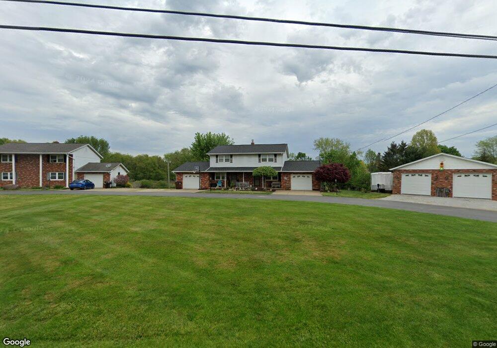
2101 Edison St NW Uniontown, OH 44685
Estimated Value: $266,000 - $297,006
4
Beds
4
Baths
2,160
Sq Ft
$132/Sq Ft
Est. Value
About This Home
This home is located at 2101 Edison St NW, Uniontown, OH 44685 and is currently estimated at $285,002, approximately $131 per square foot. 2101 Edison St NW is a home located in Stark County with nearby schools including Lake Middle/High School and Lake Center Christian School.
Ownership History
Date
Name
Owned For
Owner Type
Purchase Details
Closed on
Oct 13, 2000
Sold by
Brown Clara L
Bought by
Schrock Larry D and Schrock Catherine M
Current Estimated Value
Home Financials for this Owner
Home Financials are based on the most recent Mortgage that was taken out on this home.
Original Mortgage
$135,915
Interest Rate
8.03%
Create a Home Valuation Report for This Property
The Home Valuation Report is an in-depth analysis detailing your home's value as well as a comparison with similar homes in the area
Home Values in the Area
Average Home Value in this Area
Purchase History
| Date | Buyer | Sale Price | Title Company |
|---|---|---|---|
| Schrock Larry D | $159,900 | -- |
Source: Public Records
Mortgage History
| Date | Status | Borrower | Loan Amount |
|---|---|---|---|
| Closed | Schrock Larry D | $135,915 | |
| Closed | Schrock Larry D | $7,995 |
Source: Public Records
Tax History Compared to Growth
Tax History
| Year | Tax Paid | Tax Assessment Tax Assessment Total Assessment is a certain percentage of the fair market value that is determined by local assessors to be the total taxable value of land and additions on the property. | Land | Improvement |
|---|---|---|---|---|
| 2025 | -- | $79,490 | $22,190 | $57,300 |
| 2024 | -- | $79,490 | $22,190 | $57,300 |
| 2023 | $2,968 | $57,190 | $15,960 | $41,230 |
| 2022 | $2,978 | $57,190 | $15,960 | $41,230 |
| 2021 | $3,010 | $57,190 | $15,960 | $41,230 |
| 2020 | $3,093 | $52,470 | $13,720 | $38,750 |
| 2019 | $3,069 | $57,020 | $20,160 | $36,860 |
| 2018 | $3,335 | $57,020 | $20,160 | $36,860 |
| 2017 | $3,336 | $52,750 | $17,960 | $34,790 |
| 2016 | $3,343 | $52,750 | $17,960 | $34,790 |
| 2015 | $3,343 | $52,750 | $17,960 | $34,790 |
| 2014 | $1,120 | $50,510 | $17,190 | $33,320 |
| 2013 | $1,560 | $50,510 | $17,190 | $33,320 |
Source: Public Records
Map
Nearby Homes
- 1905 Hampshire Cir NW
- 1711 Batavia St NW Unit 518B
- 2498 Foxfire St NW
- 12374 Springwater Ave NW
- 13341 Sugar Bush Ave NW
- 12340 Waterfall Ave NW
- 2348 Ledgestone Dr NW
- 2452 Ledgestone Dr NW
- 13342 Prince Georges Ave NW
- 2399 Ledgestone Dr NW
- 2455 Ledgestone Dr NW
- 2439 Ledgestone Dr NW
- 2411 Ledgestone Dr NW
- 2693 Ledgestone Dr NW
- 0 Pontius Rd Unit 5163828
- 12494 Bridgemont Ave NW
- 1581 Poppy Dr NW
- 835 Brodie Ct
- 843 Brodie Ct
- 1195 Marigold St NW
- 2137 2139 Edison St NW
- 2139 Edison St NW
- 2137 Edison St NW
- 2157 Edison St NW
- 12839 Hoover Ave NW
- 2053 Edison St NW
- 12857 Hoover Ave NW
- 12877 Hoover Ave NW
- 2056 Edison St NW
- 2191 Edison St NW
- 12895 Hoover Ave NW
- 12906 Jamestown Ave NW
- 12926 Jamestown Ave NW
- 12915 Hoover Ave NW
- 2033 Edison St NW
- 12944 Jamestown Ave NW
- 12822 Hoover Ave NW
- 12870 Hoover Ave NW
- 2030 Edison St NW
- 2205 Edison St NW