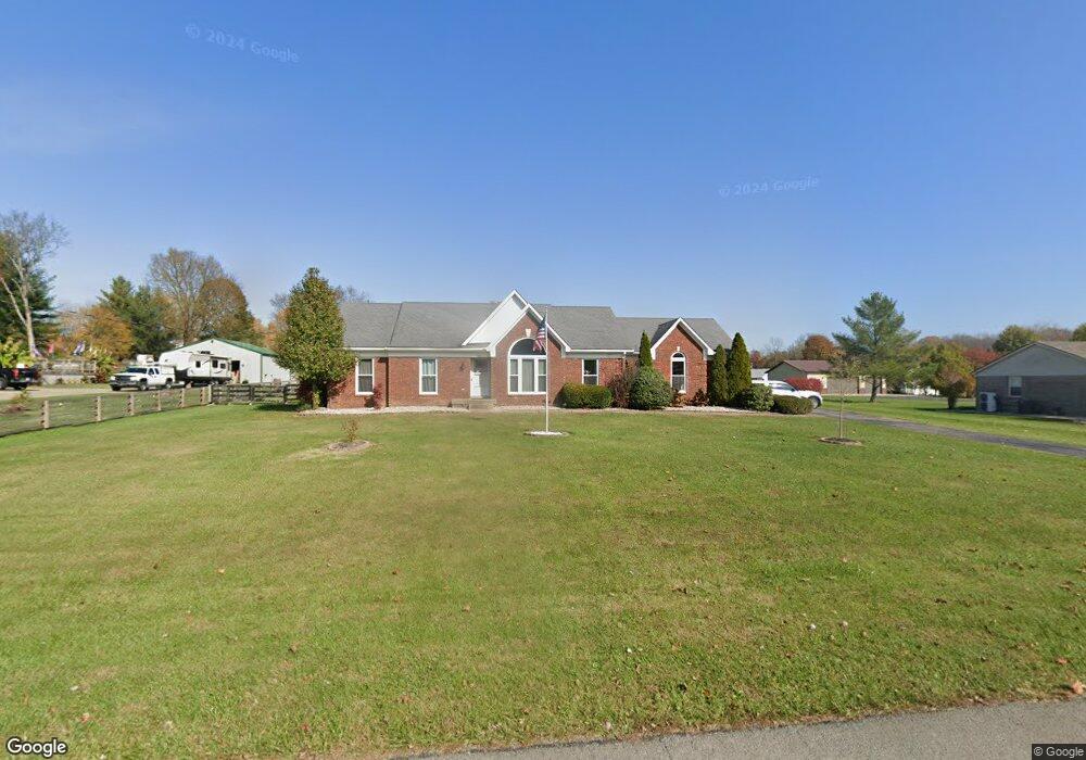
2101 Fox Trail Dr La Grange, KY 40031
Estimated Value: $372,000 - $442,000
3
Beds
2
Baths
1,940
Sq Ft
$212/Sq Ft
Est. Value
About This Home
This home is located at 2101 Fox Trail Dr, La Grange, KY 40031 and is currently estimated at $411,361, approximately $212 per square foot. 2101 Fox Trail Dr is a home located in Oldham County with nearby schools including Centerfield Elementary School, East Oldham Middle School, and Oldham County High School.
Ownership History
Date
Name
Owned For
Owner Type
Purchase Details
Closed on
Aug 10, 2010
Sold by
Dodge N P and National Equity Inc
Bought by
Mcmurry Jason R and Mcmurry Toni Lynn
Current Estimated Value
Home Financials for this Owner
Home Financials are based on the most recent Mortgage that was taken out on this home.
Original Mortgage
$175,000
Outstanding Balance
$116,101
Interest Rate
4.61%
Mortgage Type
New Conventional
Estimated Equity
$295,260
Purchase Details
Closed on
Jul 8, 2010
Sold by
Neigel John A and Neigel Vonda
Bought by
Dodge N P and National Equity Inc
Home Financials for this Owner
Home Financials are based on the most recent Mortgage that was taken out on this home.
Original Mortgage
$175,000
Outstanding Balance
$116,101
Interest Rate
4.61%
Mortgage Type
New Conventional
Estimated Equity
$295,260
Purchase Details
Closed on
Sep 23, 2005
Sold by
Missun Ronald E and Missun Traci
Bought by
Heigel John A and Neigel Vonda
Create a Home Valuation Report for This Property
The Home Valuation Report is an in-depth analysis detailing your home's value as well as a comparison with similar homes in the area
Home Values in the Area
Average Home Value in this Area
Purchase History
| Date | Buyer | Sale Price | Title Company |
|---|---|---|---|
| Mcmurry Jason R | $195,000 | None Available | |
| Dodge N P | $195,000 | None Available | |
| Heigel John A | $191,000 | None Available |
Source: Public Records
Mortgage History
| Date | Status | Borrower | Loan Amount |
|---|---|---|---|
| Open | Mcmurry Jason R | $175,000 |
Source: Public Records
Tax History Compared to Growth
Tax History
| Year | Tax Paid | Tax Assessment Tax Assessment Total Assessment is a certain percentage of the fair market value that is determined by local assessors to be the total taxable value of land and additions on the property. | Land | Improvement |
|---|---|---|---|---|
| 2024 | $3,198 | $255,000 | $40,000 | $215,000 |
| 2023 | $3,213 | $255,000 | $40,000 | $215,000 |
| 2022 | $3,198 | $255,000 | $40,000 | $215,000 |
| 2021 | $2,931 | $235,000 | $40,000 | $195,000 |
| 2020 | $2,877 | $230,000 | $35,000 | $195,000 |
| 2019 | $2,850 | $230,000 | $35,000 | $195,000 |
| 2018 | $2,851 | $230,000 | $0 | $0 |
| 2017 | $2,406 | $195,000 | $0 | $0 |
| 2013 | $2,142 | $195,000 | $35,000 | $160,000 |
Source: Public Records
Map
Nearby Homes
- 4541 Northridge Cir
- 2005 Fox Trail Dr
- 4405 Carolyn Ct
- 5003 Fairview Dr
- 5270 Payton Ln
- 4601 Sunny Hill Dr
- 1805 Wildbriar Ct
- 2915 W State Highway 22
- 1008 E Mailback Way
- 5517 Farmhouse Dr
- 3517 E Dogwood Cir
- 3903 Clarke Place
- 3203 Tara Ct
- 6910 Colton Rd
- 6209 Osage Rd
- 5501 Farmhouse Dr
- 3107 Salt Lick Rd
- 5510 Farmhouse Dr
- 5504 Farmhouse Dr
- 2302 Forrest Park Dr
- 2045 Fox Trail Dr
- 2103 Fox Trail Dr
- 2100 Fox Trail Dr
- 2102 Fox Trail Dr
- 2043 Fox Trail Dr
- 2036 Currys Fork Dr
- 2046 Fox Trail Dr
- 2107 Fox Trail Dr
- 2044 Fox Trail Dr
- 2104 Fox Trail Dr
- 2106 Fox Trail Dr
- 2111 Fox Trail Dr
- 2041 Fox Trail Dr
- 2037 Currys Fork Dr
- 2034 Currys Fork Dr
- 2113 Fox Trail Dr
- 2035 Currys Fork Dr
- 2042 Fox Trail Dr
- 2115 Fox Trail Dr
- 2037 Fox Trail Dr