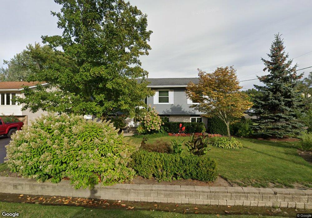
2101 N Frolic Ave Waukegan, IL 60087
Estimated Value: $255,847 - $279,000
3
Beds
2
Baths
1,120
Sq Ft
$239/Sq Ft
Est. Value
About This Home
This home is located at 2101 N Frolic Ave, Waukegan, IL 60087 and is currently estimated at $267,712, approximately $239 per square foot. 2101 N Frolic Ave is a home located in Lake County with nearby schools including Oakdale Elementary School, Miguel Juarez Middle School, and Waukegan High School.
Ownership History
Date
Name
Owned For
Owner Type
Purchase Details
Closed on
Oct 16, 2003
Sold by
Koski Mark E
Bought by
Garza Sergio A and Garza Elva I
Current Estimated Value
Home Financials for this Owner
Home Financials are based on the most recent Mortgage that was taken out on this home.
Original Mortgage
$140,800
Outstanding Balance
$63,897
Interest Rate
5.81%
Mortgage Type
Unknown
Estimated Equity
$203,815
Purchase Details
Closed on
Jan 23, 1996
Sold by
Koski Sheri L
Bought by
Koski Mark E
Home Financials for this Owner
Home Financials are based on the most recent Mortgage that was taken out on this home.
Original Mortgage
$106,400
Interest Rate
7.07%
Create a Home Valuation Report for This Property
The Home Valuation Report is an in-depth analysis detailing your home's value as well as a comparison with similar homes in the area
Home Values in the Area
Average Home Value in this Area
Purchase History
| Date | Buyer | Sale Price | Title Company |
|---|---|---|---|
| Garza Sergio A | $176,000 | -- | |
| Koski Mark E | -- | Chicago Title Insurance Co |
Source: Public Records
Mortgage History
| Date | Status | Borrower | Loan Amount |
|---|---|---|---|
| Open | Garza Sergio A | $140,800 | |
| Previous Owner | Koski Mark E | $106,400 |
Source: Public Records
Tax History Compared to Growth
Tax History
| Year | Tax Paid | Tax Assessment Tax Assessment Total Assessment is a certain percentage of the fair market value that is determined by local assessors to be the total taxable value of land and additions on the property. | Land | Improvement |
|---|---|---|---|---|
| 2024 | $4,935 | $69,378 | $7,878 | $61,500 |
| 2023 | $3,969 | $62,341 | $7,184 | $55,157 |
| 2022 | $3,969 | $48,601 | $5,740 | $42,861 |
| 2021 | $3,591 | $42,446 | $5,120 | $37,326 |
| 2020 | $3,576 | $39,544 | $4,770 | $34,774 |
| 2019 | $3,529 | $36,236 | $4,371 | $31,865 |
| 2018 | $4,839 | $45,936 | $8,661 | $37,275 |
| 2017 | $4,643 | $40,641 | $7,663 | $32,978 |
| 2016 | $4,221 | $35,316 | $6,659 | $28,657 |
| 2015 | $3,988 | $31,608 | $5,960 | $25,648 |
| 2014 | $3,940 | $30,675 | $7,603 | $23,072 |
| 2012 | $5,177 | $33,232 | $8,237 | $24,995 |
Source: Public Records
Map
Nearby Homes
- 2928 W Country Club Ave
- 3000 W Country Club Ave
- 2946 W Country Club Ave
- 3320 Sunset Ave
- 2713 Varonen Ave
- 2715 W Greenwood Ave
- 3032 W Vermont Ave
- 2705 Dana Ave
- 2440 W Cheyenne Rd
- 2708 Dana Ave
- 1913 Chippewa Rd
- 2810 W Atlantic Ave
- 12933 W Polo Ave
- 36955 N Garrick Ave
- 3436 Florida Ave
- 12312 W Audrey Ave
- 2207 Williamsburg Dr
- 36245 N Green Bay Rd
- 2813 Theresa Ave
- 12352 W Atlantic Ave
- 2109 N Frolic Ave
- 2870 W Brooke Ave
- 2111 N Frolic Ave
- 2860 W Brooke Ave
- 2891 W Brooke Ave
- 2871 W Brooke Ave
- 2900 W Brooke Ave
- 2115 N Frolic Ave
- 2106 N Frolic Ave
- 2850 W Brooke Ave
- 2861 W Brooke Ave
- 2110 N Frolic Ave
- 2032 N Frolic Ave
- 2851 W Brooke Ave
- 2840 W Brooke Ave
- 2920 W Brooke Ave
- 2028 N Frolic Ave
- 2821 Golfmoor St
- 2024 N Frolic Ave
- 2922 W Brooke Ave