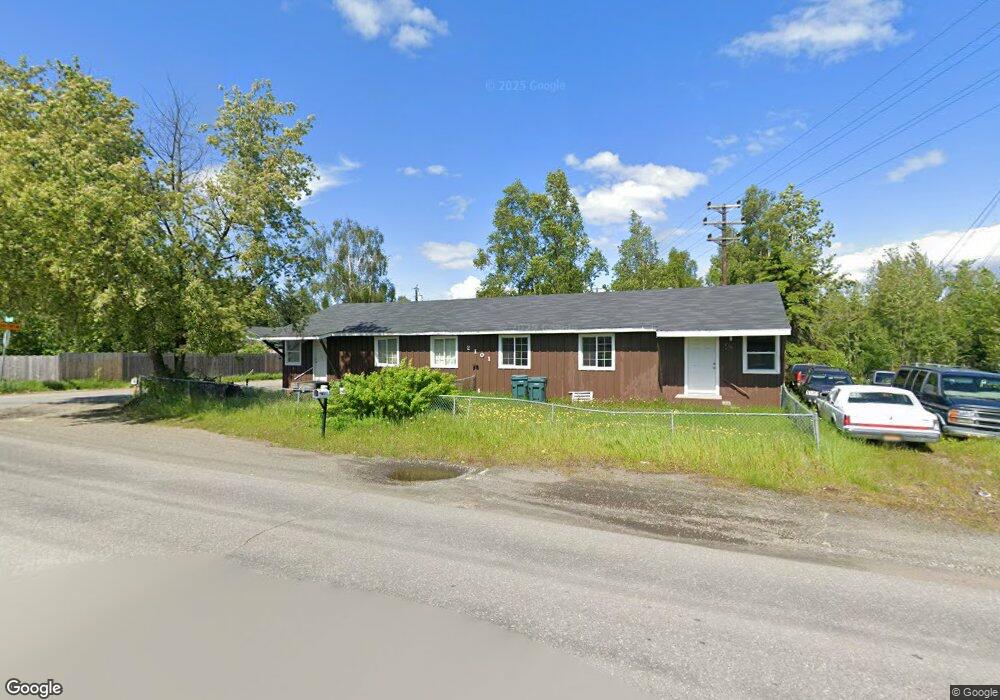
2101 W 36th Ave Anchorage, AK 99517
Spenard NeighborhoodEstimated Value: $329,192 - $371,000
6
Beds
2
Baths
1,898
Sq Ft
$184/Sq Ft
Est. Value
About This Home
This home is located at 2101 W 36th Ave, Anchorage, AK 99517 and is currently estimated at $350,096, approximately $184 per square foot. 2101 W 36th Ave is a home located in Anchorage Municipality with nearby schools including Northwood Elementary School, Romig Middle School, and West High School.
Ownership History
Date
Name
Owned For
Owner Type
Purchase Details
Closed on
Jan 11, 2001
Sold by
Leydon Tom
Bought by
Leydon Roseanne M
Current Estimated Value
Home Financials for this Owner
Home Financials are based on the most recent Mortgage that was taken out on this home.
Original Mortgage
$144,000
Outstanding Balance
$52,190
Interest Rate
7.65%
Mortgage Type
Purchase Money Mortgage
Estimated Equity
$297,906
Create a Home Valuation Report for This Property
The Home Valuation Report is an in-depth analysis detailing your home's value as well as a comparison with similar homes in the area
Home Values in the Area
Average Home Value in this Area
Purchase History
| Date | Buyer | Sale Price | Title Company |
|---|---|---|---|
| Leydon Roseanne M | -- | -- | |
| Leydon Roseanne M | -- | -- | |
| Leydon Roseanne M | -- | -- |
Source: Public Records
Mortgage History
| Date | Status | Borrower | Loan Amount |
|---|---|---|---|
| Open | Leydon Roseanne M | $144,000 | |
| Closed | Leydon Roseanne M | $144,000 |
Source: Public Records
Tax History
| Year | Tax Paid | Tax Assessment Tax Assessment Total Assessment is a certain percentage of the fair market value that is determined by local assessors to be the total taxable value of land and additions on the property. | Land | Improvement |
|---|---|---|---|---|
| 2025 | $4,571 | $285,500 | $86,400 | $199,100 |
| 2024 | $4,571 | $283,100 | $86,400 | $196,700 |
| 2023 | $4,498 | $264,100 | $86,400 | $177,700 |
| 2022 | $4,395 | $261,000 | $86,400 | $174,600 |
| 2021 | $4,516 | $250,600 | $86,400 | $164,200 |
| 2020 | $4,209 | $247,600 | $86,400 | $161,200 |
| 2019 | $3,971 | $242,700 | $86,400 | $156,300 |
| 2018 | $3,944 | $240,500 | $86,400 | $154,100 |
| 2017 | $3,873 | $247,300 | $81,900 | $165,400 |
| 2016 | $3,452 | $247,400 | $79,600 | $167,800 |
| 2015 | $3,452 | $234,200 | $79,600 | $154,600 |
| 2014 | $3,452 | $232,800 | $79,600 | $153,200 |
Source: Public Records
Map
Nearby Homes
- 3409 Oregon Dr
- 3605 Oregon Dr Unit 4
- 3406 Wyoming Dr
- 2511 Abbey Ln
- 3507 Greenland Dr
- 1808 Cleveland Ave
- 4000 Iowa Dr
- NHN Northwood Dr
- 5000 Northwood Dr
- 000 Anchorage
- 1508 W 31st Ave
- Tr A W Northern Lights Blvd
- 3517 Vintage Cir
- 3901 Hayes St
- 4420 Van Buren St
- 2060 Wenmatt Cir
- 4302 Forrest Rd
- 4300 Hayes St
- 4306 Hayes St
- 3201 Spenard Rd
- 3507 Kirby Place
- 3509 Kirby Place
- 3507 Willow St
- 3509 Willow St
- 3505 Willow St
- 3503 Willow St
- 3500 Kirby Place
- 3500 Kirby Place Unit A
- 3501 Willow St
- 3508 Willow St
- 3506 Willow St
- 3409 Willow St
- 3411 Willow Place
- 3504 Willow St
- 2007 W 36th Ave
- 2007 W 36th Ave
- 2201 W 36th Ave
- 2200 W 36th Ave
- 3407 Willow St
- 2020 W 36th Ave Unit 10
Your Personal Tour Guide
Ask me questions while you tour the home.