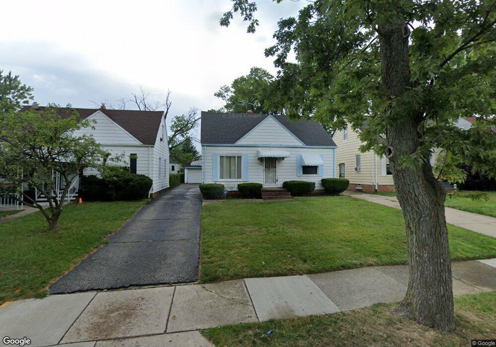
21013 Watson Rd Maple Heights, OH 44137
Estimated Value: $113,000 - $140,000
3
Beds
1
Bath
1,236
Sq Ft
$98/Sq Ft
Est. Value
About This Home
This home is located at 21013 Watson Rd, Maple Heights, OH 44137 and is currently estimated at $121,000, approximately $97 per square foot. 21013 Watson Rd is a home located in Cuyahoga County with nearby schools including Abraham Lincoln Elementary School, Rockside/ J.F. Kennedy School, and Barack Obama School.
Ownership History
Date
Name
Owned For
Owner Type
Purchase Details
Closed on
Jun 24, 1988
Sold by
Soucek Joseph G
Bought by
Roberson Gregory
Current Estimated Value
Purchase Details
Closed on
Nov 18, 1977
Sold by
Soucek Joseph G
Bought by
Soucek Joseph G
Purchase Details
Closed on
Jan 1, 1975
Bought by
Soucek Joseph G
Create a Home Valuation Report for This Property
The Home Valuation Report is an in-depth analysis detailing your home's value as well as a comparison with similar homes in the area
Home Values in the Area
Average Home Value in this Area
Purchase History
| Date | Buyer | Sale Price | Title Company |
|---|---|---|---|
| Roberson Gregory | $56,000 | -- | |
| Soucek Joseph G | -- | -- | |
| Soucek Joseph G | -- | -- |
Source: Public Records
Tax History
| Year | Tax Paid | Tax Assessment Tax Assessment Total Assessment is a certain percentage of the fair market value that is determined by local assessors to be the total taxable value of land and additions on the property. | Land | Improvement |
|---|---|---|---|---|
| 2024 | $2,551 | $27,300 | $6,720 | $20,580 |
| 2023 | $2,155 | $19,810 | $4,060 | $15,750 |
| 2022 | $2,148 | $19,810 | $4,060 | $15,750 |
| 2021 | $2,287 | $19,810 | $4,060 | $15,750 |
| 2020 | $1,961 | $15,020 | $3,080 | $11,940 |
| 2019 | $1,949 | $42,900 | $8,800 | $34,100 |
| 2018 | $1,938 | $15,020 | $3,080 | $11,940 |
| 2017 | $1,823 | $13,620 | $2,870 | $10,750 |
| 2016 | $1,764 | $13,620 | $2,870 | $10,750 |
| 2015 | $1,758 | $13,620 | $2,870 | $10,750 |
| 2014 | $1,758 | $14,980 | $3,150 | $11,830 |
Source: Public Records
Map
Nearby Homes
- 20715 Watson Rd
- 20705 Hansen Rd
- 21207 Franklin Rd
- 20600 Watson Rd
- 20517 Raymond St
- 21202 Hillgrove Ave
- 21600 Franklin Rd
- 20806 Clare Ave
- 5147 Warrensville Center Rd
- 21202 Gardenview Dr
- 19931 Raymond St
- 21860 Louis Rd
- 21607 Libby Rd
- 0 Miles Rd Unit 5188561
- 19520 Maple Heights Blvd
- 5165 Camden Rd
- 19289 Stafford Ave
- 22711 Vera St
- 5194 Homewood Ave
- 18851 Raymond St
- 21017 Watson Rd
- 21009 Watson Rd
- 21101 Watson Rd
- 21005 Watson Rd
- 21105 Watson Rd
- 21008 Hansen Rd
- 21001 Watson Rd
- 21004 Hansen Rd
- 21012 Hansen Rd
- 21016 Hansen Rd
- 21000 Hansen Rd
- 21109 Watson Rd
- 20915 Watson Rd
- 21012 Watson Rd
- 21100 Hansen Rd
- 20916 Hansen Rd
- 21008 Watson Rd
- 21016 Watson Rd
- 21004 Watson Rd
- 21113 Watson Rd
Your Personal Tour Guide
Ask me questions while you tour the home.