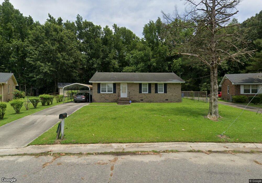
2102 Cedar Ln Kinston, NC 28501
Estimated Value: $64,000 - $102,000
2
Beds
1
Bath
1,050
Sq Ft
$83/Sq Ft
Est. Value
About This Home
This home is located at 2102 Cedar Ln, Kinston, NC 28501 and is currently estimated at $87,647, approximately $83 per square foot. 2102 Cedar Ln is a home located in Lenoir County with nearby schools including Southeast Elementary School, Rochelle Middle School, and Kinston High School.
Ownership History
Date
Name
Owned For
Owner Type
Purchase Details
Closed on
Mar 29, 2011
Sold by
Kilpatrick Lewis H and Kilpatrick Kimberly Dawn
Bought by
Graham George W and Graham Marilyn C
Current Estimated Value
Home Financials for this Owner
Home Financials are based on the most recent Mortgage that was taken out on this home.
Original Mortgage
$28,500
Outstanding Balance
$16,806
Interest Rate
5.6%
Mortgage Type
Adjustable Rate Mortgage/ARM
Estimated Equity
$70,841
Create a Home Valuation Report for This Property
The Home Valuation Report is an in-depth analysis detailing your home's value as well as a comparison with similar homes in the area
Home Values in the Area
Average Home Value in this Area
Purchase History
| Date | Buyer | Sale Price | Title Company |
|---|---|---|---|
| Graham George W | $30,000 | None Available | |
| Graham George W | $30,000 | -- |
Source: Public Records
Mortgage History
| Date | Status | Borrower | Loan Amount |
|---|---|---|---|
| Open | Graham George W | $28,500 | |
| Closed | Graham George W | $28,500 |
Source: Public Records
Tax History
| Year | Tax Paid | Tax Assessment Tax Assessment Total Assessment is a certain percentage of the fair market value that is determined by local assessors to be the total taxable value of land and additions on the property. | Land | Improvement |
|---|---|---|---|---|
| 2025 | $940 | $66,895 | $10,058 | $56,837 |
| 2024 | $438 | $27,121 | $5,500 | $21,621 |
| 2023 | $4 | $27,121 | $5,500 | $21,621 |
| 2022 | $438 | $27,121 | $5,500 | $21,621 |
| 2021 | $438 | $27,121 | $5,500 | $21,621 |
| 2020 | $427 | $27,121 | $5,500 | $21,621 |
| 2019 | $427 | $27,121 | $5,500 | $21,621 |
| 2018 | $415 | $27,121 | $5,500 | $21,621 |
| 2017 | $416 | $27,121 | $5,500 | $21,621 |
| 2014 | $526 | $35,186 | $5,500 | $29,686 |
| 2013 | -- | $35,186 | $5,500 | $29,686 |
| 2011 | -- | $35,186 | $5,500 | $29,686 |
Source: Public Records
Map
Nearby Homes
- 112 N Secrest St
- 2005 Tower Hill Rd
- 1120 Lincoln St
- 208 Clay St
- 210 Clay St
- 212 Clay St
- 710 Haskett Ct
- 2502 State Dr
- 603 N Adkin St
- 509 Lincoln St
- 1405 Centennial Trail
- 317 E Peyton Ave
- 258 North St
- 113 E Bright St
- 109 E South St
- 404 Summit Ave
- 1204 Morningside Dr
- 201 Park Ave
- 1014 N Independence St
- 0 Highway 70 Lot Unit WP001
Your Personal Tour Guide
Ask me questions while you tour the home.