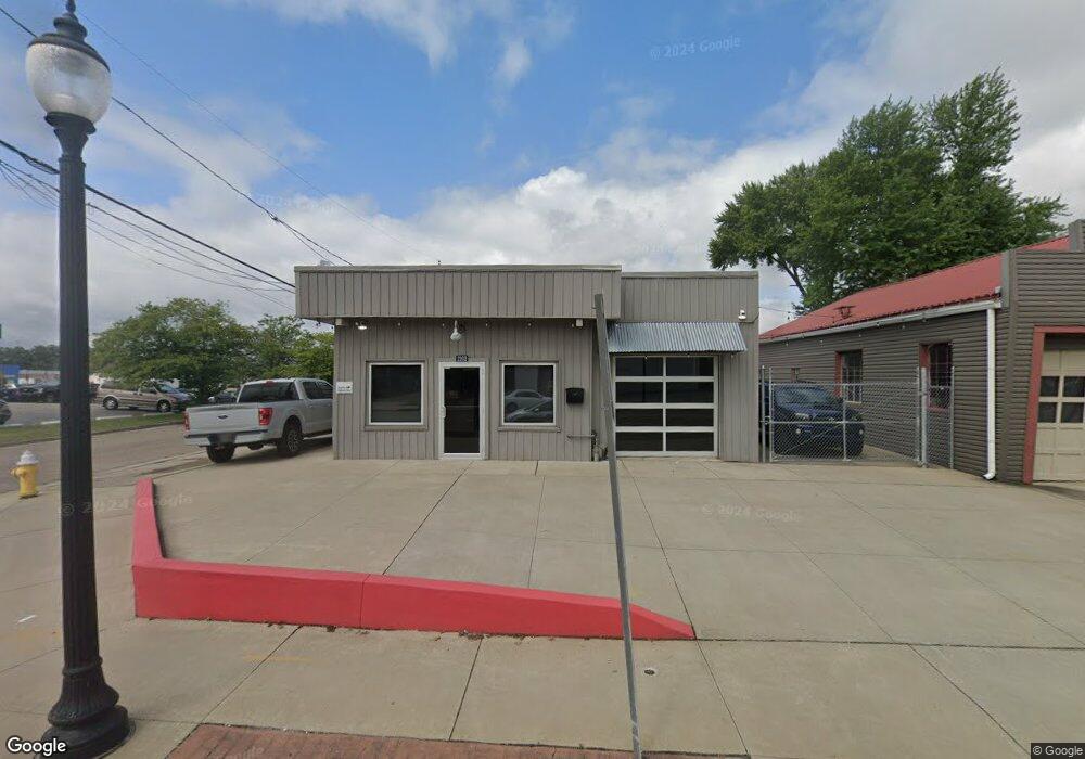
2102 S Main St Akron, OH 44301
Firestone Park NeighborhoodEstimated Value: $132,143
--
Bed
--
Bath
1,686
Sq Ft
$78/Sq Ft
Est. Value
About This Home
This home is located at 2102 S Main St, Akron, OH 44301 and is currently estimated at $132,143, approximately $78 per square foot. 2102 S Main St is a home located in Summit County with nearby schools including Kenmore Garfield Community Learning Center, Main Preparatory Academy, and Eagle Elementary.
Ownership History
Date
Name
Owned For
Owner Type
Purchase Details
Closed on
Mar 29, 2024
Sold by
Hovater David B
Bought by
Highbridge Restoration Llc
Current Estimated Value
Purchase Details
Closed on
Mar 27, 2024
Sold by
Hovater David B
Bought by
Highbridge Restoration Llc
Purchase Details
Closed on
May 21, 2015
Sold by
Myers Theodore A
Bought by
Hovater David B
Purchase Details
Closed on
Oct 9, 2009
Sold by
Myers Theodore A
Bought by
City Of Akron
Purchase Details
Closed on
Jun 28, 1999
Sold by
Miller Phyllis J
Bought by
Myers Theodore A
Create a Home Valuation Report for This Property
The Home Valuation Report is an in-depth analysis detailing your home's value as well as a comparison with similar homes in the area
Home Values in the Area
Average Home Value in this Area
Purchase History
| Date | Buyer | Sale Price | Title Company |
|---|---|---|---|
| Highbridge Restoration Llc | $125,000 | None Listed On Document | |
| Highbridge Restoration Llc | $125,000 | None Listed On Document | |
| Hovater David B | $75,000 | Buckeye Reserve Title Agency | |
| City Of Akron | -- | Minnesota Title | |
| Myers Theodore A | $75,010 | Bond & Associates Title Agen |
Source: Public Records
Tax History Compared to Growth
Tax History
| Year | Tax Paid | Tax Assessment Tax Assessment Total Assessment is a certain percentage of the fair market value that is determined by local assessors to be the total taxable value of land and additions on the property. | Land | Improvement |
|---|---|---|---|---|
| 2025 | $2,396 | $24,511 | $8,351 | $16,160 |
| 2024 | $2,396 | $24,511 | $8,351 | $16,160 |
| 2023 | $2,396 | $24,511 | $8,351 | $16,160 |
| 2022 | $2,442 | $24,511 | $8,351 | $16,160 |
| 2021 | $2,445 | $24,511 | $8,351 | $16,160 |
| 2020 | $2,418 | $24,510 | $8,350 | $16,160 |
| 2019 | $2,645 | $24,720 | $6,450 | $18,270 |
| 2018 | $2,631 | $24,720 | $6,450 | $18,270 |
| 2017 | $2,698 | $24,720 | $6,450 | $18,270 |
| 2016 | $2,677 | $26,000 | $6,790 | $19,210 |
| 2015 | $2,698 | $26,000 | $6,790 | $19,210 |
| 2014 | $2,668 | $26,000 | $6,790 | $19,210 |
| 2013 | -- | $26,000 | $5,770 | $20,230 |
Source: Public Records
Map
Nearby Homes
- 41 W Woodsdale Ave
- 21 W Linwood Ave
- 40 E Dresden Ave
- 88 E Dresden Ave
- 23 Selden Ave
- 74 E Catawba Ave
- 1861 S Main St
- 41 E Rosewood Ave
- 75 W Dartmore Ave
- 249 Naomi St
- 2513 Christensen Ave
- 1637 Rockford St
- 364 Rexford St
- 363 Lockwood St
- 739 S Firestone Blvd
- 2179 Glenmount Ave
- 1614 Glenmount Ave
- 197 E Wilbeth Rd
- 227 Crescent Dr
- 2365 Pelton Ave
- 17 W Boxwood Ave
- 2118 S Main St
- 21 W Boxwood Ave
- 25 W Boxwood Ave
- 20 W Ralston Ave
- 20 W Ralston Ave
- 26 W Ralston Ave
- 22 W Ralston Ave
- 2126 S Main St
- 35 W Boxwood Ave
- 2087 S Main St
- 30 W Ralston Ave
- 39 W Boxwood Ave
- 20 E Ralston Ave
- 45 W Boxwood Ave
- 21 W Ralston Ave
- 24 E Ralston Ave
- 25 W Ralston Ave
- 2063 S Main St
- 2063 S Main St