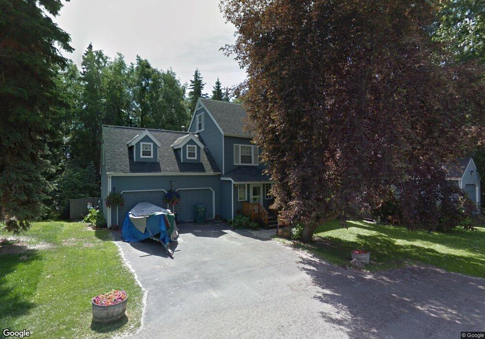
2102 W 31st Ave Anchorage, AK 99517
Spenard NeighborhoodEstimated Value: $270,000 - $598,469
3
Beds
2
Baths
2,352
Sq Ft
$193/Sq Ft
Est. Value
About This Home
This home is located at 2102 W 31st Ave, Anchorage, AK 99517 and is currently estimated at $453,490, approximately $192 per square foot. 2102 W 31st Ave is a home located in Anchorage Municipality with nearby schools including Turnagain Elementary School, Romig Middle School, and West High School.
Ownership History
Date
Name
Owned For
Owner Type
Purchase Details
Closed on
Sep 26, 1996
Sold by
Wolf Daniel C and Wolf Kristi R
Bought by
Howard Craig S and Easter Catherine M
Current Estimated Value
Home Financials for this Owner
Home Financials are based on the most recent Mortgage that was taken out on this home.
Original Mortgage
$175,500
Outstanding Balance
$15,800
Interest Rate
7.87%
Mortgage Type
New Conventional
Estimated Equity
$437,690
Create a Home Valuation Report for This Property
The Home Valuation Report is an in-depth analysis detailing your home's value as well as a comparison with similar homes in the area
Home Values in the Area
Average Home Value in this Area
Purchase History
| Date | Buyer | Sale Price | Title Company |
|---|---|---|---|
| Howard Craig S | -- | -- |
Source: Public Records
Mortgage History
| Date | Status | Borrower | Loan Amount |
|---|---|---|---|
| Open | Howard Craig S | $175,500 |
Source: Public Records
Tax History Compared to Growth
Tax History
| Year | Tax Paid | Tax Assessment Tax Assessment Total Assessment is a certain percentage of the fair market value that is determined by local assessors to be the total taxable value of land and additions on the property. | Land | Improvement |
|---|---|---|---|---|
| 2025 | $5,049 | $563,400 | $126,700 | $436,700 |
| 2024 | $5,049 | $537,700 | $126,700 | $411,000 |
| 2023 | $8,506 | $499,500 | $126,700 | $372,800 |
| 2022 | $4,705 | $479,400 | $126,700 | $352,700 |
| 2021 | $7,334 | $407,000 | $126,700 | $280,300 |
| 2020 | $3,647 | $415,700 | $126,700 | $289,000 |
| 2019 | $3,553 | $417,200 | $126,700 | $290,500 |
| 2018 | $3,638 | $421,800 | $123,200 | $298,600 |
| 2017 | $6,369 | $426,700 | $123,200 | $303,500 |
| 2016 | $4,673 | $415,300 | $126,000 | $289,300 |
| 2015 | $4,673 | $418,000 | $126,000 | $292,000 |
| 2014 | $4,673 | $381,200 | $126,000 | $255,200 |
Source: Public Records
Map
Nearby Homes
- Tr A W Northern Lights Blvd
- 3409 Oregon Dr
- 3103 Barbara St
- 3406 Wyoming Dr
- 2502 W 34th Ave
- 2607 W 33rd Ave
- 3311 Greenland Dr Unit B
- 1508 W 31st Ave
- 3605 Oregon Dr Unit 7
- 3605 Oregon Dr Unit 4
- 3507 Greenland Dr
- 000 Anchorage
- 2511 Abbey Ln
- 2543 La Honda Dr Unit 7
- 1407 W 33rd Ave
- 2400 Belmont Dr
- 2064 Belair Dr
- 2702 Mcrae Rd
- 1471 W 26th Ave
- 2925 W 36th Ave
- 2104 W 31st Ave
- 2100 W 31st Ave
- 14 Doris St Unit 14
- 13 Doris St Unit 13
- 2101 W 31st Ave
- 3010 Doris St
- 2103 W 32nd Ave
- 3101 Willow St
- 2105 W 32nd Ave
- 2101 W 32nd Ave
- 2005 W 31st Ave
- 3105 Willow St
- 3013 Willow St
- 3008 Doris St
- 2006 W 31st Ave
- 2006 W 31st Ave
- 2011 W 32nd Ave
- 3011 Willow St
- 3107 Willow St
- 3107 Willow St Unit 2