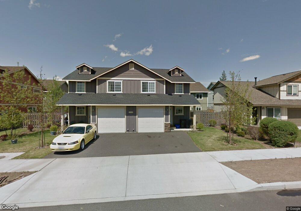
21028 Damascus Ln Bend, OR 97701
Larkspur NeighborhoodEstimated Value: $695,000 - $734,000
About This Home
This home is located at 21028 Damascus Ln, Bend, OR 97701 and is currently estimated at $712,867, approximately $293 per square foot. 21028 Damascus Ln is a home located in Deschutes County with nearby schools including Bear Creek Elementary School, Pilot Butte Middle School, and Bend Senior High School.
Ownership History
We collect this data history from publicly available records. To have your information removed, we recommend requesting removal directly through your county’s website.
Purchase Details
Purchase Details
Home Financials for this Owner
Home Financials are based on the most recent Mortgage that was taken out on this home.Home Values in the Area
Average Home Value in this Area
Purchase History
We collect this data history from publicly available records. To have your information removed, we recommend requesting removal directly through your county’s website.
| Date | Buyer | Sale Price | Title Company |
|---|---|---|---|
| -- | None Available | ||
| $320,000 | Western Title & Escrow Co |
Mortgage History
We collect this data history from publicly available records. To have your information removed, we recommend requesting removal directly through your county’s website.
| Date | Status | Borrower | Loan Amount |
|---|---|---|---|
| Open | $197,000 |
Tax History
We collect this data history from publicly available records. To have your information removed, we recommend requesting removal directly through your county’s website.
| Year | Tax Paid | Tax Assessment Tax Assessment Total Assessment is a certain percentage of the fair market value that is determined by local assessors to be the total taxable value of land and additions on the property. | Land | Improvement |
|---|---|---|---|---|
| 2025 | $4,691 | $277,640 | -- | -- |
| 2024 | $4,513 | $269,560 | -- | -- |
| 2023 | $4,184 | $261,710 | $0 | $0 |
| 2022 | $3,904 | $246,690 | $0 | $0 |
| 2021 | $3,909 | $239,510 | $0 | $0 |
| 2020 | $3,709 | $239,510 | $0 | $0 |
| 2019 | $3,606 | $232,540 | $0 | $0 |
| 2018 | $3,504 | $225,770 | $0 | $0 |
| 2017 | $3,401 | $219,200 | $0 | $0 |
| 2016 | $3,244 | $212,820 | $0 | $0 |
| 2015 | $3,154 | $206,630 | $0 | $0 |
| 2014 | $3,061 | $200,620 | $0 | $0 |
Map
- 62017 NE Nate's Place
- 62062 Dean Swift Rd
- 217 SE Soft Tail Dr
- 209 SE Soft Tail Dr
- 61984 Pettigrew Rd
- 253 SE Soft Tail Dr
- 2241 SE Pilatus Ln
- 2200 NE Hwy 20 Unit 15
- 21125 Bear Creek Rd
- 210 NE Alpenview Ln
- 61908 Pettigrew Rd
- 23 SE Benaiah Cir
- 940 NE Purcell Blvd
- 1652 NE Redrose Ct
- 21171 SE Kayla Ct
- 968 NE Paula Dr
- 131 SE Airpark Dr
- 1627 NE Bear Creek Rd
- 973 NE Paula Dr
- 21184 Silverado Valley Ln
- 21028 Damascus Ln Unit 2
- 21022 Damascus Ln
- 21034 Damascus Ln
- 21023 Carl St
- 21027 Carl St
- 21031 Carl St
- 62043 Dean Swift Rd
- 62043 Dean Swift Rd Unit A&B
- 21033 Damascus Ln
- 21029 Damascus Ln
- 21025 Damascus Ln
- 21015 Carl St Unit 11
- 21015 Carl St Unit 10
- 21015 Carl St Unit 7
- 21015 Carl St Unit 6
- 21015 Carl St Unit 1
- 21015 Carl St
- 62048 NE Nates Place Unit 2
- 62048 NE Nates Place
- 62044 NE Nates Place
Ask me questions while you tour the home.