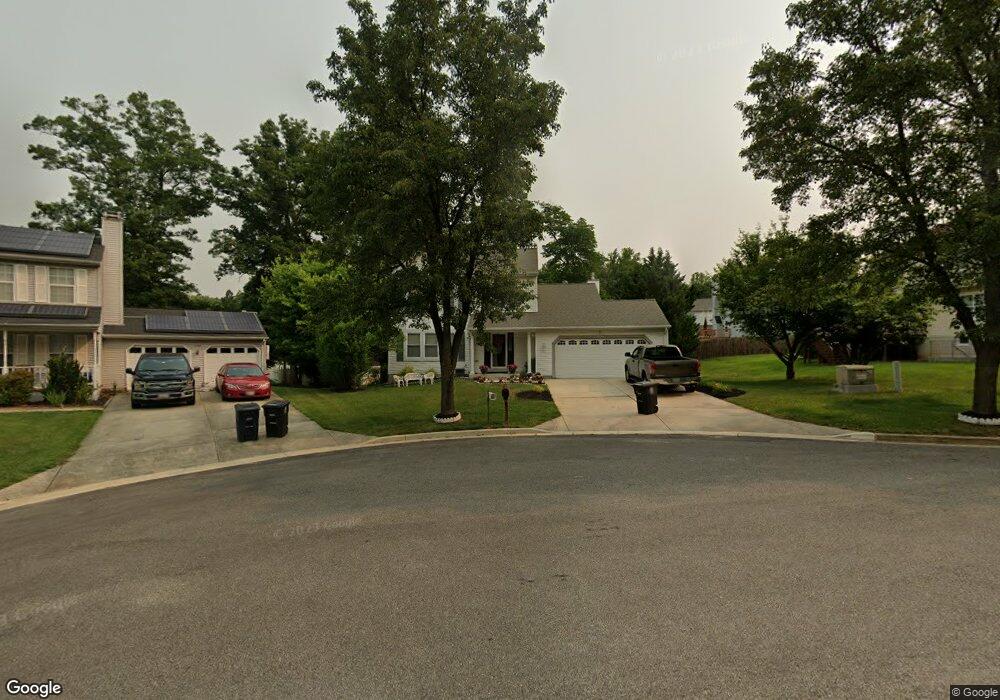
2103 Dorking Run Upper Marlboro, MD 20774
Estimated Value: $395,000 - $515,000
Studio
3
Baths
1,760
Sq Ft
$264/Sq Ft
Est. Value
About This Home
This home is located at 2103 Dorking Run, Upper Marlboro, MD 20774 and is currently estimated at $464,748, approximately $264 per square foot. 2103 Dorking Run is a home located in Prince George's County with nearby schools including Perrywood Elementary School, Kettering Middle School, and Largo High School.
Ownership History
Date
Name
Owned For
Owner Type
Purchase Details
Closed on
Aug 8, 2012
Sold by
Toomer Hollice T and Toomer Carol F
Bought by
Toomer Hollice and Toomer Carol F
Current Estimated Value
Purchase Details
Closed on
Apr 15, 2011
Sold by
Toomer Family Trust
Bought by
Toomer Hollice and Toomer Carol F
Purchase Details
Closed on
Mar 10, 2005
Sold by
Toomer Hollice and Toomer Carol
Bought by
Toomer Family Trust
Purchase Details
Closed on
Nov 21, 1994
Sold by
Barnes Christopher
Bought by
Toomer Hollice
Home Financials for this Owner
Home Financials are based on the most recent Mortgage that was taken out on this home.
Original Mortgage
$137,600
Interest Rate
8.9%
Create a Home Valuation Report for This Property
The Home Valuation Report is an in-depth analysis detailing your home's value as well as a comparison with similar homes in the area
Home Values in the Area
Average Home Value in this Area
Purchase History
| Date | Buyer | Sale Price | Title Company |
|---|---|---|---|
| Toomer Hollice | -- | None Available | |
| Toomer Hollice | -- | -- | |
| Toomer Hollice | -- | -- | |
| Toomer Family Trust | -- | -- | |
| Toomer Hollice | $172,000 | -- |
Source: Public Records
Mortgage History
| Date | Status | Borrower | Loan Amount |
|---|---|---|---|
| Previous Owner | Toomer Hollice | $137,600 |
Source: Public Records
Tax History
| Year | Tax Paid | Tax Assessment Tax Assessment Total Assessment is a certain percentage of the fair market value that is determined by local assessors to be the total taxable value of land and additions on the property. | Land | Improvement |
|---|---|---|---|---|
| 2025 | $4,914 | $436,400 | $111,200 | $325,200 |
| 2024 | $4,914 | $404,367 | -- | -- |
| 2023 | $4,676 | $372,333 | $0 | $0 |
| 2022 | $4,392 | $340,300 | $101,200 | $239,100 |
| 2021 | $4,442 | $327,200 | $0 | $0 |
| 2020 | $4,354 | $314,100 | $0 | $0 |
| 2019 | $4,243 | $301,000 | $100,600 | $200,400 |
| 2018 | $4,093 | $284,467 | $0 | $0 |
| 2017 | $3,967 | $267,933 | $0 | $0 |
| 2016 | -- | $251,400 | $0 | $0 |
| 2015 | $3,899 | $245,567 | $0 | $0 |
| 2014 | $3,899 | $239,733 | $0 | $0 |
Source: Public Records
Map
Nearby Homes
- 2209 Brown Station Rd
- 12250 Open View Ln
- 13008 Boykin Place
- 2628 Brown Station Rd
- 932 Pine Forest Ln
- 923 Pine Forest Ln
- 904 Pine Forest Ln
- 1309 Merganser Ct
- 1106 Mandarin Dr
- 950 Dunloring Ct
- 2411 Baikal Loop
- 905 Faber Place
- 11200 Lenox Dr
- 2300 Old Largo Rd
- 13506 Perrywood Ct
- 2304 Norwich Place
- 2903 Wood Valley Rd
- 10904 Golden Glow Ave
- 3006 Wind Whisper Way
- 3005 Wind Whisper Way
- 2105 Dorking Run
- 12405 Ronald Beall Rd
- 12403 Ronald Beall Rd
- 2110 Robert Bowie Dr
- 2106 Robert Bowie Dr
- 2112 Robert Bowie Dr
- 2106 Dorking Run
- 2100 Robert Bowie Dr
- 2116 Robert Bowie Dr
- 2100 Dorking Run
- 2104 Dorking Run
- 2102 Dorking Run
- 2120 Robert Bowie Dr
- 2122 Robert Bowie Dr
- 12404 Ronald Beall Rd
- 12406 Ronald Beall Rd
- 2016 Robert Bowie Dr
- 12409 Ronald Beall Rd
- 2124 Robert Bowie Dr
- 12408 Ronald Beall Rd
Your Personal Tour Guide
Ask me questions while you tour the home.