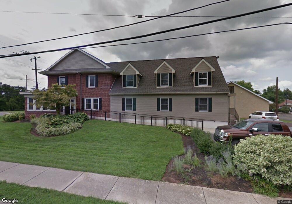
2103 E High St Pottstown, PA 19464
Estimated Value: $519,234
Studio
1
Bath
6,678
Sq Ft
$78/Sq Ft
Est. Value
About This Home
This home is located at 2103 E High St, Pottstown, PA 19464 and is currently estimated at $519,234, approximately $77 per square foot. 2103 E High St is a home located in Montgomery County with nearby schools including Lower Pottsgrove Elementary School, Pottsgrove Middle School, and Pottsgrove Senior High School.
Ownership History
Date
Name
Owned For
Owner Type
Purchase Details
Closed on
Sep 17, 2014
Sold by
Tri County Urologic Real Estate Partners
Bought by
Tyco Enterprises Llc
Current Estimated Value
Home Financials for this Owner
Home Financials are based on the most recent Mortgage that was taken out on this home.
Original Mortgage
$210,000
Outstanding Balance
$160,531
Interest Rate
4.1%
Mortgage Type
Construction
Estimated Equity
$358,703
Purchase Details
Closed on
Apr 28, 2000
Sold by
Rose Robert M and Rose Patricia D
Bought by
Tri County Urologic Real Estate Prtnrshp
Create a Home Valuation Report for This Property
The Home Valuation Report is an in-depth analysis detailing your home's value as well as a comparison with similar homes in the area
Home Values in the Area
Average Home Value in this Area
Purchase History
| Date | Buyer | Sale Price | Title Company |
|---|---|---|---|
| Tyco Enterprises Llc | $292,000 | None Available | |
| Tri County Urologic Real Estate Prtnrshp | $163,852 | -- |
Source: Public Records
Mortgage History
| Date | Status | Borrower | Loan Amount |
|---|---|---|---|
| Open | Tyco Enterprises Llc | $210,000 |
Source: Public Records
Tax History
| Year | Tax Paid | Tax Assessment Tax Assessment Total Assessment is a certain percentage of the fair market value that is determined by local assessors to be the total taxable value of land and additions on the property. | Land | Improvement |
|---|---|---|---|---|
| 2025 | $7,744 | $157,550 | $49,250 | $108,300 |
| 2024 | $7,744 | $157,550 | $49,250 | $108,300 |
| 2023 | $7,505 | $157,550 | $49,250 | $108,300 |
| 2022 | $7,391 | $157,550 | $49,250 | $108,300 |
| 2021 | $7,246 | $157,550 | $49,250 | $108,300 |
| 2020 | $7,179 | $157,550 | $49,250 | $108,300 |
| 2019 | $7,142 | $157,550 | $49,250 | $108,300 |
Source: Public Records
Map
Nearby Homes
- 2088 E High St
- 233 Creekside Dr
- 420 Oaktree Ct
- 207 Cherrywood Ct
- 524 Oaktree Ct Unit 524
- 101 Cherrywood Ct
- 5 Creekside Dr
- 1613 Rosewood Ct Unit 79
- 277 N Pleasantview Rd
- 260 Hause Ave
- 510 N Pleasantview Rd
- 45 Pebble Beach Ln
- 1511 Cherry Ln
- 103 Sunrise Dr
- 1397 1/2 Queen St
- 2105 Walnut Ridge Dr
- 1436 Cherry Ln
- 3505 Walnut Ridge Estate Unit 3505
- 3106 Walnut Ridge Estate
- 3605 Walnut Ridge Dr
- 2093 E High St
- 2081 E High St Unit 200
- 2081 E High St Unit 100
- 2081 E High St
- 2117 E High St
- 2108 E High St
- 74 Willow Rd
- 2047 E High St
- 95 Willow Rd
- 2087b E High St
- 94 Willow Rd
- 2087 E High St
- 2087 E High St Unit B
- 2120 E High St
- 36 1st Ave
- 2023 E High St
- 33 1st Ave
- 2130 E High St
- 2132 E High St
- 2050 E High St
Your Personal Tour Guide
Ask me questions while you tour the home.