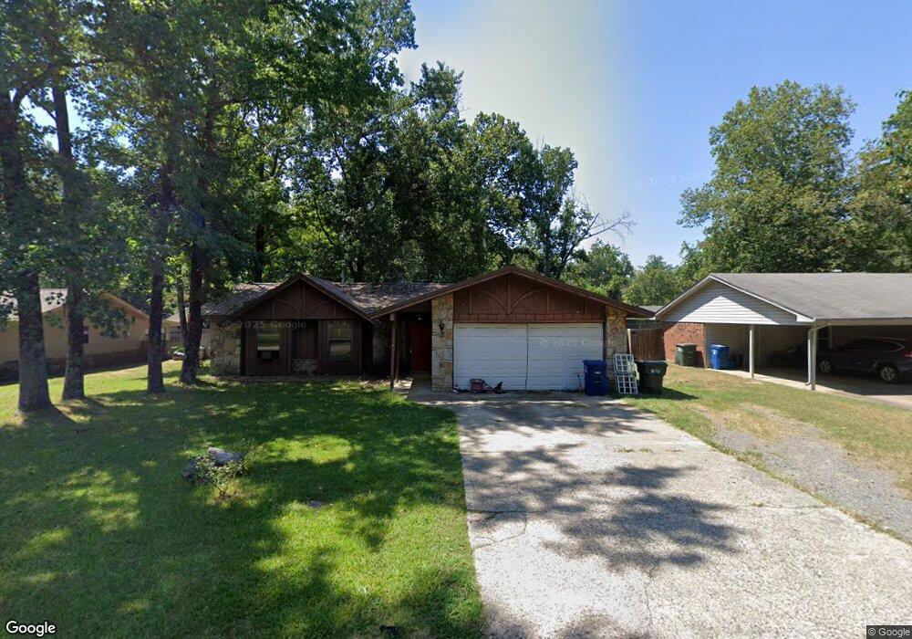
2103 West St Conway, AR 72032
Downtown Conway NeighborhoodEstimated Value: $181,469 - $210,000
--
Bed
2
Baths
1,354
Sq Ft
$145/Sq Ft
Est. Value
About This Home
This home is located at 2103 West St, Conway, AR 72032 and is currently estimated at $195,867, approximately $144 per square foot. 2103 West St is a home located in Faulkner County with nearby schools including Ida Burns Elementary School, Conway Junior High School, and Ruth Doyle Intermediate School.
Ownership History
Date
Name
Owned For
Owner Type
Purchase Details
Closed on
May 2, 2006
Bought by
Sanford
Current Estimated Value
Purchase Details
Closed on
Apr 19, 2006
Sold by
Lemay Jeff S and Lemay Karen
Bought by
Sanford Jeffrey L and Sanford Tammy L
Purchase Details
Closed on
Sep 28, 1993
Bought by
Coats
Purchase Details
Closed on
Nov 8, 1988
Bought by
Roebuck
Create a Home Valuation Report for This Property
The Home Valuation Report is an in-depth analysis detailing your home's value as well as a comparison with similar homes in the area
Home Values in the Area
Average Home Value in this Area
Purchase History
| Date | Buyer | Sale Price | Title Company |
|---|---|---|---|
| Sanford | $92,000 | -- | |
| Sanford Jeffrey L | $92,000 | None Available | |
| Sanford | $92,000 | -- | |
| Coats | $58,000 | -- | |
| Roebuck | $51,000 | -- |
Source: Public Records
Tax History Compared to Growth
Tax History
| Year | Tax Paid | Tax Assessment Tax Assessment Total Assessment is a certain percentage of the fair market value that is determined by local assessors to be the total taxable value of land and additions on the property. | Land | Improvement |
|---|---|---|---|---|
| 2025 | $1,270 | $33,370 | $3,600 | $29,770 |
| 2024 | $1,212 | $33,370 | $3,600 | $29,770 |
| 2023 | $1,154 | $23,220 | $3,600 | $19,620 |
| 2022 | $729 | $23,220 | $3,600 | $19,620 |
| 2021 | $679 | $23,220 | $3,600 | $19,620 |
| 2020 | $629 | $19,840 | $3,600 | $16,240 |
| 2019 | $629 | $19,840 | $3,600 | $16,240 |
| 2018 | $654 | $19,840 | $3,600 | $16,240 |
| 2017 | $654 | $19,840 | $3,600 | $16,240 |
| 2016 | $654 | $19,840 | $3,600 | $16,240 |
| 2015 | $1,044 | $20,640 | $3,600 | $17,040 |
| 2014 | $694 | $20,640 | $3,600 | $17,040 |
Source: Public Records
Map
Nearby Homes
- 2107 West St
- 1905 Hutto St
- 1906 Hutto St
- 1813 Tyler St
- 2450 Village Court Dr
- 1204 Harton St
- 2103 Tyler St
- 1527 Clifton St
- 2007 Arkansas Ave
- 2107 Broadview Ave
- 2010 Hairston St
- 1535 Clifton St
- 1415 Watkins St
- 1800 Altus St
- 1416 Donaghey Ave
- 1834 Johnston Ave
- 2420 Morse Dr
- 860 Steel Ave
- 2115 Hairston St
- 1311 Clifton St