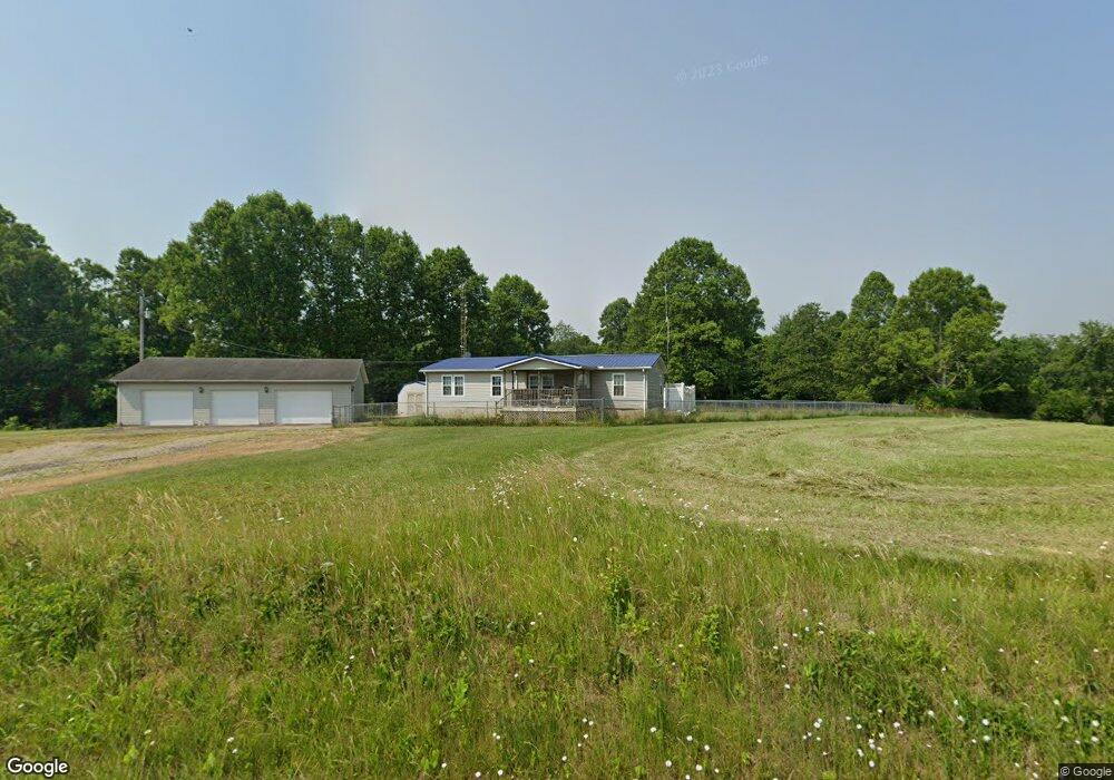
21030 State Route 676 Marietta, OH 45750
Estimated Value: $145,000 - $185,000
3
Beds
2
Baths
744
Sq Ft
$216/Sq Ft
Est. Value
About This Home
This home is located at 21030 State Route 676, Marietta, OH 45750 and is currently estimated at $160,627, approximately $215 per square foot. 21030 State Route 676 is a home with nearby schools including Warren High School, Veritas Classical Academy, and St. John Central Grade School.
Ownership History
Date
Name
Owned For
Owner Type
Purchase Details
Closed on
Mar 27, 2024
Sold by
Hasley Donna M
Bought by
Hasley Donna M and Ritchie Kristina A
Current Estimated Value
Home Financials for this Owner
Home Financials are based on the most recent Mortgage that was taken out on this home.
Original Mortgage
$156,000
Outstanding Balance
$153,678
Interest Rate
6.9%
Mortgage Type
Construction
Estimated Equity
$6,949
Purchase Details
Closed on
Feb 19, 2020
Sold by
Estate Of Gary W Hasley
Bought by
Hasley Donna M
Purchase Details
Closed on
Sep 19, 1991
Bought by
Hasley Gary W and Hasley Donna M
Create a Home Valuation Report for This Property
The Home Valuation Report is an in-depth analysis detailing your home's value as well as a comparison with similar homes in the area
Home Values in the Area
Average Home Value in this Area
Purchase History
| Date | Buyer | Sale Price | Title Company |
|---|---|---|---|
| Hasley Donna M | -- | None Listed On Document | |
| Hasley Donna M | -- | None Available | |
| Hasley Gary W | -- | -- |
Source: Public Records
Mortgage History
| Date | Status | Borrower | Loan Amount |
|---|---|---|---|
| Open | Hasley Donna M | $156,000 |
Source: Public Records
Tax History Compared to Growth
Tax History
| Year | Tax Paid | Tax Assessment Tax Assessment Total Assessment is a certain percentage of the fair market value that is determined by local assessors to be the total taxable value of land and additions on the property. | Land | Improvement |
|---|---|---|---|---|
| 2024 | $987 | $25,860 | $11,190 | $14,670 |
| 2023 | $987 | $42,960 | $11,190 | $31,770 |
| 2022 | $1,628 | $42,960 | $11,190 | $31,770 |
| 2021 | $1,293 | $32,570 | $7,760 | $24,810 |
| 2020 | $1,312 | $32,570 | $7,760 | $24,810 |
| 2019 | $1,299 | $32,570 | $7,760 | $24,810 |
| 2018 | $1,199 | $29,130 | $6,750 | $22,380 |
| 2017 | $1,192 | $29,130 | $6,750 | $22,380 |
| 2016 | $1,483 | $29,130 | $6,750 | $22,380 |
| 2015 | $1,013 | $27,400 | $6,480 | $20,920 |
| 2014 | $1,410 | $27,400 | $6,480 | $20,920 |
| 2013 | $984 | $27,400 | $6,480 | $20,920 |
Source: Public Records
Map
Nearby Homes
- 20645 Ohio 676
- 565 Lang Farm Rd
- 100 Pineview Dr
- 305 Flintwood Dr
- 116 Pineview Dr
- 65 High Point Dr
- 117 Clark St
- 211 Beaver St
- 101 Laramie Rd
- 132 Mound Dr
- 203 Marion St
- 111 Hanson Dr
- 375 Belavista Dr
- 977 Gilman Ave
- 107 Strecker Hill
- 101 W Montgomery St
- 204 Coventry Rd
- 721 Front St
- 213 E Montgomery St
- 904 Garfield Ave
- 21062 State Route 676
- 21084 State Route 676
- 21005 State Route 676
- 20943 State Route 676
- 20995 State Route 676
- 21110 State Route 676
- 21115 State Route 676
- 20890 State Route 676
- 21159 Ohio 676
- 20899 State Route 676
- 21120 State Route 676
- 21124 State Route 676
- 21185 Ohio 676
- 21185 State Route 676
- 20796 State Route 676
- 21197 State Route 676
- 21200 Ohio 676
- 21200 State Route 676
- 21219 State Route 676
- 21212 State Route 676