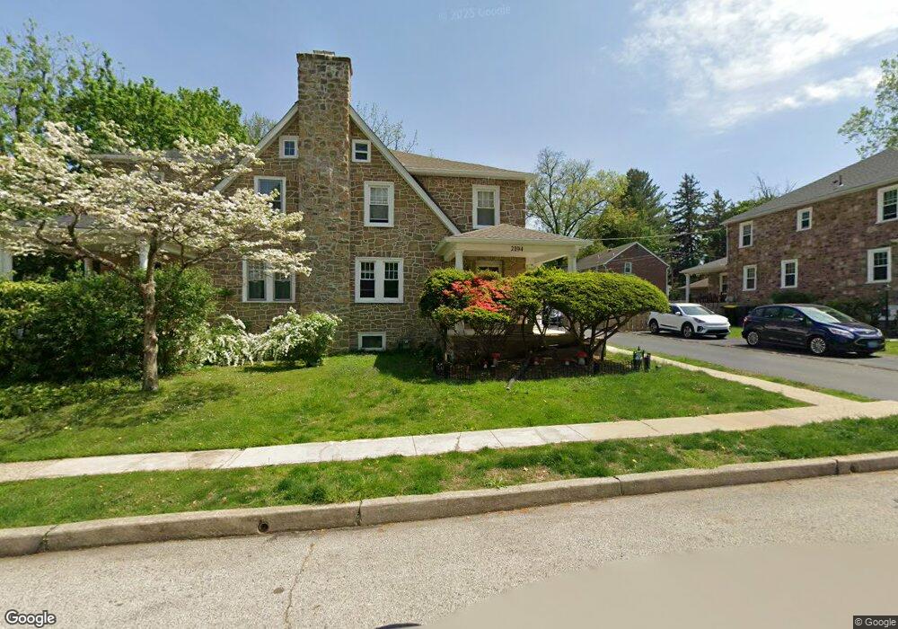
2104 Coles Blvd Unit 20 Norristown, PA 19401
Estimated Value: $359,000 - $386,404
3
Beds
1
Bath
1,708
Sq Ft
$219/Sq Ft
Est. Value
About This Home
This home is located at 2104 Coles Blvd Unit 20, Norristown, PA 19401 and is currently estimated at $373,851, approximately $218 per square foot. 2104 Coles Blvd Unit 20 is a home located in Montgomery County with nearby schools including Cole Manor Elementary School, East Norriton Middle School, and Charles Blockson Middle School.
Ownership History
Date
Name
Owned For
Owner Type
Purchase Details
Closed on
Nov 21, 2003
Sold by
Tarmin Suzanne
Bought by
Tarmin Suzanne and Tarmin Glenn
Current Estimated Value
Home Financials for this Owner
Home Financials are based on the most recent Mortgage that was taken out on this home.
Original Mortgage
$112,000
Outstanding Balance
$52,032
Interest Rate
6.03%
Estimated Equity
$321,819
Purchase Details
Closed on
Jul 25, 1997
Sold by
Jones Ronald and Schnably Leah Opal
Bought by
Jones Suzanne L
Create a Home Valuation Report for This Property
The Home Valuation Report is an in-depth analysis detailing your home's value as well as a comparison with similar homes in the area
Home Values in the Area
Average Home Value in this Area
Purchase History
| Date | Buyer | Sale Price | Title Company |
|---|---|---|---|
| Tarmin Suzanne | -- | -- | |
| Jones Suzanne L | $107,850 | -- |
Source: Public Records
Mortgage History
| Date | Status | Borrower | Loan Amount |
|---|---|---|---|
| Open | Tarmin Suzanne | $112,000 |
Source: Public Records
Tax History Compared to Growth
Tax History
| Year | Tax Paid | Tax Assessment Tax Assessment Total Assessment is a certain percentage of the fair market value that is determined by local assessors to be the total taxable value of land and additions on the property. | Land | Improvement |
|---|---|---|---|---|
| 2025 | $5,600 | $118,890 | $41,420 | $77,470 |
| 2024 | $5,600 | $118,890 | $41,420 | $77,470 |
| 2023 | $5,535 | $118,890 | $41,420 | $77,470 |
| 2022 | $5,498 | $118,890 | $41,420 | $77,470 |
| 2021 | $5,463 | $118,890 | $41,420 | $77,470 |
| 2020 | $5,294 | $118,890 | $41,420 | $77,470 |
| 2019 | $5,171 | $118,890 | $41,420 | $77,470 |
| 2018 | $5,170 | $118,890 | $41,420 | $77,470 |
| 2017 | $4,870 | $118,890 | $41,420 | $77,470 |
| 2016 | $4,824 | $118,890 | $41,420 | $77,470 |
| 2015 | $4,571 | $118,890 | $41,420 | $77,470 |
| 2014 | $4,571 | $118,890 | $41,420 | $77,470 |
Source: Public Records
Map
Nearby Homes
- 204 Francis Ave
- 107 Hancock Ave
- 4 W Johnson Hwy
- 182 Bradbury Dr
- 9 Crimson Dr
- 108 Lawnton Rd
- 1651 Markley St
- 1805 Powell St
- 1613 Juniper St
- 2600 Swede Rd
- 111 Lafayette Rd
- 2300 Sienna Dr
- 2461 Merri Claude Dr
- 2609 Swede Rd
- 2405 Romano Ct
- 1883 Arbor Place Dr Unit 81C
- 1883 Arbor Place Dr Unit 82C
- 1883 Arbor Place Dr Unit 84A
- 7 Merri Claude Dr
- 270 Harmony Ct Unit 77B
- 2106 Coles Blvd
- 2102 Coles Blvd
- 2100 Coles Blvd
- 2108 Coles Blvd
- 326 Hancock Ave
- 327 W Hartranft Blvd
- 324 Hancock Ave
- 2110 Coles Blvd
- 2105 Coles Blvd
- 2107 Coles Blvd
- 2103 Coles Blvd
- 325 W Hartranft Blvd
- 2101 Coles Blvd
- 2109 Coles Blvd
- 2002 Coles Blvd
- 2111 Coles Blvd
- 2103 3rd St
- 2101 3rd St
- 2105 3rd St
- 348 Hancock Ave