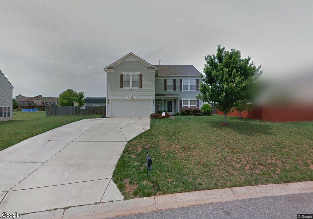
2104 Drewman Place Unit 211 Clover, SC 29710
Estimated Value: $390,000 - $408,000
3
Beds
3
Baths
3,178
Sq Ft
$126/Sq Ft
Est. Value
About This Home
This home is located at 2104 Drewman Place Unit 211, Clover, SC 29710 and is currently estimated at $400,777, approximately $126 per square foot. 2104 Drewman Place Unit 211 is a home located in York County with nearby schools including Griggs Road Elementary School, Clover Middle School, and Clover High School.
Ownership History
Date
Name
Owned For
Owner Type
Purchase Details
Closed on
Apr 22, 2020
Sold by
Barber Joseph E and Barber Joann M
Bought by
Dodge John Edward
Current Estimated Value
Home Financials for this Owner
Home Financials are based on the most recent Mortgage that was taken out on this home.
Original Mortgage
$252,103
Outstanding Balance
$222,908
Interest Rate
3.3%
Mortgage Type
New Conventional
Estimated Equity
$177,869
Purchase Details
Closed on
Dec 9, 2005
Sold by
C P Morgan Communities Of Charlotte Llc
Bought by
Barber Joseph E and Barber Joann M
Home Financials for this Owner
Home Financials are based on the most recent Mortgage that was taken out on this home.
Original Mortgage
$188,362
Interest Rate
6.29%
Mortgage Type
VA
Purchase Details
Closed on
Sep 13, 2005
Sold by
C P Morgan Communities Lp
Bought by
C P Morgan Communities Of Charlotte Llc
Create a Home Valuation Report for This Property
The Home Valuation Report is an in-depth analysis detailing your home's value as well as a comparison with similar homes in the area
Home Values in the Area
Average Home Value in this Area
Purchase History
| Date | Buyer | Sale Price | Title Company |
|---|---|---|---|
| Dodge John Edward | $259,900 | None Available | |
| Barber Joseph E | $182,345 | -- | |
| C P Morgan Communities Of Charlotte Llc | -- | -- |
Source: Public Records
Mortgage History
| Date | Status | Borrower | Loan Amount |
|---|---|---|---|
| Open | Dodge John Edward | $252,103 | |
| Previous Owner | Barber Joseph E | $188,362 |
Source: Public Records
Tax History Compared to Growth
Tax History
| Year | Tax Paid | Tax Assessment Tax Assessment Total Assessment is a certain percentage of the fair market value that is determined by local assessors to be the total taxable value of land and additions on the property. | Land | Improvement |
|---|---|---|---|---|
| 2024 | $1,400 | $9,905 | $1,600 | $8,305 |
| 2023 | $1,435 | $9,905 | $1,600 | $8,305 |
| 2022 | $1,183 | $9,905 | $1,600 | $8,305 |
| 2021 | -- | $9,905 | $1,600 | $8,305 |
| 2020 | $0 | $0 | $0 | $0 |
| 2019 | $0 | $0 | $0 | $0 |
| 2018 | $0 | $0 | $0 | $0 |
| 2017 | -- | $0 | $0 | $0 |
| 2016 | -- | $0 | $0 | $0 |
| 2014 | $862 | $6,220 | $1,000 | $5,220 |
| 2013 | $862 | $7,560 | $1,200 | $6,360 |
Source: Public Records
Map
Nearby Homes
- 1958 Leesburg Dr
- 1961 Leesburg Dr
- 1965 Leesburg Dr
- 1909 Leesburg Dr
- 1300 Dunmore Ct
- 961 Poplar Forest Ridge
- 735 Langley Ct
- 3063 Riker St Unit 16
- 3079 Riker St
- 4306 Penrose Ct
- 2599 Highway 557 None
- 1876 Tradd Ave
- 2104 Gillette Dr
- 1821 Tradd Ave
- 1817 Tradd Ave
- 179 N Paraham Rd
- 1288 Century Dr
- 1280 Century Dr
- 1219 Century Dr
- 3039 S Paraham Rd
- 2104 Drewman Place
- 2108 Drewman Place
- 2108 Drewman Place Unit 212
- 1934 Leesburg Dr
- 1938 Leesburg Dr
- 1930 Leesburg Dr
- 2112 Drewman Place
- 1946 Leesburg Dr
- 2107 Drewman Place
- 1922 Leesburg Dr
- 1728 Grove Tree Ln
- 1918 Leesburg Dr
- 2116 Drewman Place
- 2115 Drewman Place
- 1941 Leesburg Dr
- 1950 Leesburg Dr
- 1929 Leesburg Dr
- 1933 Leesburg Dr
- 1945 Leesburg Dr
- 1945 Leesburg Dr Unit 178