Estimated Value: $445,000 - $479,000
3
Beds
2
Baths
2,060
Sq Ft
$222/Sq Ft
Est. Value
About This Home
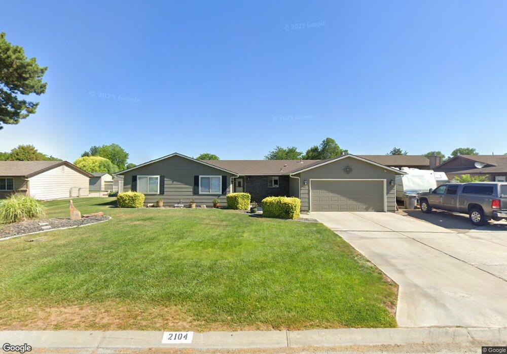
This home is located at 2104 E Massachusetts Ave, Nampa, ID 83686 and is currently estimated at $457,807, approximately $222 per square foot. 2104 E Massachusetts Ave is a home located in Canyon County with nearby schools including Greenhurst Elementary School, South Middle School, and Skyview High School.
Ownership History
Date
Name
Owned For
Owner Type
Purchase Details
Closed on
Feb 8, 2007
Sold by
Bull Jeffrey T
Bought by
Bull Jeffrey T and Bull Karey R
Current Estimated Value
Home Financials for this Owner
Home Financials are based on the most recent Mortgage that was taken out on this home.
Original Mortgage
$168,000
Interest Rate
6.19%
Mortgage Type
Stand Alone Refi Refinance Of Original Loan
Create a Home Valuation Report for This Property
The Home Valuation Report is an in-depth analysis detailing your home's value as well as a comparison with similar homes in the area
Home Values in the Area
Average Home Value in this Area
Purchase History
| Date | Buyer | Sale Price | Title Company |
|---|---|---|---|
| Bull Jeffrey T | -- | Pioneer Title Company |
Source: Public Records
Mortgage History
| Date | Status | Borrower | Loan Amount |
|---|---|---|---|
| Closed | Bull Jeffrey T | $168,000 |
Source: Public Records
Tax History Compared to Growth
Tax History
| Year | Tax Paid | Tax Assessment Tax Assessment Total Assessment is a certain percentage of the fair market value that is determined by local assessors to be the total taxable value of land and additions on the property. | Land | Improvement |
|---|---|---|---|---|
| 2025 | $1,094 | $421,400 | $123,000 | $298,400 |
| 2024 | $1,094 | $420,200 | $123,000 | $297,200 |
| 2023 | $1,061 | $415,600 | $123,000 | $292,600 |
| 2022 | $1,463 | $458,400 | $150,200 | $308,200 |
| 2021 | $1,478 | $320,700 | $68,000 | $252,700 |
| 2020 | $1,508 | $261,800 | $57,500 | $204,300 |
| 2019 | $1,623 | $249,500 | $54,500 | $195,000 |
| 2018 | $1,497 | $0 | $0 | $0 |
| 2017 | $1,172 | $0 | $0 | $0 |
| 2016 | $1,069 | $0 | $0 | $0 |
| 2015 | $1,026 | $0 | $0 | $0 |
| 2014 | $958 | $154,500 | $34,000 | $120,500 |
Source: Public Records
Map
Nearby Homes
- 2019 Kentucky Dr
- 1835 E Kentucky Ave
- 1801 E Iowa Ave
- 1426 Chicago St
- 2622 Boulder Ave
- 2912 E Iowa Ave
- 2308 E Elm Grove Dr
- 2714 S Almond Ct
- 1157 S Powerline Rd
- 946 S Almond Ct
- 945 S Almond Ct
- 1403 Sunflower Ct
- 1047 S 20th St
- 2121 Lambert Dr
- 3601 S Angel Falls Way
- 2040 W Ibis Dr
- 3630 S Angel Falls Way
- 7232 E Merlin Hawk Ct
- 11623 W Black Dog Dr
- 1426 E Sharons Loop
- 2024 E Massachusetts Ave
- 2112 E Massachusetts Ave
- 2105 E Maryland Ave
- 2113 E Maryland Ave
- 2101 E Massachusetts Ave
- 2016 E Massachusetts Ave
- 2120 E Massachusetts Ave
- 2109 E Massachusetts Ave
- 2121 E Maryland Ave
- 2017 E Maryland Ave
- 2008 E Massachusetts Ave
- 2009 S Chicago Ave
- 2100 Belle Aire Dr
- 1921 S Chicago Ave
- 2009 E Maryland Ave
- 2110 Belle Aire Dr
- 2106 E Maryland Ave
- 2100 E Maryland Ave
- 2125 E Massachusetts Ave
- 2114 E Maryland Ave